Skip to content

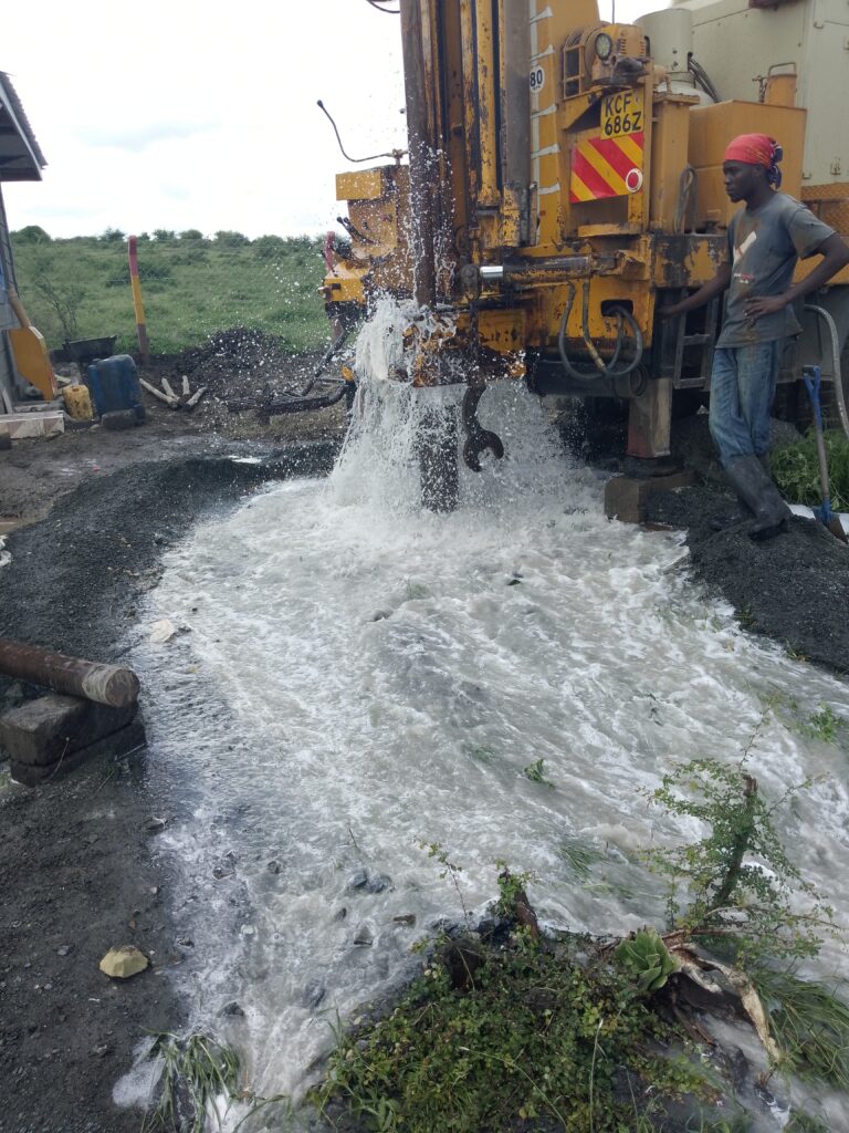
Ask ten borehole owners in Kenya how they chose where to drill, and you will hear different answers. Some will say a hydrogeologist did a survey. Others will say a diviner walked the plot with a forked stick, wire rods or a pendulum and “felt” the water. A few will say the driller “knew” the area. All of them may report success, because in many parts of Kenya there is groundwater almost everywhere if you drill deep enough.
That is exactly why the question matters. Success is not the same as skill. A method should be judged on whether it performs better than chance, whether it can predict depth, yield and quality, and whether it satisfies legal requirements. This article compares water divining (dowsing) with scientific hydrogeological survey using evidence and practical considerations, so you can protect your investment.
What Is Water Divining?
Water divining, also called dowsing or water witching, is the traditional practice of locating underground water using a hand-held tool or the diviner’s own perception. Common tools include forked branches (often hazel or other woods), bent metal rods (L-rods), pendulums and, increasingly, electronic “detectors” marketed with scientific-sounding claims. The practitioner walks the area, and the tool is said to move, dip or rotate when it passes over groundwater.
Dowsing has a long history across many cultures, and many diviners are sincere and respected in their communities. The question is not honesty but effectiveness.
What Is a Scientific Hydrogeological Survey?
A hydrogeological survey uses the principles of geology, hydrology and geophysics to estimate where groundwater occurs and how much can be obtained. As our other articles describe, it typically involves:
- A desktop study of geology, topography, rainfall and nearby borehole records.
- Remote sensing and lineament analysis to identify structures that may control groundwater.
- Field geological observation.
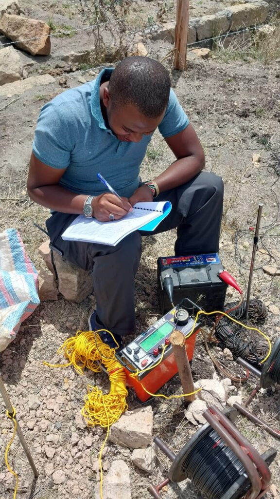
- Geophysical measurements, such as vertical electrical sounding (VES) and resistivity profiling, which measure physical properties of the ground.
- Interpretation by a qualified hydrogeologist and a written report with recommended drilling points, expected depth, likely yield and quality risks.
Every step is documented, and the reasoning can be checked and challenged.
What Does the Evidence Say About Dowsing?
Dowsing has been tested repeatedly under controlled conditions. The overall picture is consistent:
- Controlled trials have not shown that dowsers perform better than chance. In well-known experiments, dowsers were asked to locate buried water pipes or water-filled channels under conditions where the position of the water was hidden from them, and the results were compared with random guessing. In general, performance did not exceed chance levels.
- Large-scale field studies have reported mixed or unconvincing results. A frequently cited German research programme in the 1980s reported some positive findings for a small number of dowsers, but the results have been heavily criticised for statistical and methodological problems, and independent reviews did not find them persuasive evidence of a real ability.
- Dowsing movements are widely attributed to the ideomotor effect. This is an unconscious, involuntary muscle movement in response to expectation, which can make rods or a pendulum move without the person intending it. It explains why sincere dowsers feel the tool move on its own.
- Apparent success is explained by the geology. In regions where groundwater is widespread, such as many parts of Kenya’s volcanic highlands, almost any location can yield some water if drilling is deep enough, so a “hit” does not prove the method worked. Dowsers also tend to select sites using visible clues such as valleys, vegetation and drainage, which are scientifically meaningful but not unique to dowsing, and the successes are remembered while failures are forgotten.
In short, there is no reliable scientific evidence that dowsing finds groundwater better than chance or better than an informed observer using basic geological reasoning. That does not mean every dowsing-sited borehole fails. It means the success cannot be credited to the technique, and the technique cannot tell you what matters most: depth, yield and quality.
Where Traditional Knowledge Does Have Value
It is worth distinguishing dowsing from local ecological and hydrological knowledge, which can be genuinely useful:
- Phreatophytes (plants whose roots reach the water table, such as certain acacias, figs and other deep-rooted species) can indicate shallow groundwater.
- Springs, seeps and wetlands show where groundwater reaches the surface.
- Traditional wells and their seasonal behaviour reveal depth to water and seasonal fluctuation.
- Local experience of where boreholes succeeded or failed is valuable data that a hydrogeologist should collect.
These clues reflect real hydrogeological processes and are used by scientists too. Good surveys respect and incorporate local knowledge, while adding quantitative measurements and interpretation.
Why Science Outperforms Dowsing for Borehole Siting
1. It measures something real. Resistivity surveys measure how well the ground conducts electricity. Geological mapping identifies rock types and structures. Borehole records show what the ground actually contains. These are physical observations, not subjective sensations.
2. It estimates depth, yield and quality. Dowsing at best claims “water is here.” It cannot reliably tell you whether the aquifer is at 60 metres or 250, whether the yield will be 0.5 or 10 m³/h, or whether the water will be fresh, saline or high in fluoride. In regions such as the Rift Valley and arid north, quality is as important as presence.
3. It is repeatable and testable. Two hydrogeologists given the same data should reach broadly consistent conclusions, and the findings can be checked against drilling results. Dowsing results vary between practitioners and are not reproducible under controlled conditions.
4. It produces documents regulators accept. The Water Resources Authority expects hydrogeological reports to support drilling applications. A diviner’s verbal recommendation is not a technical report and does not satisfy regulatory requirements.
5. It reduces risk and cost. Depth drives drilling cost. Knowing the likely depth range, drilling method and casing needs helps you budget realistically, avoid over-drilling and negotiate contracts.
6. It addresses sustainability and interference. A survey considers recharge, neighbouring boreholes and safe yield, which protects both you and the aquifer.
The Real Cost of Getting It Wrong
Consider the economics. Drilling a borehole in Kenya commonly costs several thousand shillings per metre. For a 150-metre hole at around KSh 7,000 per metre, drilling alone is about KSh 1.05 million. A hydrogeological survey, in comparison, typically costs tens of thousands to around KSh 150,000. A diviner may charge a smaller fee or none, which makes the method attractive.
But the comparison that matters is not survey fee versus diviner fee. It is the expected cost of the whole project. If a diviner’s choice leads you to a poor-yield, saline or fluoride-rich borehole, or a dry hole, the loss is hundreds of thousands to millions of shillings. If a survey raises the probability of success or helps avoid even one failed or over-deep borehole, it pays for itself many times over.
Common Objections and Honest Answers
“My neighbour used a diviner and got water.” Perhaps, but in many areas there is water almost anywhere if you go deep enough. The question is whether the borehole delivered adequate yield and quality at reasonable cost, and whether another location would have done better. One success proves little.
“The diviner can tell me the exact depth.” Without measurements, depth claims are guesses. Where predictions are right, they often reflect local experience of typical depths, not the divining tool.
“Scientific surveys also fail sometimes.” That is true. Groundwater is uncertain, and no method guarantees success. But a good survey improves odds, gives a rational basis for decisions, quantifies risk and is transparent about uncertainty. The standard is not perfection, it is better decisions.
“Surveys are expensive.” Compared with drilling costs, they are modest, and they are often a regulatory necessity anyway.
“Diviners are part of our culture.” Respect for cultural practice is important. Communities can still combine respect for local knowledge with scientific methods, for example by involving elders in site selection discussions while relying on survey data for technical decisions.
Beware of “High-Tech” Gadgets
Be especially cautious of devices marketed as groundwater detectors that claim to detect water from the surface through “frequency,” “magnetic resonance of water” or “electromagnetic signatures” without any published validation. Several such devices around the world have been exposed as nothing more than antennae or rods with no real detection capability. Genuine geophysical instruments, such as resistivity meters and electromagnetic systems, have published principles, calibration procedures and results that can be explained and checked. If a seller cannot explain the physics, or refuses independent testing, do not rely on the device.
A Practical Way Forward
- Use science as the foundation. Commission a hydrogeological survey from a qualified professional.
- Collect local knowledge. Share information about springs, traditional wells, successful and failed boreholes and seasonal changes with the hydrogeologist.
- Ask for a written report with coordinates, expected depth range, yield and quality risks, and a limitations statement.
- Do not skip permits. Water Resources Authority requirements apply regardless of how the site was chosen.
- Hire a licensed driller and supervise. Log the drilling and compare with predictions.
- Test pump and analyse the water. Confirm yield and quality before investing in equipment.
- Keep records so future decisions in your area improve.
Frequently Asked Questions
Is dowsing illegal in Kenya? No. But drilling a borehole without proper authorisation is regulated, and technical documentation is required, so dowsing alone cannot support an application.
Can I use a diviner and a hydrogeologist together? You can, but treat the hydrogeologist’s technical findings as the basis for decisions. If the two disagree, ask the hydrogeologist to explain the data.
Why do some dowsers seem so accurate? Experience with local geology, careful observation of terrain and vegetation, the ideomotor effect, widespread groundwater and selective memory all contribute.
What if a scientific survey and my experience conflict? Raise the issue with your consultant. Local observations may reveal factors not yet considered, and good consultants will take them seriously and explain their reasoning.
Is a survey worthwhile for a shallow well? Yes. Even shallow wells benefit from checking geology, water table depth and contamination risks.
Conclusion
Water divining is a long-standing tradition, but the evidence does not support it as a reliable way to locate groundwater, estimate depth or yield, or assess quality. A scientific hydrogeological survey combines geology, remote sensing, geophysics and borehole data to deliver quantified, documented, regulator-ready recommendations that improve your chance of drilling a productive, safe and legal borehole. Given the cost of drilling in Kenya, relying on measurement rather than intuition is the wiser investment.
For scientific hydrogeological surveys and borehole siting, contact Reg. Geol. Mbugua Githae (MGSK) through consult.innercoregeoconsultants.co.ke.