Groundwater is an essential but often under‑appreciated natural resource in Kenya. Serving as the primary source of water for domestic use, agriculture, livestock, and industry in many parts of the country, groundwater supports livelihoods in both rural and urban settings. In arid and semi‑arid lands (ASALs), where surface water is scarce or seasonal, groundwater becomes critical for resilience and sustainable development.
Groundwater mapping — the systematic identification, characterization, and visualization of subsurface water resources — is a foundational step in effective water resource management. It helps determine the spatial distribution of aquifers, aquifer properties, recharge zones, and groundwater flow dynamics. In Kenya, groundwater mapping underpins policy decisions, borehole siting, wellfield development, and drought mitigation planning. This article presents a detailed, scientific overview of groundwater mapping methods, applications, challenges, and a real case study illustrating practical implementation in the field.
The Importance of Groundwater Mapping
Groundwater mapping serves several key purposes:
- Assessment of groundwater availability and sustainable yield.
- Identification of groundwater recharge and discharge zones.
- Support for borehole siting and design, which enhances drilling success rates.
- Protection of groundwater quality through delineation of contaminant vulnerability zones.
- Water resource planning and water security strategies.
In Kenya, where rainfall is highly variable and surface water resources are limited, detailed groundwater mapping enables efficient use of scarce water supplies and supports national goals for water access and climate change adaptation.
Hydrogeological Frameworks in Kenya
Kenya’s geology is diverse, broadly categorized into:
- Crystalline Basement Complex — Precambrian rocks with limited primary porosity; groundwater occurs mainly in weathered and fractured zones.
- Volcanic and Rift Valley Systems — Highly variable permeability; major aquifers associated with rift‑related structures.
- Sedimentary Basins — These include Tertiary and Quaternary sediments with varying groundwater storage capacities.
Because hydrogeological conditions vary significantly, groundwater mapping must be tailored to local geological context.
Methods and Techniques for Groundwater Mapping
Groundwater mapping integrates multiple data sources and analytical methods. These can be grouped into:
Remote Sensing and GIS Techniques
Modern groundwater mapping relies heavily on satellite remote sensing and Geographic Information Systems (GIS). These tools allow for regional‑scale analysis of terrain, geology, vegetation, and surface water indicators. Key applications include:
- Digital Elevation Models (DEMs) for watershed and drainage pattern analysis.
- Land use/land cover classification to estimate recharge potential.
- Lineament analysis (fracture and fault mapping) using high‑resolution imagery.
- Normalized Difference Vegetation Index (NDVI) to detect moisture trends.
GIS allows these layers to be integrated into Groundwater Potential Index (GWPI) models, producing spatial maps of groundwater potential zones.
Geophysical Exploration Methods
Geophysical surveys provide subsurface information critical for delineating aquifers. Common techniques include:
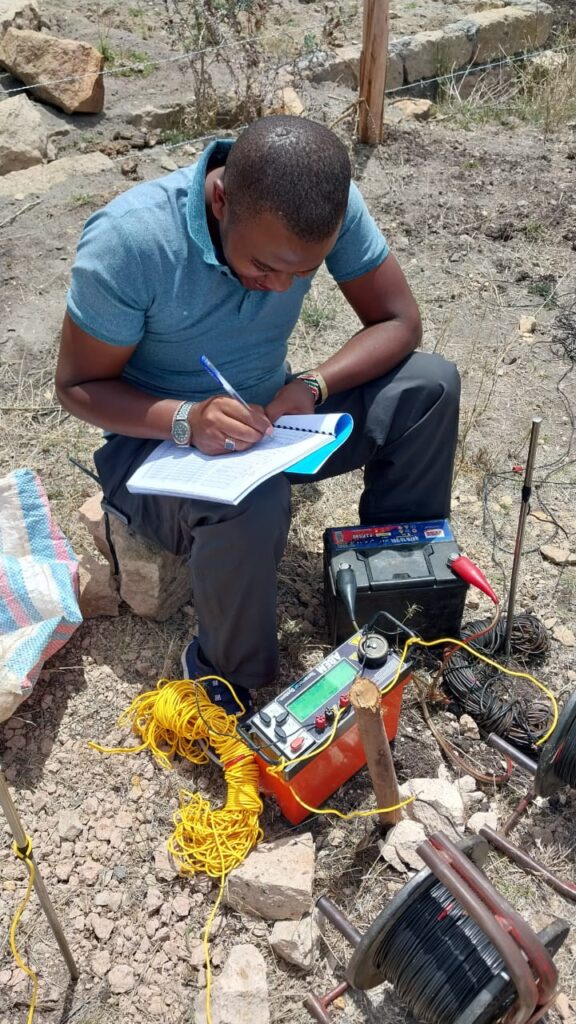
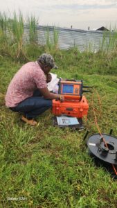
- Electrical Resistivity Tomography (ERT) — Measures subsurface resistivity contrasts to identify saturated zones and aquifer boundaries.
- Vertical Electrical Sounding (VES) — Offers layered resistivity profiles to estimate depth to water table and lithology.
- Magnetotellurics (MT) — Useful in deep aquifer detection and rift zone studies.
- Seismic Refraction — Determines rock velocities and helps distinguish between saturated and dry layers.
Integration of geophysical data with borehole lithology improves the reliability of groundwater maps.
Hydrogeological Field Investigations
Groundwater mapping is incomplete without direct field observations, including:
- Borehole drilling logs — Provide information on lithology, aquifer thickness, and water strikes.
- Pump tests — Determine transmissivity, storativity, and yield.
- Water quality sampling — Identifies chemical constituents and potential contaminants.
These data are essential for classifying aquifer properties and validating subsurface models.
Numerical Groundwater Modeling
Where data density permits, numerical groundwater models simulate flow dynamics and storage behavior. Models such as MODFLOW can help predict responses to pumping, climate variability, or land use changes.
Groundwater Mapping Process Overview
A typical groundwater mapping workflow involves:
- Data collection: Remote sensing, geological maps, existing borehole records, and rainfall data.
- GIS analysis: Creation of thematic layers for slope, geology, lineaments, soil type, and recharge indices.
- Geophysical surveys: Field campaigns to acquire subsurface resistivity and seismic data.
- Field verification: Drilling logs, pump tests, and water quality sampling.
- Map production: Integration of all data into groundwater potential and aquifer distribution maps.
- Modeling and interpretation: Numerical or conceptual models to characterize flow systems and sustainable yields.
- Challenges in Groundwater Mapping in Kenya
Despite advancements, several challenges persist:
- Data scarcity in remote and ASAL regions.
- High cost of geophysical surveys and drilling.
- Complex geology requiring multi‑method integration.
- Limited capacity in terms of trained hydrogeologists and technical personnel in local governments.
- Inadequate monitoring networks for water table and quality tracking.
Addressing these challenges requires investment in capacity building, data repositories, and collaborative research initiatives.
Case Study: Groundwater Mapping in Kitui County, Kenya
Background:
Kitui County, located in southeastern Kenya, typifies many ASAL regions dependent on groundwater. Seasonal rainfall and limited surface water resources have made groundwater mapping a priority for county water planners.
Methods Applied:
- Remote Sensing & GIS Analysis:
ASTER and Landsat imagery were used to derive lineaments, slope, soil type, and recharge indices. These layers were integrated into a multi‑criteria evaluation model to produce a preliminary groundwater potential map. - Geophysical Surveys:
Electrical resistivity surveys (VES and 2‑D ERT) were conducted across selected zones. The surveys delineated subsurface layers and identified low‑resistivity zones indicative of saturated formations. - Drilling and Hydrogeological Testing:
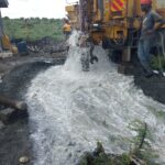
Targeted boreholes were drilled at high‑potential locations identified by GIS and geophysics. Pump tests conducted on completed wells revealed yields ranging from 2 m³/hr to 10 m³/hr, suitable for community water supplies. - Water Quality Assessment:
Major ions — Ca²⁺, Mg²⁺, Na⁺, Cl⁻, SO₄²⁻, NO₃⁻ — were analyzed. Groundwater was generally within WHO potable limits, though elevated nitrate levels near agricultural zones highlighted localized contamination.
Results:
- Groundwater Potential Map:
Kitui was classified into high, moderate, and low groundwater potential zones. High potential aligned with fractured crystalline rocks near lineaments. - Aquifer Characterization:
Fractured saprolite and weathered basement units were identified as primary aquifers with moderate storage and sustainable yields for rural water supply. - Recommendations:
Priority should be given to development in high‑potential zones, and regular water quality monitoring should be established to protect resources from contamination.
- Applications of Groundwater Mapping
Groundwater maps in Kenya have numerous applications:
- Borehole Planning & Siting: Reduces drilling failure risks.
- Drought Preparedness: Identifies communities at risk and alternative water sources.
- Agricultural Water Planning: Supports irrigation and livestock needs.
- Urban Water Supply Expansion: Guides utility investments.
- Environmental Protection: Delineates vulnerable recharge areas for conservation.
Groundwater mapping is indispensable for sustainable water resource development in Kenya. By combining remote sensing, GIS, geophysical surveying, field hydrogeology, and numerical modeling, scientists and planners can produce reliable groundwater resource maps. Although challenges remain, especially in data‑scarce regions, advances in technology and collaborative research continue to improve our understanding of subsurface water systems.
The Kitui County case study demonstrates the real‑world impact of integrated groundwater mapping — from identifying viable aquifers to improving water access for local communities. As Kenya strives to achieve water security and climate resilience, groundwater mapping will remain central to effective planning and resource management.