Skip to content
The Earth beneath our feet holds a vital, often unseen, resource: groundwater. This hidden water plays a crucial role in sustaining life, supporting ecosystems, and providing for human needs, from drinking water to agriculture and industry. However, locating, assessing, and managing this resource effectively isn’t a matter of guesswork; it requires a specialized scientific investigation known as a hydrogeological survey.
A hydrogeological survey is a comprehensive scientific study that evaluates the presence, availability, depth, quality, and sustainability of underground water sources, known as aquifers, before any drilling or major water-related project commences. Think of it as creating a detailed roadmap to the subterranean water world, allowing us to make informed decisions about how to tap into and protect this precious resource. Without this crucial groundwork, drilling a borehole can be a risky and expensive undertaking, potentially leading to dry or low-yield wells, wasted time, and significant financial losses.
The primary objective of a hydrogeological survey is to eliminate uncertainty by providing a clear understanding of the subsurface environment. It helps determine if sufficient water exists to support a borehole, the optimal depth for drilling, whether the water is safe from contaminants, and how water moves underground to ensure its long-term sustainability. This scientific approach ensures that we secure reliable, clean, and sustainable water sources for various applications.
The Science Behind the Survey: Methods and Tools
Conducting a hydrogeological survey is a meticulous process that combines desk-based research, on-site investigations, and advanced technological tools to gather accurate data about groundwater resources. Hydrogeologists, acting as “detectives of the underground world,” use data and physics to map the subterranean environment.
Systematic Approach to Data Collection
The methodology for a hydrogeological survey typically involves several systematic steps:
- Desktop Study: This initial phase involves collecting and reviewing existing geological and hydrological data relevant to the site. This includes:
- Topographical maps and satellite imagery.
- Existing geological maps and previous studies.
- Water well databases and historical yield information.
- Meteorological data.
- Assessing factors like geology, slope, drainage density, and rainfall to identify groundwater potential zones.
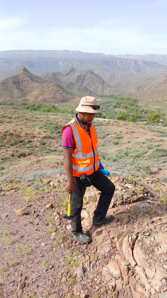
- Site Reconnaissance/Field Investigation: Following the desktop study, experts visit the location to physically inspect the terrain. This involves:
- Assessing surface geology, surrounding boreholes, and natural water sources.
- Looking for clues such as dry lake beds, valleys, or specific types of vegetation that might indicate the presence of water.
- Ground-truthing with test pits or shallow augers to confirm fracture zones and soil types.
- Geophysical Investigation: This is a crucial step where advanced scientific equipment is deployed to map subsurface features without invasive drilling. Water-saturated soils and fractures conduct electricity better than dry rock, a principle exploited by these instruments.
- Electrical Resistivity (ER) Methods: This is the most widely used geophysical method for groundwater prospecting. Techniques like Vertical Electrical Sounding (VES) and resistivity meters send a mild electrical current into the ground and measure how it returns. This allows surveyors to map a subsurface profile, revealing low-resistivity zones that indicate potential water-bearing formations or aquifers.
- Seismic Surveys: These surveys use sound waves to create images of subsurface rock layers and structures, helping to identify formations that could hold water.
- Electromagnetic (EM) Surveys: These methods also measure the ground’s electrical conductivity to detect water-bearing zones.
- Ground Penetrating Radar (GPR): Used for subsurface mapping, particularly for shallower features.
- Gravity and Magnetic Surveys: While not directly detecting water, magnetic surveys help identify geological structures like faults and fractures that influence groundwater movement and storage. Gravity-based methods investigate basin architecture and sediment thickness, which are fundamental to understanding groundwater systems.
- LiDAR: Airborne LiDAR surveys provide high-resolution digital terrain models, essential for accurate terrain corrections in geophysical processing and for identifying surface expressions of faults and drainage patterns that support groundwater recharge studies.
- Soil & Rock Analysis: Different soil and rock types significantly affect groundwater storage and flow. Analyzing the geological composition helps determine drilling feasibility and aquifer characteristics.
- Water Quality Assessment: A hydrogeological survey includes assessments of potential contaminants like fluoride, salinity, or bacteria, and natural water quality parameters. This helps determine if the water is suitable for its intended use and if additional filtration or treatment is required.
- Aquifer Testing: Performing pump tests evaluates the capacity of an aquifer, including its recharge rates and potential yield.
- Data Analysis and Modeling: Raw data collected from field investigations is processed using specialized software (e.g., IPI2win, ArcGIS, HEC-Ras) to create 2D or 3D underground models. This allows for the calculation of maximum flow, flood surface extent, and water levels, helping to understand the hydrogeological character of the region.
- Reporting and Recommendations: The final stage involves generating a comprehensive report with GPS coordinates for optimal drilling locations, expected water yield, borehole construction and design recommendations, and an assessment of environmental and health risks.
Key Tools Used in Hydrogeological Surveys
The precision of a hydrogeological survey relies heavily on the sophisticated tools and technologies employed:
- Electrical Resistivity Meters (e.g., Terrameter): These instruments are fundamental for measuring the electrical properties of subsurface layers to identify water-bearing formations.
- Seismic Equipment: Used for seismic refraction and reflection surveys to image subsurface geological structures.
- GPS Devices: For accurate mapping and pinpointing survey locations and potential drilling sites.
- Water Quality Testing Kits/Laboratories: For on-site and laboratory analysis of water samples to determine chemical and biological properties.
- Geographic Information Systems (GIS): Used for spatial analysis, mapping groundwater potential zones, and integrating various datasets.
- Remote Sensing Techniques: Including satellite imagery and aerial photography, to gather preliminary information and assess large areas.
- Drilling Rigs (for test drilling): To collect direct samples of soil and rock and observe subsurface conditions.
These tools, combined with the expertise of hydrogeologists, allow for a robust understanding of the complex underground water systems, moving beyond traditional, less reliable methods like dowsing.

Impact and Applications: From Water Supply to Environmental Protection
The insights gained from a hydrogeological survey have far-reaching impacts across various sectors, providing the foundational knowledge for sustainable water management and environmental protection.
Securing Water Supply
One of the most direct and crucial applications of a hydrogeological survey is in ensuring reliable water supplies.
- Borehole Drilling and Well Design: Surveys are essential before drilling any borehole or well. They confirm the presence of water, determine the optimal depth to access a reliable supply, and help avoid drilling dry or low-yield wells, thereby saving significant time and money. They also inform the optimal design and placement of wells, enhancing efficiency and longevity.
- Groundwater Resource Assessment: Hydrogeological studies evaluate aquifer depth, recharge rates, and overall water availability. This information is critical for long-term planning, ensuring that water extraction does not lead to over-extraction, aquifer depletion, or adverse effects on surrounding ecosystems.
- Rural and Urban Water Provision: For both domestic and commercial clients, these surveys are vital for identifying clean and usable water sources for drinking, irrigation, and industrial processes. In water-stressed regions, they can help identify alternative groundwater sources, supporting agriculture and providing drinking water.
Environmental Protection and Management
Beyond direct water supply, hydrogeological surveys play a critical role in safeguarding our environment.
- Contamination and Remediation Studies: They are essential for detecting pollutants, assessing contamination risks, and designing effective remediation strategies for groundwater pollution. Understanding groundwater movement and its interaction with surrounding soil and rock is crucial for managing contamination issues.
- Environmental Impact Assessments (EIA): Hydrogeological assessments are often a preliminary study required for EIA applications and other permit processes. They help understand how groundwater interacts with surrounding ecosystems and development projects, ensuring compliance with environmental regulations.
- Sustainable Water Management: By providing data on groundwater levels, recharge rates, and aquifer characteristics, surveys help achieve sustainable water management, balancing usage with natural replenishment. This prevents over-extraction, manages contamination risks, and ensures sustainable groundwater use for the long term.
- Defining Protection Areas: Surveys help define recharge and discharge areas and delimit protection zones for groundwater sources, crucial for preserving water quality.
- Mitigating Water Conflicts: By providing clear data on water availability and usage limits, hydrogeological surveys can help reduce water conflicts in regions facing scarcity.
Infrastructure Development and Other Applications
The benefits of hydrogeological surveys extend to various engineering and development projects.
- Infrastructure Planning: Understanding groundwater conditions is essential for safe and stable construction. Hydrogeological assessments help anticipate potential problems like excessive groundwater during construction, improving site work planning and reducing health and safety risks. They inform the selection and design of dewatering methods, ensuring sound risk management.
- Mining Operations: These surveys are used to determine the need for dewatering in mining areas and to deal with groundwater problems associated with mining activities.
- Geothermal Energy: Hydrogeologists also contribute to harnessing geothermal energy through groundwater-based heat pumps.
- Flood Risk Analysis: High-resolution digital terrain models from LiDAR, often integrated with hydrogeological studies, support flood risk analysis and groundwater recharge studies.
In essence, a hydrogeological survey is not merely a technical procedure; it’s a fundamental investment in the future of our water resources and the environment. By providing detailed insights into the earth’s hidden waters, we can make informed, sustainable decisions that benefit communities, industries, and ecosystems for generations to come.