Skip to content


Africa’s geology is a continental archive that stretches from some of the oldest crust on Earth to the active rifting of the East African Rift. It holds the minerals that power modern technology, the aquifers that sustain millions of people, the heat that can drive clean electricity, and the hazards that shape where and how societies build. When geoscientists gathered in Nairobi for CAG30, the thirtieth edition of a meeting convened by the Geological Society of Africa and hosted locally by the Geological Society of Kenya, the theme asked a direct question: how can we unveil this endowment and turn it into sustainable development? This article explores the answer from the perspective of practising geoscientists.
A Continent of Geological Diversity
Africa’s geological framework is exceptionally varied. Archaean cratons such as the Kaapvaal, Zimbabwe, and Tanzania cratons host ancient greenstone belts rich in gold and nickel. Palaeoproterozoic and Neoproterozoic belts, including the Pan-African orogens, preserve the record of continental collision and host copper, cobalt, tin, tungsten, gemstones, and industrial minerals. Phanerozoic basins contain hydrocarbons, coal, evaporites, and phosphates, while the Rift system brings volcanism, geothermal fields, soda ash, and fluorspar. This diversity means that almost every country has some form of geological opportunity, but each requires specific, evidence-based understanding.
The same diversity explains why the Colloquium’s programme was so broad. Sessions ranged from Pan-African tectonics and ore deposit geology to groundwater, geothermal development, geohazards, geoheritage, and artificial intelligence. Together they show that sustainable development is not served by a single resource but by an integrated understanding of the whole Earth system.
From Raw Material to Shared Value
Africa supplies a significant share of the world’s minerals, among them cobalt, platinum group metals, manganese, bauxite, phosphate, chromium, and gold. As the world shifts to batteries, renewable energy, and electrified transport, demand for these critical and strategic minerals is rising, and geopolitical interest in Africa’s resources has grown with it.
The central challenge is not simply to extract more, but to capture more value locally. Too often, minerals leave the continent as concentrates or raw ore, and the larger economic gains from processing, manufacturing, and services are realised elsewhere. Frameworks such as the African Mining Vision call for mining that is linked to local industry, infrastructure, and skills. Geoscientists have a direct role in this agenda. Reliable resource definition, honest reporting standards, metallurgical understanding, and early planning for processing and logistics all determine whether a deposit becomes a catalyst for broader development or an isolated enclave.
Better Tools for Finding What Remains Hidden
Much of Africa remains under-explored by modern standards. Deep weathering, thick regolith cover, vegetation, and limited access mean that many deposits probably lie undiscovered. Exploration is shifting accordingly from surface prospecting toward methods that see through cover.
Airborne and ground geophysics, hyperspectral and radar remote sensing, soil and regolith geochemistry, and portable analytical instruments now allow explorers to screen large areas quickly and cheaply. Integrated interpretation matters more than any single tool. A magnetic anomaly, a geochemical halo, and a structural trend that coincide justify a drill hole far more convincingly than any one of them alone. Staged programmes with clear decision points protect capital and reduce environmental disturbance, because fewer unnecessary holes are drilled.
Artificial Intelligence and Machine Learning in Geoscience
AI and machine learning were among the most discussed topics at CAG30, and for good reason. These methods can process satellite imagery, geophysical grids, and geochemical databases at scales no human team can match, identify patterns that suggest mineral prospectivity, classify lithologies from spectral or core-scan data, and support groundwater and hazard mapping.
Their promise comes with conditions. Algorithms are only as good as the data and geological understanding behind them. Training data in many African regions are sparse, uneven, or poorly documented, and models can produce confident-looking maps that are geologically meaningless. The most productive approach treats AI as a tool for geologists rather than a replacement: models generate hypotheses, and field geology, structural analysis, and drilling test them. Transparent methods, clear uncertainty statements, and local capacity to run and interpret models are essential if the benefits are to be shared.
Geodata as Development Infrastructure
Roads and power lines are recognised as infrastructure. Geological data deserve the same status. National geological surveys hold decades of maps, borehole records, geophysical surveys, and reports, but much of it is on paper, scattered, or hard to access. Digitising, standardising, and openly publishing these records lowers the cost and risk of exploration, supports land-use planning, improves water and hazard management, and increases investor confidence. Continental and international efforts to build shared geodata initiatives, with the support of bodies such as the International Union of Geological Sciences and UNESCO, point in the right direction. Strong geological surveys, adequately funded and staffed, remain the foundation on which every other geoscience activity rests.
Groundwater: The Resource Under Our Feet
For many African communities, the most important geological resource is not a mineral but water. Groundwater supplies drinking water, irrigation, livestock, and industry across large parts of the continent, and it is often the most reliable source during drought. Its value will grow as climate variability intensifies.
Sustainable groundwater development starts with understanding aquifers: their geometry, recharge, storage, and water quality. In basement terrains, productive zones are tied to fractures and weathering. In volcanic and Rift settings, faults control both flow and chemistry, and natural contaminants such as fluoride can limit use. In sedimentary basins, large aquifers may hold ancient water that is renewed very slowly. Hydrogeological surveys, geophysics, pumping tests, monitoring networks, and sound regulation help ensure that boreholes deliver safe water without depleting the resource. Protecting recharge areas and preventing pollution are as important as drilling new wells.
Energy: Geothermal, Hydrocarbons, and a Balanced Transition
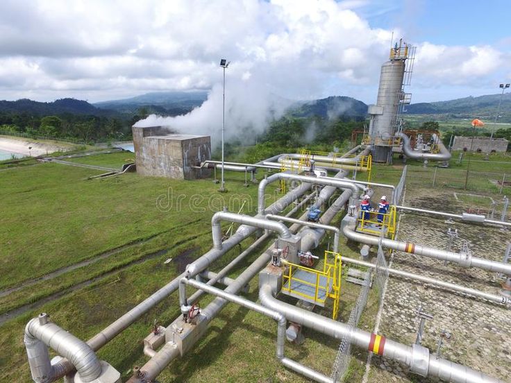
Africa’s energy needs are large, and the geological options are diverse. The East African Rift is among the world’s great geothermal provinces, and Kenya has demonstrated how geothermal steam can provide firm, low-carbon electricity. Other Rift countries, including Ethiopia, Tanzania, Uganda, Rwanda, and Djibouti, are advancing their own prospects. Geothermal development needs strong exploration science, risk-sharing finance, and community engagement, and it also supports direct uses such as agriculture and industry.
At the same time, petroleum, gas, and coal remain part of the energy picture in several countries. The theme of energy resources amid climate change calls for honest, pragmatic discussion: how to use hydrocarbons responsibly where they support development, how to reduce emissions and flaring, and how to invest revenues in diversified, cleaner systems. Geoscientists contribute by improving resource assessment, reducing environmental risk, and identifying new low-carbon opportunities such as geological storage and critical-mineral supply chains for renewables.
Living Safely with the Earth: Geohazards and Engineering Geology
Rapid urbanisation across Africa is placing buildings, roads, dams, and pipelines on ground that is poorly understood. Expansive clays, soft alluvium, steep weathered slopes, active faults, floods, and volcanic activity all pose risks. Engineering geological mapping, geotechnical investigation, and hazard zoning reduce those risks at modest cost compared with the price of failures. Embedding geological information into planning and building regulation is among the most practical ways geoscience can protect lives and investments.
Geoheritage, Geodiversity, and Geotourism
Africa’s landscapes are also a cultural and economic asset. Rift lakes, volcanoes, fossil sites, gorges, caves, and ancient rock exposures attract visitors and tell the story of Earth and human origins. Geotourism, when planned with local communities, can create jobs, support conservation, and diversify economies that depend on mining or agriculture. Recognising and protecting geoheritage sites, including through UNESCO geoparks and similar designations, links geological science to education and local pride.
Investing in People and Institutions
No strategy for sustainable development succeeds without skilled people. Africa needs more geologists, geophysicists, geochemists, hydrogeologists, and engineering geologists, and it needs them equipped with modern tools and supported by strong universities, surveys, and research networks. Geoscience education should combine solid fundamentals with field skills, data science, and awareness of environmental and social responsibility. Mentoring early-career scientists, supporting women in geoscience, funding regional research collaboration, and creating pathways between universities, industry, and government help keep talent on the continent and strengthen its voice in global science.
Collaboration Across Borders
Geology does not respect national boundaries. Cratons, orogenic belts, basins, and aquifers cross borders, and so do the problems they present. CAG30 reflected this by bringing together researchers, policymakers, and industry from across the continent and beyond, including a special session with the International Union of Geological Sciences and UNESCO on the needs and challenges of African geoscience research. Initiatives that support early-career researchers, open data sharing, and joint project proposals help African scientists compete internationally and tackle shared questions, from groundwater in transboundary aquifers to the tectonic history of the Pan-African belts.
Governance, Investment, and Responsible Practice
Finally, geological opportunity becomes development only within sound governance. Transparent licensing, enforceable reporting standards, fair fiscal terms, environmental safeguards, and meaningful community participation are as important as geological knowledge. Investors seek clarity and stability, while communities seek fair benefits and protection from harm. Geoscientists, who understand both the opportunity and the uncertainty, have a responsibility to communicate honestly with decision-makers and the public, and to resist overstating prospects.
Conclusion
Unveiling Africa’s geological resources means more than finding deposits. It means understanding the continent’s rocks, water, heat, and hazards well enough to make wise choices about them. It means using new tools, from geophysics to artificial intelligence, while keeping field geology at the centre. It means treating geological data as shared infrastructure, building local capacity, and ensuring that benefits reach communities. The Colloquium of African Geology has long been a place where this knowledge is exchanged, and the discussions in Nairobi reinforced a clear message: with rigorous science, responsible governance, and collaboration across borders, Africa’s geology can underpin a sustainable and prosperous future.