Skip to content

Yes. In practice, you need a hydrogeological survey before drilling a borehole in Kenya. There are two reasons: it is effectively required by law as part of the Water Resources Authority (WRA) application process, and it is the single best protection against wasting money on a dry or low-yielding borehole.
Even if you could somehow bypass the paperwork, drilling without a survey is a gamble with a very expensive stake. A typical borehole costs from several hundred thousand to several million shillings. A survey costs a small fraction of that and substantially improves your odds.
The Legal Requirement
Groundwater in Kenya is a public resource regulated under the Water Act 2016 and the Water Resources Regulations. The Water Resources Authority is responsible for regulating its use. Before you drill, you must obtain authorisation, and the application is normally supported by a hydrogeological report prepared by a qualified professional. The report documents the site, the expected aquifer, the proposed borehole depth and construction, and the likely impact on other users.
Drilling without WRA authorisation is an offence and can result in penalties, enforcement action or being unable to register and legally use the borehole. In addition, depending on the project, NEMA may require an Environmental Impact Assessment or screening, and some counties (such as Nairobi, Kiambu and Machakos) require a “no objection” or planning clearance. Only WRA-licensed drilling contractors may legally construct boreholes.
Requirements and procedures can be updated, so confirm current rules with WRA before you proceed. Our permit guides walk through the usual sequence.
The Scientific Reason: Groundwater Is Hidden and Variable
Surface features give limited clues about what lies beneath. Two plots side by side can have completely different groundwater prospects. This happens because:
- Aquifers are patchy. In volcanic rock, water-bearing layers can be discontinuous. In hard basement rock, water often occurs only in fractures, which occupy a tiny fraction of the rock volume.
- Depth varies. Water might be struck at 60 metres on one plot and 220 metres on another.
- Quality varies. Fluoride, salinity, iron and hardness can differ sharply over short distances, particularly in the Rift Valley.
- Yield varies. A borehole may produce 0.5 cubic metres per hour or 20, depending on the aquifer intersected.
A hydrogeological survey interprets this variability using geology, geophysics and local borehole data, converting guesswork into an informed probability.
What the Survey Tells You
A competent survey should answer, with stated uncertainty:
- Is groundwater likely at your site? And if so, in what type of rock?
- At what depth range? This is critical for budgeting, because depth drives cost.
- What yield is realistic? This should be compared against your demand to see if one borehole is enough.
- What are the water quality risks? For example, fluoride in parts of Nakuru and Naivasha, or salinity in some arid areas.
- Where exactly should you drill? The report should give coordinates and an alternate point.
- What construction design is appropriate? Casing diameter, screen positions, gravel pack and drilling method.
- Are there contamination or interference concerns? Latrines, septic tanks, other boreholes and surface water bodies.
The Financial Case: Survey Cost Versus Dry Hole Cost
Consider an example. A hydrogeological survey with a report might cost KSh 50,000 to KSh 100,000. A 150-metre borehole at KSh 7,000 per metre costs about KSh 1.05 million for drilling alone. If you skip the survey and the borehole turns out dry or yields too little, you may be left with a large bill and no water. Even if you drill a second hole, you have doubled the loss.
Surveys also help you avoid over-drilling. If the best aquifer is expected at 120 to 150 metres, drilling to 250 metres wastes money and may reach water of poorer quality. Conversely, stopping too shallow can mean missing the productive zone. The survey sets a sensible target.
Another benefit is right-sizing the equipment. If the survey and test pumping indicate a sustainable yield of 4 cubic metres per hour, you can choose a pump accordingly rather than buying an oversized one.
What Happens If You Skip the Survey?
- You cannot complete the legal process properly. The authorisation and later abstraction permit rely on documented hydrogeological information.
- Your risk of a dry or poor borehole rises. There is no guarantee even with a survey, but the odds are better.
- You may drill in a contamination hotspot. Without checking the surroundings, you could site too close to a latrine or septic tank.
- You might interfere with neighbours. This could trigger disputes and regulatory problems.
- Insurance, lenders or buyers may question the borehole. Documented compliance supports property value and financing.
Is Any Case Exempt?
Sometimes people ask about very shallow wells or hand-dug wells. Regulations may treat small or low-risk abstraction differently, and some domestic uses may qualify for simplified procedures or screening exemptions. However, “simpler” is not the same as “no assessment.” Even a shallow well benefits from checking geology, water table depth and contamination risk, and you should confirm the requirement with WRA instead of assuming an exemption applies.
For any machine-drilled borehole of typical depth, assume that a hydrogeological survey and report are required.
When a Survey Is Especially Important
Commercial and agricultural projects. Flower farms, horticulture, dairies and factories need reliable, high-volume supplies and face higher regulatory scrutiny. A wrongly sized borehole can disrupt operations.
Areas with known water quality issues. In the Rift Valley, high fluoride is documented. For example, studies in Nakuru County have recorded fluoride levels from 0.5 up to 72 milligrams per litre, far above the World Health Organization guideline of 1.5 milligrams per litre. Fluoride was highest on the hot rift floor and lower on the escarpments, a pattern a hydrogeologist can factor into siting.
Crowded urban and peri-urban areas. Many boreholes in a small area compete for the same aquifer. A survey helps estimate interference and sustainable yield.
Basement terrain. Fracture-controlled aquifers make siting very sensitive, so the survey is essential.
Arid and semi-arid regions. Recharge is limited, so you need a realistic estimate of sustainable abstraction.
How the Survey Fits Into the Whole Borehole Process
A typical Kenyan borehole project follows this sequence, with variations by county and project type:
- Hydrogeological survey and report.
- County approval where required.
- NEMA screening or EIA where required.
- WRA drilling authorisation.
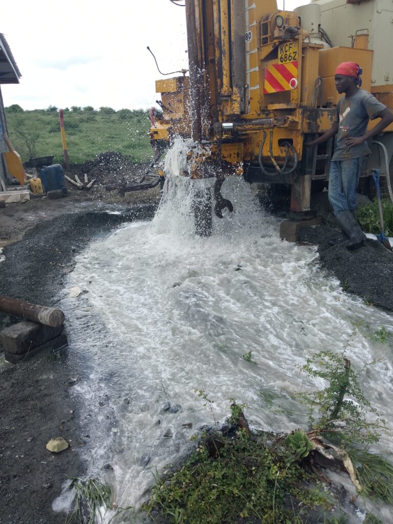
- Drilling by a WRA-licensed contractor, with logging and construction as designed.
- Test pumping and water quality analysis.
- Completion report submission to WRA.
- Water abstraction permit and installation of a water meter.
- Pump installation, commissioning and regular monitoring.
Everything downstream depends on the quality of step one.
How to Choose a Survey Provider Wisely
- Look for a qualified geologist or hydrogeologist with relevant experience in your area.
- Ask for sample reports and examples of boreholes sited in similar geology.
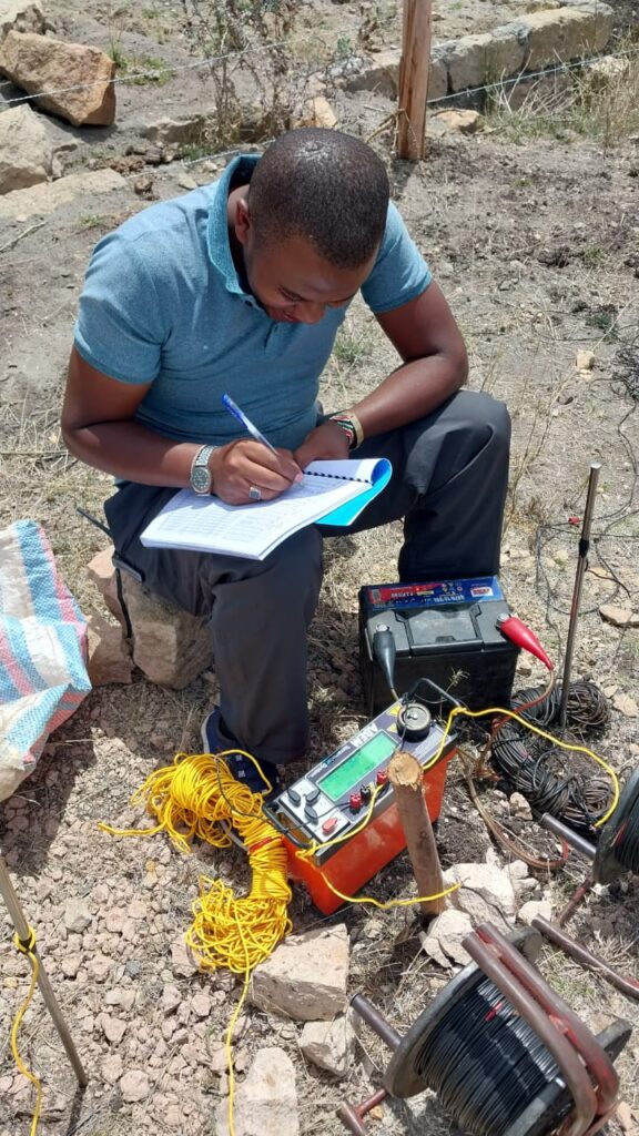
- Confirm the methods (geological mapping, resistivity, remote sensing) and what the deliverables will be.
- Check that the report will meet WRA requirements.
- Prefer independence. A consultant who is not paid by the metre drilled has no incentive to recommend a deeper hole.
- Avoid anyone promising guaranteed water.
Frequently Asked Questions
Can my drilling company do the survey? Many do, and some do it well. Independence is valuable, so consider having the survey done by a separate hydrogeologist who can also review the drilling contractor’s quote.
Is a neighbour’s successful borehole enough evidence? It is useful evidence, but not sufficient. Depth, yield and quality can change over short distances, and your neighbour’s borehole may tap a different layer.
What if the survey says prospects are poor? That is valuable information. Alternatives include relocating the borehole on your property, using a shallower well with treatment, rainwater harvesting, connecting to a utility or sharing a source. See our article on rainwater harvesting versus boreholes.
Does a survey guarantee a successful borehole? No. It improves the odds and informs design, but groundwater uncertainty can never be eliminated.
How soon should I do the survey? Early, before you commit to drilling dates, budgets or financing, since permits depend on it and it influences the entire budget.
Conclusion
A hydrogeological survey is both a legal expectation and a smart investment. It supports your permit application, helps locate and design a productive borehole, flags water quality and contamination risks, and protects you from the costly mistake of drilling blind. In Kenya’s geologically diverse landscape, where aquifers range from volcanic to basement to sedimentary and water quality can change within a few kilometres, the survey is the foundation of every successful borehole.
For professional hydrogeological surveys, geophysics and permit-ready reports, contact Reg. Geol. Mbugua Githae (MGSK) through consult.innercoregeoconsultants.co.ke.