Skip to content
A successful borehole isn’t the product of a single lucky guess — it’s the end result of a structured hydrogeological survey process, one that moves systematically from broad regional understanding down to a precisely sited, properly designed water point. Skipping stages in that process is exactly how communities and organizations end up with dry holes, low-yielding wells, or boreholes that fail within a few years of poor design decisions. Understanding the full methodology — not just the final drilling step — is what separates a defensible groundwater development project from an expensive gamble.
Stage 1: Desk Study and Data Compilation
Every credible hydrogeological survey begins before anyone sets foot in the field. This desk study phase compiles existing geological maps, topographic data, satellite and remote sensing imagery, climate and rainfall records, and any available records from previous drilling or hydrogeological investigations in the area. The goal is to build a preliminary conceptual model of the local hydrogeological setting — likely aquifer types, expected depth to water table, general groundwater flow direction, and any known constraints such as poor water quality zones or over-exploited areas — before committing field resources to the site.
In areas with limited existing data, which describes much of rural East Africa, this stage leans more heavily on remote sensing analysis (structural lineament mapping, geomorphological interpretation, vegetation indices) to compensate for sparse ground-based records, and on interviews with local communities about existing wells, springs, and historical water availability, which often provide valuable practical insight that formal records simply don’t capture.
Stage 2: Reconnaissance and Field Mapping
Field reconnaissance verifies and refines the desk study’s conceptual model against ground truth. This typically includes geological mapping of outcrops and structural features, inventorying existing water points (wells, springs, boreholes) and recording their yield, depth, and water quality where available, and identifying land use factors relevant to both water demand and potential contamination sources near candidate sites — proximity to pit latrines, agricultural chemical use, or industrial activity, for instance.
Stage 3: Geophysical Survey
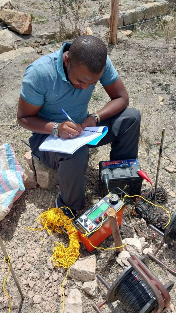
With the conceptual model refined by field observation, geophysical methods — most commonly electrical resistivity, sometimes supplemented by electromagnetic or seismic methods depending on terrain and target depth — are deployed at candidate sites to characterize subsurface conditions directly. Resistivity surveys are particularly effective at distinguishing saturated, permeable zones (which conduct electricity more readily) from dry or impermeable material, and at estimating approximate depth to productive aquifer zones before drilling begins.
Stage 4: Borehole Siting and Design
Geophysical results, combined with the broader geological and structural understanding built through earlier stages, inform the final decision on exact borehole location. Siting decisions weigh not just the likelihood of intersecting a productive aquifer, but also practical factors: accessibility for drilling equipment, distance from potential contamination sources, and proximity to where the water will actually be used or distributed.
Borehole design itself — casing diameter and material, screen placement and slot size, gravel pack specifications, and total depth — needs to be matched to the specific aquifer characteristics identified through the survey process. A screen placed against the wrong interval, or slot sizes mismatched to aquifer grain size, can significantly reduce a borehole’s yield and lifespan regardless of how well the site itself was chosen.
Stage 5: Drilling, Construction, and Development
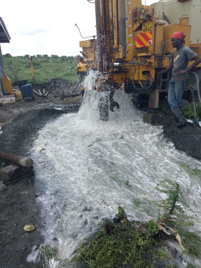
During drilling, careful lithological logging of cuttings or core — recording rock type, water strikes, and any changes in drilling behavior — provides critical real-time confirmation (or correction) of the pre-drilling conceptual model. Once the target depth is reached and casing and screen are installed, the borehole undergoes development — typically surging, airlifting, or jetting to remove drilling fluid residue and fine sediment from the area immediately surrounding the screen, improving hydraulic connection between the aquifer and the well.
Stage 6: Test Pumping and Sustainable Yield Assessment
This stage is where many groundwater projects, particularly smaller or budget-constrained ones, are tempted to cut corners — and where cutting corners causes the most long-term harm. A proper pumping test involves pumping the borehole at controlled rates over an extended period (commonly 24-72 hours for a standard constant-rate test) while monitoring water level drawdown, allowing hydrogeologists to calculate key aquifer parameters — transmissivity, storativity, and critically, a sustainable long-term yield that the borehole can support without depleting the aquifer faster than it recharges.
A borehole that appears to produce excellent water during a brief, informal test can still fail within a year or two if it’s subsequently pumped at a rate the aquifer can’t sustain — a failure mode that a proper, sufficiently long pumping test is specifically designed to catch before it becomes an operational problem.
Stage 7: Water Quality Assessment
Parallel to yield testing, water samples should be collected and analyzed for physical, chemical, and microbiological parameters relevant to the intended use — drinking water standards for domestic supply, or specific chemistry requirements for agricultural or industrial use. In many parts of East Africa, naturally occurring fluoride and, in some settings, salinity present genuine water quality concerns that a thorough survey needs to screen for before a borehole is put into service, since these issues aren’t always apparent from yield or general appearance alone.
Why Skipping Stages Causes Problems
Every stage in this methodology exists because skipping it introduces a specific, predictable risk. Skipping the desk study means field time gets spent on poorly prioritized sites. Skipping geophysics means drilling decisions rely on surface geology alone, missing subsurface structure that controls actual water availability. Skipping a proper pumping test means a borehole’s true sustainable yield remains unknown until it fails in service — often at exactly the moment, during a dry season, when reliable water matters most.
The Bottom Line
A hydrogeological survey is a sequential risk-reduction process, not a single field visit followed by a drilling contract. Each stage narrows uncertainty and reduces the chance of costly failure at the next — and for organizations investing in groundwater development, whether for a single community borehole or a larger agricultural or industrial water supply, following the full methodology consistently produces more reliable, longer-lasting results than any shortcut ever does.