Skip to content


A continental rift is a zone where the lithosphere (the rigid outer shell of the Earth) is stretched and thinned. As the crust extends, it breaks along faults, and blocks of crust drop down to form valleys called grabens or tilt to form half-grabens. The thinned lithosphere allows hot mantle material to rise, producing volcanism and high heat flow. If extension continues long enough, a rift can evolve into a new ocean basin, as is happening in the Afar region, where the Red Sea, Gulf of Aden, and East African rifts meet.
Large-Scale Setting
The EARS separates the African continent into the larger Nubian Plate to the west and the Somali Plate to the east, with smaller blocks, such as the Victoria microplate, between rift branches. Rates of extension are slow, of the order of a few millimetres per year, but over millions of years they produce kilometres of crustal stretching.
The rift system is commonly divided into two main branches around the Tanzanian craton:
The Eastern Branch (Gregory Rift) runs from the Afar region through the Main Ethiopian Rift, the Turkana depression, and the Kenya Rift into northern Tanzania. It is characterised by abundant volcanism.
The Western Branch curves around the western side of the Tanzanian craton through Uganda, Rwanda, Burundi, and the Democratic Republic of Congo, hosting deep lakes such as Albert, Edward, Kivu, Tanganyika, and Malawi, with generally less volcanism but very deep sedimentary basins.
Kenya lies within the Eastern Branch, with the Lake Victoria basin sitting between the two branches.
The Kenya Rift: A Structural Portrait
The Kenya Rift trends roughly north-south, running from Lake Turkana in the north through the Baringo-Bogoria, Nakuru-Naivasha, and Magadi regions to the Tanzanian border. Its structure changes along strike.
Northern Kenya and the Turkana depression. Here the rift widens into a broad zone of extension where the lithosphere is strongly thinned. The Turkana region has thick sedimentary and volcanic successions, and rifting here began earlier than in the south, with extension recorded from the Paleogene. Several basins and half-grabens occur, partly associated with older rift structures, such as the Cretaceous-age Anza basin, and with the Cenozoic Lokichar basin.
Central Kenya Rift. The rift narrows to a roughly 50 to 70 kilometre wide valley bounded by major escarpments. Prominent border faults include those that form the western Elgeyo Escarpment and the eastern Kinangop and Aberdare flanks, as well as the Mau Escarpment on the western side further south. The rift floor is cut by dense swarms of small normal faults, called the inner rift faulting, with a distinctive north-south to north-northeast grain, forming horsts and grabens. Large central volcanoes, including Menengai, Longonot, Suswa, Eburru, and Olkaria, occur on the rift floor and are aligned with the fault trends.
Southern Kenya Rift. The rift broadens again toward Magadi and northern Tanzania, where faulting steps out onto the flanks and into a wider zone of block faulting, with the Nguruman escarpment forming a major western boundary and the Magadi trough hosting evaporites and trona.
Half-Grabens, Border Faults, and Accommodation Zones
Many rift basins in the EARS are asymmetric half-grabens: a major border fault on one side forms a steep escarpment with deep subsidence, while the opposite side forms a gentler flexural margin. The polarity of the half-graben (which side has the border fault) commonly alternates along the rift. The transition zones, where polarity switches, are called accommodation zones or transfer zones. These zones, where strain is transferred between overlapping fault segments, often show complex fault patterns, relay ramps, and concentrated volcanic and hydrothermal activity, which makes them interesting targets for geothermal and mineral exploration.
Rift Flanks and Uplift
Alongside rifting, the crust on either side has been uplifted, forming broad rift shoulders that raise highlands such as the Aberdares, Mount Kenya region, and the Mau. This uplift influences drainage patterns, rainfall, and erosion, directing rivers away from the rift or into closed basins that host lakes. Mount Kenya itself is a large volcano whose growth is related to the rift setting.
Volcanism and Its Structural Control
Volcanism in the Kenya Rift began in the Paleogene in the north and migrated southward through time, with major phases in the Miocene and Pliocene. Magma has erupted as flood phonolites, trachytes, basalts, and large pyroclastic deposits, building thick volcanic piles. Eruptive centres and fissures commonly align with fault zones, since faults provide pathways for magma ascent. Young faulting and fissuring continue today, with active volcanoes such as Longonot and Menengai showing recent activity, and geothermal fields exploiting the heat associated with shallow magma chambers.
The Role of Inherited Basement Structures
The rift did not form on blank crust. Beneath the Kenya Rift lie ancient rocks of the Mozambique Belt, a Neoproterozoic orogenic belt with strongly deformed metamorphic rocks, shear zones, and thrusts, and to the west the Archean Tanzanian craton, which is thick and strong. Rift faults tend to follow or reactivate older structures where these are suitably oriented, while the cratonic block resists deformation and deflects the rift around it. This is why the Eastern and Western branches pass on either side of the Tanzanian craton. Foliations and shear zones in the basement control local fault geometry, with some rift faults showing segmentation and changes in orientation that mirror the underlying fabric.
Further north, large Precambrian shear zones, such as the Aswa shear zone, intersect the rift region and influenced basin development and fault trends in northwest Kenya and Uganda.
Fault Systems and Kinematics
Most faults in the main part of the Kenya Rift are normal faults accommodating roughly east-west extension. Their orientation is dominantly north-south to north-northeast, perpendicular to the extension direction. In places, oblique and strike-slip components occur where faults reactivate older structures at an angle to the extension direction, or where the rift changes trend. Fault scarps may preserve evidence of repeated movement, with displacement accumulated over millions of years, while fissures and open cracks form in zones of very recent extension. Detailed mapping of fault geometry, offsets, and relay zones helps explain patterns of volcanism, hydrothermal activity, and earthquake risk.
Sedimentary Basins and Lakes
Subsidence along rift faults creates basins that collect sediments and water. The rift lakes of Kenya, including Turkana, Baringo, Bogoria, Nakuru, Elmenteita, Naivasha, and Magadi, vary from freshwater to highly saline and alkaline. Lake sediments, volcanic ash, and alluvial deposits fill the basins, forming layered sequences up to several kilometres thick in the deepest depocentres. These sedimentary successions record climate change, volcanic activity, and early human evolution, with famous fossil sites in the Turkana basin.
Resources Linked to Rift Structure
Geothermal energy. The Kenya Rift hosts some of Africa’s most important geothermal resources, notably at Olkaria, Menengai, Longonot, Suswa, and Baringo-Silali. Heat comes from shallow magma bodies, and permeability is controlled by faults and fractures, which guide hot fluids to the surface. Structural mapping is a core part of geothermal exploration, as it identifies upflow zones, accommodation zones, and fault intersections where permeability is best.
Industrial minerals and evaporites. Lake Magadi produces soda ash from trona deposits formed by evaporation of alkaline brines in a closed rift basin. Diatomite, fluorspar, and other deposits are also associated with rift settings, for example, fluorspar in the Kerio Valley, which is linked to faults and hydrothermal fluids.
Groundwater. Faulted and fractured volcanic rocks and sediments form aquifers, but also complicate flow paths and water quality. High fluoride concentrations in some rift groundwater are linked to volcanic rocks and geothermal fluids, a significant public health concern in some regions.
Hydrocarbons. Sedimentary basins in northern Kenya, such as the Lokichar basin, have been explored for oil, with structural traps formed by rift-related faulting.
Hazards Related to Rift Structure
Earthquakes. Active faulting generates earthquakes, mostly of low to moderate magnitude, though larger events are possible. Seismic hazard must be considered in the design of dams, tall buildings, and critical infrastructure in and around the rift.
Volcanic hazards. Active and recently active volcanoes pose risks of eruption, ash fall, and gas emissions. Monitoring and hazard mapping are important in densely used areas.
Ground fissures and subsidence. Open fissures and localised subsidence occur in the rift floor, sometimes damaging roads, pipelines, and buildings.
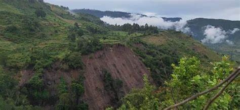
Landslides and slope instability. The steep fault escarpments, especially in wet periods, are prone to landslides and rockfalls.
Geothermal and gas hazards. Natural emissions of carbon dioxide and other gases occur in some areas, creating local risks in low-lying spots.
How Structural Geologists Study the Rift
Researchers and exploration teams combine remote sensing (satellite imagery and digital elevation models to map scarps and lineaments), geophysics (gravity, magnetic, seismic reflection, and magnetotelluric surveys to image basins and faults at depth), field mapping (fault kinematics, fault-slip data, fracture patterns), geochronology (dating volcanic rocks to constrain the timing of faulting), seismology and geodesy (earthquake locations and GPS measurements of present-day motion), and drilling (wells in geothermal and hydrocarbon exploration provide direct data on structure at depth).
Frequently Asked Questions
Will Africa split along the rift? Over many millions of years, continued extension could create a new ocean basin, but the process is very slow and the outcome uncertain.
Why is the rift volcanic in Kenya but less so in the Western Branch? Differences in lithospheric thickness, mantle upwelling, and structural setting influence the amount of magmatism.
Does the rift affect everyday life in Kenya? Yes: through geothermal power, water quality, soil types, earthquakes, and agriculture in the fertile volcanic highlands.
Conclusion
The East African Rift System is a living laboratory of continental breakup, and its structural geology explains much about Kenya’s landscape and resources. Normal faults, half-grabens, accommodation zones, volcanic centres, and inherited basement fabrics together control where heat, fluids, minerals, and sediments accumulate, and where hazards arise. For geologists, engineers, and planners working in Kenya, understanding rift structure is essential for exploring geothermal energy, managing water, siting infrastructure safely, and appreciating one of the planet’s most remarkable geological regions.