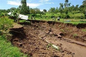
Ground doesn’t move quickly — until it does. Subsidence and deformation often unfold over months or years, invisible to the naked eye, right up until infrastructure cracks, pipelines fail, or a slope gives way. Interferometric Synthetic Aperture Radar (InSAR) has become one of the most valuable tools in geoscience for catching this movement early, measuring ground displacement at millimeter-scale precision across areas far too large to monitor with ground instruments alone.
This article explains how InSAR works, where it’s most effective, and how geoconsulting teams use it to support infrastructure, mining, and environmental monitoring projects.
What Is InSAR?
InSAR compares two or more radar images of the same location, captured by satellite at different times, to detect tiny changes in the distance between the satellite and the ground surface. Because radar wavelengths are measured in centimeters, InSAR can detect vertical or horizontal ground movement as small as a few millimeters — a level of precision that would be impractical to achieve across large areas using ground-based surveying alone.
The technique relies on the phase difference between radar signals reflected off the same point on two separate passes. If the ground has moved between acquisitions, the returning signal’s phase shifts in a measurable, predictable way. Processed correctly, this phase information is converted into a deformation map showing exactly where — and how much — the ground has moved.
Why Ground Deformation Monitoring Matters
Ground movement is rarely dramatic in its early stages, which is exactly what makes it dangerous. A few millimeters of subsidence per year sounds negligible until it accumulates into meters of displacement, or until it concentrates unevenly and cracks a foundation, tilts a structure, or ruptures a pipeline.
Subsidence and deformation can stem from a range of causes: groundwater extraction, mining activity, natural compaction of sediments, tectonic activity, landslide creep, or engineered structures like dams and tailings facilities settling under load. Each of these has different risk implications, and each benefits from being caught and quantified early.
Common Applications
Urban Infrastructure Monitoring
Cities built on compressible soils or with extensive groundwater withdrawal are particularly prone to subsidence. InSAR allows municipalities and engineering firms to monitor deformation across entire metropolitan areas, flagging zones where infrastructure — roads, rail corridors, utility networks, buildings — may be at elevated risk. This is far more cost-effective than installing dense networks of ground-based sensors across an entire city.
Mining and Tailings Facility Monitoring
Mining operations generate some of the clearest and highest-stakes use cases for InSAR. Open pit walls, underground workings, waste rock dumps, and tailings storage facilities are all subject to deformation, and failures in any of these can be catastrophic. InSAR provides operators with a way to monitor deformation trends across an entire site continuously, complementing ground-based instrumentation like extensometers, inclinometers, and GPS monitoring points.
Tailings dam monitoring in particular has become a major focus following several high-profile failures globally, and many jurisdictions and industry bodies now expect satellite-based deformation monitoring as part of a robust tailings management program.
Groundwater and Aquifer Management
In regions where groundwater is heavily extracted for agriculture or urban use, land subsidence is a well-documented consequence of aquifer compaction. InSAR time series data can be correlated with groundwater withdrawal records to help water resource managers understand the relationship between extraction rates and land surface response, informing more sustainable groundwater management policy.
Landslide and Slope Stability Monitoring
Slow-moving landslides — sometimes called creeping slopes — can be difficult to detect with the naked eye but are readily identified through InSAR time series analysis. This makes the technique valuable for transportation corridors, hillside developments, and any infrastructure situated on or below potentially unstable slopes.
Post-Seismic and Volcanic Deformation
InSAR is widely used in geohazard research to map deformation following earthquakes or during volcanic unrest, helping scientists understand fault behavior and magma movement. While this use case leans more academic and governmental, it’s a good illustration of the technique’s sensitivity and range.
How the Data Is Processed
Raw InSAR interferograms are affected by several sources of noise and error that need to be corrected before the data is usable:
- Atmospheric effects — variations in atmospheric water vapor can introduce phase delays that mimic ground deformation and must be modeled and removed.
- Topographic effects — a precise digital elevation model is needed to isolate deformation signal from elevation-related phase differences.
- Temporal and geometric decorrelation — vegetation, snow cover, and significant time gaps between acquisitions can degrade the coherence of the radar signal, particularly in vegetated or rapidly changing terrain.
- Orbital errors — small inaccuracies in satellite positioning need to be corrected to avoid introducing artificial trends into the data.
Advanced processing techniques, such as Persistent Scatterer InSAR (PS-InSAR) and Small Baseline Subset (SBAS) methods, use large stacks of images over time to build long-term deformation time series while filtering out much of this noise. These multi-temporal approaches have become the standard for operational deformation monitoring, as they’re far more robust than single interferogram pairs.
Integrating InSAR with Ground Truth
InSAR is extremely powerful, but it’s not a standalone solution. Radar satellites measure deformation along the line of sight to the sensor, which means the raw output doesn’t always directly correspond to true vertical or horizontal displacement without additional geometric correction or complementary ascending/descending orbit data.
For this reason, InSAR results are almost always validated and calibrated against ground-based instrumentation — GPS/GNSS stations, survey benchmarks, or geotechnical sensors — to confirm accuracy and build confidence in the satellite-derived trends. This combination of satellite-scale coverage and ground-based precision is where InSAR delivers the most value: broad spatial monitoring that tells you where to look closer, paired with targeted instrumentation that tells you exactly what’s happening at critical points.
Choosing the Right Monitoring Approach
Not every project needs the same InSAR configuration. Monitoring frequency, satellite selection, and processing methodology should be tailored to the specific risk being managed — a slow-moving regional subsidence study has very different requirements than active tailings dam surveillance, which may demand near-continuous monitoring and rapid alerting.
An experienced geoconsulting partner can help determine the right balance of satellite data, processing methodology, and ground instrumentation for your specific site conditions and risk profile, and can translate raw deformation data into clear, actionable risk assessments for engineers, regulators, and stakeholders.
If your project involves infrastructure, mining operations, or groundwater-dependent land, InSAR monitoring can provide an early warning system for ground movement long before it becomes visible on the surface. Reach out to our team to discuss a monitoring program tailored to your site.