Skip to content

Natural hazards rarely strike without warning signs — the challenge has always been recognizing those signs across large, complex landscapes in time to act on them. GeoAI is transforming disaster risk management by combining satellite data, terrain analysis, and machine learning to identify hazard-prone areas before disaster strikes, and to respond faster and more precisely when it does.
This article explores how GeoAI is applied across landslide, flood, and erosion risk management, and what governments, insurers, and infrastructure planners should understand about its current capabilities.
Why GeoAI Matters for Disaster Risk Management
Traditional hazard assessment has relied heavily on historical records, expert field judgment, and relatively coarse regional hazard maps — valuable, but limited by the amount of ground experienced professionals can physically cover and the historical data available to work from. GeoAI addresses both limitations: it can process satellite and terrain data across vast areas simultaneously, and it can identify subtle statistical patterns linking terrain, geology, and hazard occurrence that might not be obvious even to experienced practitioners working from historical records alone.
This doesn’t replace expert judgment — it extends it, allowing risk managers to prioritize limited resources toward the areas most likely to need attention, and to update hazard assessments continuously as new data becomes available, rather than relying on static maps that may be years or decades out of date.
Landslide Risk Prediction
How It Works
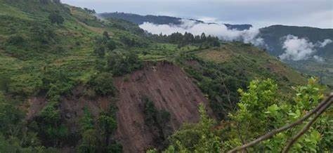
Landslide susceptibility modeling using machine learning typically combines multiple data layers: terrain characteristics derived from digital elevation models (slope angle, aspect, curvature), geological and soil data, land cover and vegetation information, rainfall patterns, and — critically — historical landslide inventories that provide the training examples the model learns from.
Machine learning models, trained on these combined datasets, learn the complex relationships between terrain and environmental conditions and landslide occurrence, then generate susceptibility maps that predict the relative likelihood of landsliding across the entire study area, including locations that have never experienced a documented landslide.
Real-World Applications
Landslide susceptibility maps generated through GeoAI support several practical applications: identifying high-risk zones for land use planning restrictions, prioritizing slope stabilization investment for transportation corridors, informing evacuation planning ahead of forecast heavy rainfall events, and supporting insurance risk assessment in landslide-prone regions.
Some organizations are also developing near-real-time landslide early warning systems, combining susceptibility modeling with rainfall forecasting and, where available, ground deformation monitoring from InSAR, to flag areas at elevated short-term risk during specific storm events.
Limitations
Landslide prediction models are only as good as their training data, and many regions lack comprehensive historical landslide inventories, particularly for smaller or remote events that were never formally documented. Models can also struggle to account for triggering factors that change rapidly, like short-duration extreme rainfall, without access to correspondingly high-resolution weather data.
Flood Risk Modeling
How It Works
AI-enhanced flood risk modeling combines terrain data, historical flood extent mapping (often derived from satellite imagery of past flood events), rainfall and hydrological data, and land use information. Machine learning models trained on this data can generate flood susceptibility maps and, in more advanced applications, near-real-time flood extent predictions during active weather events.
Satellite-based flood mapping itself has also improved significantly, with radar satellites in particular able to detect flood extent through cloud cover — a crucial capability given that major flood events are often accompanied by exactly the persistent cloud cover that would obscure optical satellite imagery.
Real-World Applications
Flood risk modeling supports floodplain mapping and land use planning, infrastructure design (culvert and drainage sizing, road elevation planning), insurance risk pricing, and emergency response, where near-real-time flood extent mapping helps responders prioritize areas for evacuation or resource allocation during active flood events.
Limitations
Flood modeling accuracy depends heavily on the quality of underlying terrain and rainfall data, and climate change is altering historical rainfall and flood patterns in ways that can reduce the reliability of models trained purely on historical data. Increasingly, flood risk models need to incorporate forward-looking climate projections rather than relying solely on past event data.
Erosion Risk Assessment
How It Works
Erosion risk modeling using GeoAI typically integrates terrain characteristics, soil type and erodibility data, land cover and vegetation density, and rainfall intensity patterns. Machine learning approaches can improve on traditional erosion models by better capturing the complex, non-linear interactions between these factors, particularly across large and environmentally variable regions.
Satellite-based change detection also plays a role here, allowing monitoring of erosion-related changes over time — bank erosion along waterways, gully formation, or vegetation loss in erosion-prone areas — supporting both predictive risk assessment and ongoing monitoring of erosion progression.
Real-World Applications
Erosion risk assessment supports agricultural land management, infrastructure planning near waterways and coastlines, mining rehabilitation planning, and watershed management programs aimed at reducing sediment loads affecting downstream water quality and reservoir capacity.
Integrating Multiple Hazards
Many of the most valuable disaster risk management applications don’t look at a single hazard in isolation, since real landscapes often face compound and interacting risks — a wildfire that strips vegetation cover can dramatically increase landslide and erosion risk in the following rainy season, for example, and flooding can trigger or exacerbate landslide activity on saturated slopes.
Integrated multi-hazard GeoAI platforms aim to capture these interactions, providing a more realistic picture of cumulative risk than assessing each hazard independently. This is a rapidly developing area, and organizations working across multiple hazard types increasingly look for modeling approaches that can account for these compounding relationships rather than treating each hazard as a separate, unrelated problem.
Considerations for Implementation
Data quality and availability remain the primary constraint. GeoAI models are only as reliable as the historical hazard data, terrain data, and environmental data available to train them, and data availability varies enormously by region — well-documented in some developed regions, sparse in many developing regions where hazard risk is often highest.
Model outputs require expert validation. Susceptibility and risk maps generated through machine learning should be reviewed by experienced geoscientists and hazard specialists before being used to inform major planning, investment, or emergency response decisions, since models can produce confident-looking outputs that don’t always hold up to expert scrutiny in specific local contexts.
Continuous updating improves reliability. Static hazard models become less reliable over time as land use, climate patterns, and other conditions change. The most effective GeoAI disaster risk programs incorporate ongoing monitoring and periodic model retraining rather than treating hazard maps as a one-time deliverable.
Communication matters as much as accuracy. Even highly accurate hazard predictions deliver limited value if they’re not translated into clear, actionable information for the decision-makers, planners, and communities who need to act on them.
The Path Forward
GeoAI is meaningfully expanding what’s possible in disaster risk management, allowing more comprehensive, frequently updated, and spatially detailed hazard assessment than was previously achievable through traditional methods alone. Realizing that value requires combining strong technical implementation with the geological and hazard expertise needed to validate, contextualize, and communicate results responsibly.
Looking to strengthen disaster risk management for a region, infrastructure network, or development project? Our team combines geoscience expertise with modern GeoAI tools to deliver hazard assessments you can act on. Get in touch to discuss your project.