Skip to content

Call/WhatsApp +254 (0) 722 672 309 / 0202672309 / 0720675811.

Structural and Exploration Geologist

Geol Mbugua Githae
  • Home
  • About
    • Geologist
  • Services
    • IoT
      • IoT Equipments
      • Softwares.
  • Data Centre
  • C & S
  • GeoAI
    • Geo Tools
    • GeoAI
      • GeoGPT
    • Research
    • Remote Sensing
  • Articles
    • Renewable Energy
      • Geothermal
      • Solar
    • Geotechnical
    • Remote sensing
    • Mining
      • Mineral Feasibility Studies
      • geological maps
      • Exploration
    • Hydrogeology
    • Carbon Capture
    • Hazards
  • Contact Us
Search
Get a quote
Get a quote
Geol Mbugua Githae
  • Home
  • About
    • Geologist
  • Services
    • IoT
      • IoT Equipments
      • Softwares.
  • Data Centre
  • C & S
  • GeoAI
    • Geo Tools
    • GeoAI
      • GeoGPT
    • Research
    • Remote Sensing
  • Articles
    • Renewable Energy
      • Geothermal
      • Solar
    • Geotechnical
    • Remote sensing
    • Mining
      • Mineral Feasibility Studies
      • geological maps
      • Exploration
    • Hydrogeology
    • Carbon Capture
    • Hazards
  • Contact Us
GEOLOGICAL GeoAI

Multispectral vs. Hyperspectral Imaging: Which Is Right for Your Geological Survey?

Choosing the right imaging technology can make or break the value of a remote sensing survey. Multispectral and hyperspectral imaging

Multispectral vs. Hyperspectral Imaging: Which Is Right for Your Geological Survey? Read More »

Radar

Land Subsidence Monitoring Using Satellite Radar (InSAR): A Guide

Ground doesn’t usually move fast enough for people to notice — a few centimeters a year is invisible to the

Land Subsidence Monitoring Using Satellite Radar (InSAR): A Guide Read More »

Remote Sensing for Mineral Exploration

Understanding the Differences Between DEM, DSM, and DTM in Geospatial Analysis

In the fields of geospatial science, remote sensing, and geomatics, elevation data plays a critical role in terrain analysis, engineering

Understanding the Differences Between DEM, DSM, and DTM in Geospatial Analysis Read More »

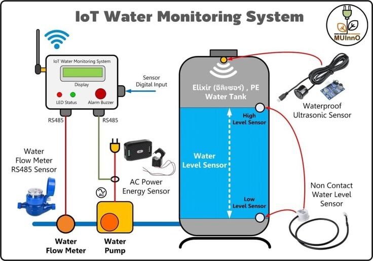
Remote Water Monitoring with IoT: A New Era in Hydrogeology

Water resources are among the most valuable natural assets on Earth. Effective water management requires accurate and continuous monitoring of

Remote Water Monitoring with IoT: A New Era in Hydrogeology Read More »

Top IoT Sensors Transforming Modern Geoconsultancy

The integration of the Internet of Things (IoT) into geoscience and engineering has significantly transformed how geoconsultancy firms collect, analyze,

Top IoT Sensors Transforming Modern Geoconsultancy Read More »

Kenya Wins the Bid to Host the World Geothermal Congress 2029

Kenya has achieved a major milestone in the global renewable energy sector after successfully winning the bid to host the

Kenya Wins the Bid to Host the World Geothermal Congress 2029 Read More »

World Geothermal Congress 2026: Advancing Global Geothermal Energy in Canada

Later this year, the global geothermal community will gather in Canada for one of the most important international events in

World Geothermal Congress 2026: Advancing Global Geothermal Energy in Canada Read More »

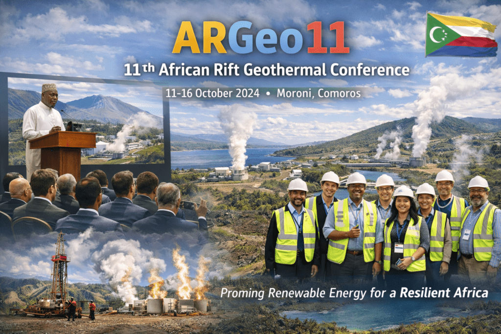
ArGEO11: Advancing Geothermal Development in Africa at Moroni, Comoros

Later this year, geothermal experts, scientists, policymakers, and energy stakeholders from across Africa and the world will gather in Moroni,

ArGEO11: Advancing Geothermal Development in Africa at Moroni, Comoros Read More »

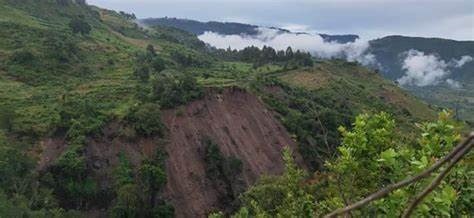
Volcanic and Seismic Hazards in the Rift Valley

Kenya Geothermal Congress 2024: Advancing Geothermal Energy for Sustainable Development

In July 2024, Kenya hosted one of the most important geothermal energy events in Africa — the Kenya Geothermal Congress

Kenya Geothermal Congress 2024: Advancing Geothermal Energy for Sustainable Development Read More »

Machine Learning for Mineral Prospectivity Mapping

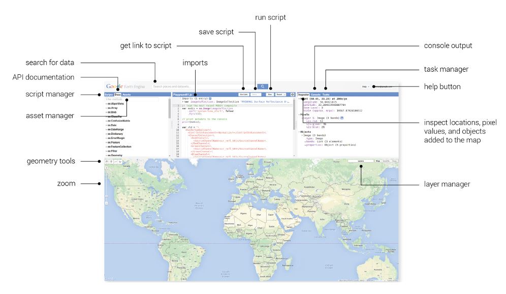
Extracting a Digital Elevation Model (DEM) for Kenya Using Google Earth Engine

Digital Elevation Models (DEMs) are fundamental datasets in geoscience, hydrology, environmental studies, infrastructure planning, and hydrogeology. In Kenya, DEMs are

Extracting a Digital Elevation Model (DEM) for Kenya Using Google Earth Engine Read More »

← Previous 1 2

Recent Posts

  • Unlocking Africa’s Geothermal Resource Potential
  • Unveiling Africa’s Geological Resources
  • Incentivizing Geothermal Energy
  • Why Boreholes Dry Up
  • Drone Mapping for Geology and Mining

Recent Comments

  1. Brenda Fassie on The Role of Remote Sensing in Identifying Mineral Deposits
  2. The ground water company on How to Read a Geological Map – Beginner to Pro
  3. The ground water company on How to Read a Geological Map – Beginner to Pro
  4. The ground water company on How to Read a Geological Map – Beginner to Pro

“Science Beneath the Surface. Strategy Above It.”

Geol. Mbugua Githae (MGSK) || Principal Geologist.

Geol Mbugua Githae

Geologist | IGSL | Proweb Tutors | Contact | Green Energy


Mailto: geologist@innercoregeoconsultants.co.ke

About Us

A leading consultant Geologist based in Kenya and operating across Africa. He specializes in structural geology, mineral exploration, geotechnical assessments, hydrogeological surveys, and GIS-based mapping solutions.

“Science Beneath the Surface. Strategy Above It.”

Reach Us

Thika Rd, Spur Mall, Kiambu, Kenya.
P.O. Box 9356 – 00200 KBU.

Tel: 0202672309.
Phone: 0722672309/0720675811.

Mailto: Geologist@innercoregeoconsultants.co.ke

Work With Us

Open Hours

Mon – Fri 0800 – 1800 Hrs
Sat            0800 – 1300 Hrs

Inquire With Us.

Copyright © 2021 | Geol Mbugua Githae, MGSK | IGSL

Structural and Exploration Geologist.

imunify-bot-check
avat

Geol Mbugua Githae

Typically replies within minutes

Any questions related to GeoAI?

WhatsApp Us

🟢 Online | Privacy policy

WhatsApp us