Skip to content

Nanyuki sits on the north-western flank of Mount Kenya, where farms, flower growers, hotels, schools and a fast-growing town depend increasingly on groundwater. Rivers are under pressure, and researchers have reported a retreating water table in the area. In this setting a poorly sited borehole can mean a dry hole or a low-yielding, expensive one. This case study walks through how a hydrogeologist approaches borehole siting in Nanyuki, using an illustrative project that follows published science on the region’s aquifers.
The Setting: A Volcanic Aquifer System
Mount Kenya is an extinct volcano, and the ground around Nanyuki is built from layers of lava flows, volcanic ash and sediment deposited over millions of years. Water moves through these layers in complex ways. Some lava flows are fractured or have rubbly tops and bases that carry water well, while dense, unfractured lava layers act as barriers. Buried soils and ash layers between flows can also hold or restrict water.
A published study of the Ewaso Ng’iro catchment on the north-eastern side of Mount Kenya found three distinct groundwater subsystems with different chemistry and recharge zones: one linked to Mount Kenya, one to the Nyambene Range, and a confined or semi-confined system in between. The water was of recent rainfall origin, and in the dry season the river was almost entirely sustained by groundwater, with the Mount Kenya subsystem providing about half of the maximum flow. The study also showed an influence of volcanic carbon dioxide on the chemistry of the middle system.
For a borehole siter, the lesson is that aquifers here are layered and compartmentalised. Two sites a few hundred metres apart can behave very differently.
The Client Brief
Imagine a landowner on the outskirts of Nanyuki who needs a reliable water supply for a small farm and homestead. A neighbour’s borehole is deep and yields modestly. Another nearby hole was abandoned dry. The client wants a site, an estimate of likely depth and yield, and advice on permits.
Step 1: Desktop Study
The hydrogeologist starts with a desk review:
- Geological maps and reports to identify the rock types and structures near the plot.
- Existing borehole records from neighbours and public databases, including depth, water strike levels, rest water level, yield and water quality. National groundwater compilations have long recorded that expected yield correlates strongly with geology, so these records are a valuable guide.
- Topography and drainage from a digital elevation model, to identify valleys, breaks of slope and possible fault or fracture lines.
- Satellite imagery to see lineaments, vegetation patterns and land use.
- Rainfall and climate data, since recharge depends on how much water reaches the aquifer.
- Nearby abstraction, because heavy pumping by neighbours can lower the water table and reduce yield.
The desk study produces a hypothesis about the likely aquifer, the expected depth range and the best areas of the plot to investigate.
Step 2: Site Reconnaissance
A field visit confirms what the maps suggest. The hydrogeologist walks the plot, notes outcrops and soil, looks for springs or seepages, checks neighbouring boreholes and talks to local people about water levels and seasonal changes. The visit also identifies practical constraints: access for a drilling rig, distance from septic tanks and latrines, power lines and property boundaries.
Step 3: Geophysical Survey
Geophysics reduces the risk of drilling blind. In volcanic terrain the usual tools are:
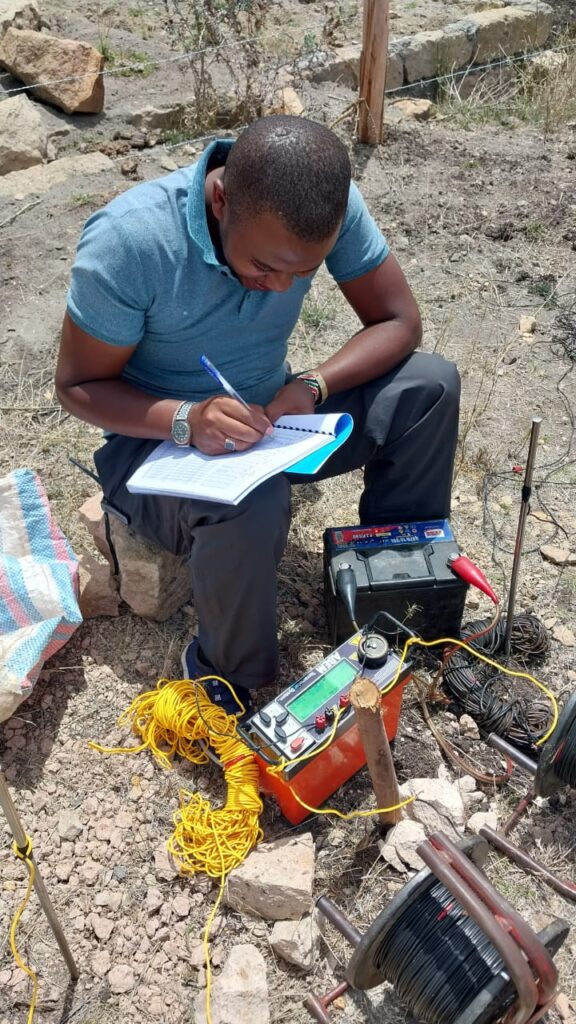
- Vertical Electrical Soundings (VES). Current is injected into the ground and voltage is measured at increasing electrode spacings, which reveals how resistivity changes with depth. Water-bearing fractured zones generally have lower resistivity than dry, dense lava, although clay can also give low readings, so interpretation needs geological judgement.
- Electrical Resistivity Tomography (ERT). A multi-electrode version that produces a two-dimensional section, helpful for tracing fractures and layer boundaries.
- Electromagnetic profiling. A rapid method to map lateral changes and locate conductive zones before more detailed work.
Surveys are laid out across suspected fracture lines or along lines chosen from the desk study. Several candidate points are then compared, and the best site is chosen on the basis of the thickness of the weathered or fractured zone, the depth to the probable water-bearing layer and the absence of confining dense rock at shallow depth.
A good report states clearly that geophysics indicates favourable conditions but cannot guarantee a yield.
Step 4: Siting Recommendation and Permits
The hydrogeologist recommends a primary site and a backup, with an expected drilling depth range and a description of the anticipated geological sequence. The report also sets out what a safe and sensible design looks like, including casing depths, screen placement and gravel packing.
In Kenya, drilling and abstracting groundwater is regulated. The client should work with the hydrogeologist to prepare the application to the Water Resources Authority for the required permits and to use a licensed drilling contractor. Confirm current requirements with the Authority before starting, as procedures and forms are updated.
Step 5: Drilling Supervision
Supervision by the hydrogeologist is often what separates a good borehole from a mediocre one. During drilling, they:
- Log the rock chips at regular depth intervals and compare them with the predicted sequence.
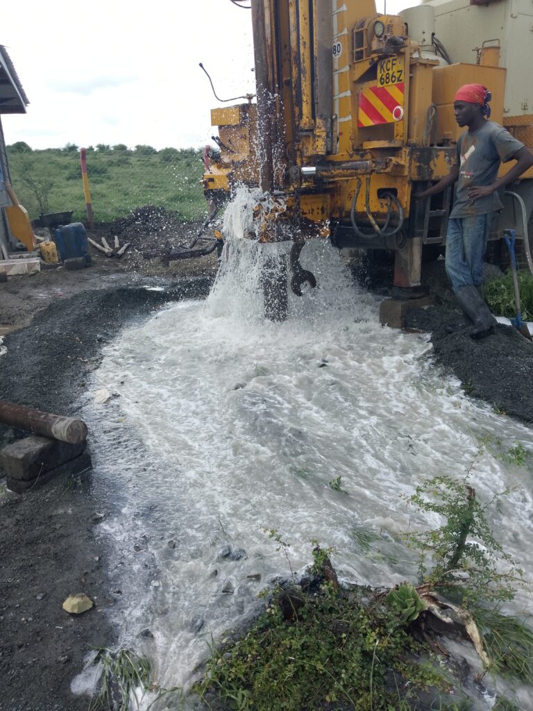
- Record water strikes, noting depth, estimated flow and any changes in drilling behaviour.
- Decide when to stop, when to go deeper and where to place screens so that productive zones are tapped and unproductive or poor-quality zones are sealed off.
- Ensure proper casing, gravel pack, sanitary seal and development of the well.
In volcanic sequences, a key skill is recognising which water strikes are real aquifer zones and which are minor seepages that will not sustain pumping.
Step 6: Pumping Test and Yield Assessment
After construction, a pumping test measures how the borehole responds. A typical programme includes a step-drawdown test, to see how the water level behaves at increasing rates, and a constant-rate test over many hours, followed by recovery monitoring. The results give the sustainable yield, the drawdown at that yield and the aquifer’s hydraulic properties.
The hydrogeologist then recommends a pump setting depth and a safe operating regime, such as daily pumping hours, so that the borehole is not over-stressed. Water samples go to a laboratory for chemical and bacteriological analysis. Volcanic groundwater can contain naturally elevated fluoride in some areas, and fluoride is a recognised issue in several volcanic parts of Kenya, so testing is essential before the water is used for drinking.
Step 7: Protection and Monitoring
A borehole is an asset to protect. Recommended practices include fencing and a sealed wellhead, a safe distance from pollution sources, a water-level meter and a log of pumping hours and volumes. Seasonal level readings reveal whether the aquifer is being drawn down over time. Because groundwater use around Nanyuki is rising, monitoring protects the client and the wider community.
Why This Process Works
Following the steps reduces the chance of three common failures: a dry borehole, a borehole too shallow to survive dry seasons, and water that fails quality standards. It also gives the client a documented basis for permitting and for dealing with neighbours if disputes arise.
Lessons for Landowners in Nanyuki and Similar Terrain
- Do not site by guesswork or by copying a neighbour. Layered volcanic aquifers vary over short distances.
- Pay for a proper survey. The cost is small compared with a failed borehole.
- Insist on supervision. Decisions made during drilling shape the final yield.
- Test water quality early.
- Think about the shared resource. Declining water tables are a community issue, so efficient use and monitoring matter.
Key Takeaways
Borehole siting around Nanyuki combines geology, geophysics and careful field judgement in a layered volcanic aquifer system. A structured process, from desk study to pumping test, improves success rates and protects both the investment and the resource.
If you are planning a borehole in the Mount Kenya region, a registered hydrogeologist can assess your plot, design the survey and supervise the drilling to a documented standard.
Sources and Further Reading
- Recharge-discharge dynamics of the Ewaso Ng’iro River and Mount Kenya groundwater subsystems
- In sustainability search, Kenya studies the unknown depths of its aquifers, Christian Science Monitor
- Kenya takes a look into the unknown: its underground water reserves, Gulf News
- Groundwater resources in Kenya (national compilation), IRC
- Groundwater situation analysis in Turkana, showing volcanic fluoride and salinity issues