Skip to content


A hydrogeological survey in Kenya typically costs between KSh 45,000 and KSh 150,000, depending on the site, the methods used and the level of reporting. Basic site surveys for a small domestic plot can sit at the lower end, while comprehensive surveys with geophysics, a full report and permit support sit at the higher end. Some published price lists for large or complex projects quote KSh 150,000 to KSh 300,000, particularly where multiple sites, extra geophysical lines or detailed aquifer studies are required.
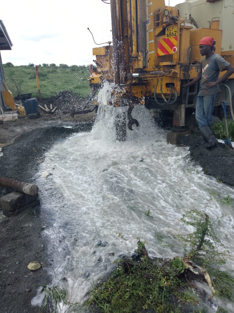
Compared with the cost of a borehole, which can run from KSh 600,000 to several million shillings, the survey is a small fraction of the total. Yet it is the step that most strongly influences whether the borehole succeeds.
What Is a Hydrogeological Survey?
Hydrogeology is the science of groundwater: where it occurs, how it moves through rock and soil, how much can be extracted sustainably and what its quality is. A hydrogeological survey applies that science to a specific site to answer practical questions:
- Is groundwater likely to be present beneath this plot?
- At roughly what depth, and in which rock layers?
- What yield can reasonably be expected?
- Is the water likely to be fresh, saline or contaminated by naturally occurring elements such as fluoride?
- Will pumping here affect neighbouring boreholes or springs?
The answers guide where to drill, how deep to go, what drilling method and casing design to use, and what to tell the Water Resources Authority (WRA) in your permit application.
What Is Included in a Typical Survey?
Prices vary because “survey” can mean different things. A professional survey normally includes some or all of the following:
1. Desktop study. The hydrogeologist reviews geological maps, topography, rainfall patterns, satellite imagery and records from existing boreholes in the area. In Kenya, WRA borehole records and published geological maps are valuable sources.
2. Field reconnaissance. A site visit to observe rock outcrops, drainage lines, vegetation, springs, nearby wells and surface features such as faults and lineaments, which can indicate fractured, water-bearing zones.
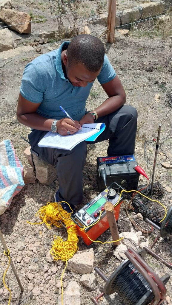
3. Geophysical measurements. The most common is Vertical Electrical Sounding (VES) or electrical resistivity profiling, which measures how easily electric current passes through the ground. Water-bearing layers usually have different resistivity from dry rock. Other methods include electromagnetic (EM) surveys and, less often, seismic refraction or magnetic surveys.
4. Data interpretation. Raw readings are processed with software and interpreted to build a picture of subsurface layers, their thickness and their likelihood of holding water.
5. Recommendations and report. The final report gives recommended drilling positions, expected depth ranges, drilling and casing advice, expected yield and quality risks, and often the statutory information needed for a drilling permit application.
Factors That Drive the Price
Site size and number of points. A single borehole on a small residential plot needs fewer measurements than a farm, estate or institution that may need several candidate sites.
Terrain and access. Rugged ground, dense vegetation or remote locations increase travel time and field effort.
Geophysical method and number of stations. Doing one VES station is cheaper than running multiple profiles or combining resistivity with EM.
Geological complexity. Volcanic terrains with layered lavas and tuffs, or basement rocks where water occurs in discrete fractures, usually need more careful investigation than uniform sedimentary plains.
Report depth and compliance support. A short site memo costs less than a full report prepared to meet WRA requirements, especially if it includes permit application assistance and an environmental screening.
Consultant experience and registration. Experienced, registered professionals charge more than informal operators but reduce your risk, which is the real value of the service.
Indicative Price Ranges in Kenya
The following ranges draw on publicly advertised contractor and consultant price lists in 2025 and 2026. They are indicative, and quotes differ widely by region and scope.
| Survey type | Typical range (KSh) |
|---|---|
| Basic site survey, small plot | 45,000 to 40,000 |
| Standard survey with geophysics and report | 50,000 to 100,000 |
| Comprehensive survey with permit support (Nairobi and surrounds) | 50,000 to 150,000 |
| Large or multi-site hydrogeological study | 150,000 to 300,000+ |
| Standalone geophysical survey | 100,000 to 250,000 for advanced work |
Some providers bundle the survey with environmental assessment and permit processing. One advertised package around KSh 100,000 includes reconnaissance, field data collection, report compilation and statutory fees. Always check what is bundled before comparing prices.
Why a Survey Pays for Itself
Consider the economics. Suppose you plan an 150-metre borehole at KSh 7,000 per metre. Drilling alone costs about KSh 1.05 million. If a poorly sited hole comes up dry or low-yielding, you may lose most of that money and face a second attempt. A survey costing KSh 50,000 to KSh 100,000 is roughly 5 to 10 percent of the drilling cost. If it improves your chance of success even modestly, or helps you avoid drilling deeper than necessary, it more than pays for itself.
Surveys also reduce other risks. They can flag zones likely to have poor water quality, steer you away from contaminated areas near pit latrines or septic tanks, and help you design a borehole that meets the sustainable yield without harming the aquifer.
The Survey and the Law
Under the Water Act 2016 and the Water Resources Regulations, drilling a borehole requires authorisation from the Water Resources Authority. The application normally needs a hydrogeological report that documents the site, the expected aquifer and the proposed construction. This is why a credible, well-documented survey is not just good practice but a regulatory requirement. Environmental authorities (NEMA) and county governments may also request supporting documents. For the permit process, see our step-by-step permit guides.
How Accurate Are Surveys? An Honest Look at Uncertainty
No survey can guarantee water. Groundwater occurs underground where we cannot see it, and geophysical measurements are indirect: they measure electrical properties, not water itself. Interpretation depends on assumptions and local calibration. In fractured hard rock, a borehole just a few metres off a fracture can miss water entirely. In layered volcanic rocks, perched aquifers and clay-rich layers can mislead.
What a good survey does is improve the odds and quantify the risk. A competent hydrogeologist will explain expected ranges rather than promise a number, will calibrate geophysics using nearby boreholes where data exist, and will be candid when a site has poor prospects. Be wary of anyone who offers “100 percent guaranteed water.”
How to Get Good Value from a Survey
- Define your water need. State your daily demand in cubic metres. A household might need 3 to 10 cubic metres per day, a small farm or school far more. The survey should relate expected yield to your need.
- Ask what methods will be used. Resistivity combined with geological interpretation is a sound standard approach. Watch out for non-scientific methods presented as surveys (see our water divining article).
- Request a written report with maps, interpreted sections, recommended coordinates, expected depth range and quality considerations.
- Check credentials and track record. Ask for recent projects in your area, professional memberships and references. Local experience matters because geology changes quickly across short distances in Kenya.
- Clarify what is included. Are permit application support, EIA screening and site supervision during drilling part of the fee?
- Compare like with like. A cheaper survey with one resistivity point and no report is not equivalent to a thorough study.
Questions to Ask Before You Hire
- Which geophysical methods do you use, and how many stations will you run on my site?
- Do you review existing borehole records in the area?
- What will the report contain, and will it be accepted by WRA?
- Can you supervise drilling and interpret drilling logs?
- What happens if the borehole is dry? (A responsible consultant will explain risk honestly and advise on options.)
Regional Considerations
Nairobi and Kiambu. Thick volcanic sequences with water at considerable depth. Surveys focus on identifying the productive aquifer horizons and avoiding clay-rich zones.
Nakuru and the Rift floor. Good yields are possible but fluoride and salinity risks are high, so the survey should include a water-quality risk assessment using nearby borehole data.
Nanyuki and Mount Kenya foothills. Recharge from the mountain supports aquifers, but variable volcanic layers require careful siting.
Arid and semi-arid north (e.g., Kakuma, Garissa). Sedimentary and basement settings with deeper, sometimes saline groundwater, where the survey may cover regional geology and recharge as well as site selection.
Basement terrain (Machakos, Kitui). Water occurs in fractures and weathered zones, so structural geology and lineament analysis are especially important.
Frequently Asked Questions
How long does a survey take? Field work for a single site often takes a few hours to a day, with the report following within days, depending on scope.
Is the survey fee refundable if I do not drill? Usually not, because the work is done and the data delivered.
Can the same company survey and drill? Yes, but independence has value. An independent hydrogeologist has no financial incentive to recommend a deeper hole.
How long is a survey valid? The geology does not change quickly, but WRA and other approvals have their own timelines. Conditions such as nearby abstraction can change, so rely on current advice.
Do I need a new survey for each borehole? Generally yes, because each site has its own geology and risk.
Conclusion
A hydrogeological survey in Kenya usually costs from about KSh 45,000 for a basic assessment to KSh 150,000 or more for a comprehensive study, which is a small percentage of the borehole investment. It informs where to drill, how deep, what to expect from water quality and how to satisfy regulators. Choose a qualified consultant, insist on a clear scope and written report, and treat the survey as the foundation of your project rather than an optional extra.
To discuss a survey for your site, contact Reg. Geol. Mbugua Githae (MGSK) through consult.innercoregeoconsultants.co.ke. Hydrogeological and geological services are offered across Kenya and the wider region.