Skip to content


Drilling a borehole is permanent and expensive. Once the rig has moved off, you cannot easily relocate the hole. That is why siting, the process of choosing where to drill, matters more than almost any other decision. A well-sited borehole delivers reliable, good-quality water for decades. A poorly sited one can produce little water, salty water or none at all.
The good news is that groundwater is not random. It follows geological and hydrological rules. Scientists use a combination of methods to read those rules and reduce the risk of drilling in the wrong place. This article explains the main siting methods used in Kenya in plain language.
How Groundwater Occurs: The Basics
Rain and river water soak into the ground, a process called recharge. The water moves downward until it reaches the water table, below which pore spaces and fractures in rock are saturated. Rock or sediment that stores and yields usable water is an aquifer.
Two properties control whether a rock makes a good aquifer:
- Porosity: how much empty space it contains.
- Permeability: how easily water can move through it.
Sand and gravel have both. Clay has high porosity but very low permeability, so it holds water but does not release it. Massive, unfractured granite has very low porosity, but weathered zones and fractures can store and transmit water. Volcanic rocks can be excellent aquifers where lavas are fractured or where layers of ash and tuff are permeable. Kenya has all of these settings, which is why local geological knowledge is essential. Our companion article on aquifer types in Kenya covers this in detail.
Method 1: Desktop Study of Geology, Maps and Existing Boreholes
Every good siting exercise starts at a desk. The hydrogeologist gathers:
- Geological maps showing rock types and faults.
- Topographic maps and digital elevation models showing valleys, ridges and drainage patterns.
- Rainfall and climate data to estimate recharge.
- Records of nearby boreholes, including depth, water strike depth, yield and water quality. These are often the most valuable data because they show what the ground actually delivered nearby.
If five neighbouring boreholes all struck water at 120 metres and yielded 3 to 5 cubic metres per hour, that is strong evidence for what to expect. If two were dry and one was saline, that is a warning.
Method 2: Remote Sensing and Lineament Analysis
Satellite images and aerial photos reveal large-scale features that are invisible from the ground. Geologists look for:
- Lineaments: straight or gently curved features in the landscape that often mark faults and fracture zones. In hard rock terrains, fractures can channel groundwater, so a borehole intersecting a fracture may yield much more than one drilled in solid rock a few metres away.
- Drainage patterns: the way streams join and bend can indicate underlying rock structure.
- Vegetation anomalies: patches of greener vegetation in dry seasons can hint at shallow groundwater or moisture-rich zones, though this is only supporting evidence.
Remote sensing is cost-effective for screening large areas, such as a farm or ranch, before field work. Modern GIS tools allow combining layers (geology, slope, drainage density, lineaments) into a groundwater potential map.
Method 3: Geological Field Reconnaissance
Field observation checks and refines desktop findings. The geologist walks the site to:
- Identify rock outcrops, weathering depth and soil types.
- Map visible fractures, joints and fault traces and measure their orientation.
- Look for springs, seeps, wetlands and traditional wells.
- Note land use and contamination risks such as pit latrines, septic tanks, waste dumps, fuel stations and industrial sites.
- Assess practical access for a drilling rig.
Structural geology is particularly important in basement and volcanic terrains. Fracture orientation influences which direction groundwater flows, so a borehole placed correctly across a water-bearing fracture can perform far better.
Method 4: Geophysical Surveys
Geophysics measures physical properties of the subsurface from the surface, helping to “see” underground without drilling. The most common methods for groundwater in Kenya are:
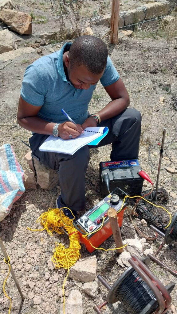
Electrical resistivity (VES and profiling). Electrodes inject current into the ground and measure the resulting voltage. The apparent resistivity changes with depth, revealing layers. Dry rock and clay-free sands have different resistivities from saturated or clay-rich layers. In general, water-bearing, fractured or weathered zones show lower resistivity than the surrounding dry, intact rock, but clays and saline water also give low values, so interpretation needs geological context. Our dedicated article on VES explains the technique in depth.
Electromagnetic (EM) methods. These use alternating electromagnetic fields to map conductive zones quickly along a line. They are useful for locating fracture zones and for mapping saline versus fresh water.
Magnetic surveys. Used mainly to detect dykes and faults in volcanic and basement rocks, which may form boundaries or conduits for water.
Seismic refraction. Measures how sound waves travel through layers; useful for estimating depth to bedrock and weathered thickness.
Geophysics does not detect water directly. It detects contrasts in physical properties that a trained interpreter relates to geology and likely water content.
Method 5: Hydrogeological Interpretation and Siting Decision
After combining all data, the hydrogeologist makes the siting decision. Good siting balances several criteria:
- Likelihood of intersecting a productive aquifer.
- Expected yield versus your demand.
- Water quality risks such as fluoride, salinity or nitrate.
- Distance from contamination sources (typically as far as practically possible from latrines and septic systems, and in line with regulatory guidance).
- Distance from existing boreholes to reduce interference.
- Access and economics. A theoretically perfect point that the rig cannot reach is useless.
The result is usually one preferred drilling position and one or two alternates, with an expected depth range and a recommended borehole design.
Method 6: Test Drilling and Borehole Logging
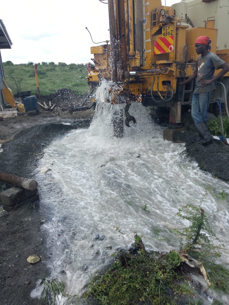
In some projects, particularly for large water supplies, a narrower exploratory borehole is drilled first to check the geology. During any drilling, a geologist records the rock chips (cuttings) brought up, noting rock type and the depth where water is struck. These drilling logs confirm or adjust the model and guide final casing and screen placement.
Geophysical logging of the drilled hole (such as natural gamma or resistivity logs) can also identify productive zones precisely, so screens go where the water is.
What About Traditional Methods?
Many Kenyans know of water diviners and traditional indicators such as certain plants, termite mounds or ant behaviour. Some indicators, for example plants that depend on shallow water (phreatophytes), have a real scientific basis, because they reflect near-surface moisture. But they do not tell you about deep aquifers at 100 to 250 metres, nor about water quality or sustainable yield. We discuss the evidence on water divining in a separate article. In practice, scientific siting is far more reliable and gives you data you can submit to regulators.
A Step-by-Step Siting Workflow You Can Follow
- Define your demand in cubic metres per day and the intended use (domestic, livestock, irrigation, industrial).
- Hire a qualified hydrogeologist with local experience.
- Provide site information: plot boundaries, title or lease documents, locations of buildings, latrines, septic tanks and existing wells.
- Allow the desktop and field study to be done before any rig is booked.
- Review the report and ask questions about expected depth, yield and quality risk.
- Mark the drilling point with coordinates and a clearly visible peg, and keep it protected from construction activity.
- Apply for the necessary permits before drilling (see our permit guides).
- Supervise drilling or have your geologist do so, ensuring the log and construction match the design.
Common Siting Mistakes
- Choosing a spot for convenience (next to the house or tank) without scientific input.
- Relying on a single indicator such as a diviner’s reading or a neighbour’s borehole without checking geology.
- Siting too close to latrines or septic tanks, risking contamination.
- Ignoring regional water quality. In the Rift Valley, high fluoride is common, so quality risk should be part of siting.
- Drilling into the same aquifer as an overpumped neighbour, leading to interference and falling levels.
- Skipping permits and later being unable to legally use or register the borehole.
Factors That Affect Success Differently Across Kenya
In volcanic areas such as Nairobi, Nakuru and Nanyuki, productive layers may be deep and separated by clay-rich or tuffaceous horizons, so siting relies on understanding the layering and structure. In basement terrain such as Machakos and Kitui, success depends heavily on locating fracture zones and thicker weathered profiles. In sedimentary basins along the coast and in the north, siting focuses on thick, clean sand and gravel layers and avoiding saline zones. In arid regions, recharge is low, so sustainable yield must be assessed carefully, since a high initial yield may not last.
Frequently Asked Questions
Can a smartphone app find water? No app can detect groundwater on its own. Apps that show maps or satellite layers can help with screening, but they do not replace field geophysics and professional interpretation.
How accurate is geophysical siting? It significantly improves the success rate compared with random siting, but it cannot guarantee a result. Local geology, data quality and interpreter experience all matter.
Can I move the borehole a few metres from the recommended point? In fractured rock a shift of even a few metres can change results. Discuss any change with your hydrogeologist first.
Is it better to drill deeper to be safe? Not necessarily. Drilling beyond the productive aquifer wastes money and may hit poorer-quality water. The design should follow the hydrogeological model.
Conclusion
Finding water for a borehole is a science-based process that combines geological mapping, remote sensing, field observation, geophysics and careful interpretation. Each method reduces uncertainty, and together they give you the best chance of drilling a productive, safe and legally compliant borehole.
If you are planning a borehole and want professional siting, contact Reg. Geol. Mbugua Githae (MGSK) via consult.innercoregeoconsultants.co.ke for hydrogeological surveys, geophysics, GIS and remote sensing services across Kenya and the region.