Skip to content


People often ask, “How deep should my borehole be?” A fair answer is: as deep as the aquifer requires, and no deeper. Depth depends on where productive aquifers lie beneath your plot, which is controlled by geology, topography and the position of the water table. Still, regional patterns exist, and understanding them helps you set realistic budgets and expectations.
As a broad guide, many boreholes in the volcanic terrains around Nairobi, Kiambu, Nakuru and Nanyuki are drilled to roughly 100 to 300 metres, but individual boreholes fall well outside this range. Shallower holes of 60 to 100 metres exist in favourable spots, and some deep boreholes exceed 300 metres. The figures in this article are indicative ranges based on typical practice and published contractor guides, not guarantees for any specific plot. Only a site-specific hydrogeological survey can estimate depth for your location.
Key Terms You Should Know
- Water table: the top of the saturated zone underground.
- Static water level (SWL): the depth from the surface to the water level in a borehole when it is not being pumped.
- Water strike: the depth at which the drill first encounters water-bearing rock.
- Aquifer thickness and depth: the interval of rock that stores and yields water. A borehole should penetrate sufficient aquifer thickness to deliver the required yield.
- Total depth (TD): the final drilled depth, which is usually below the main water strike to provide a sump and allow casing and screens to be positioned correctly.
- Pump setting depth: where the pump sits in the borehole, which must be below the lowest expected pumping water level.
Notice that borehole depth is not the same as water depth. Water may be struck at 90 metres, but the borehole may be drilled to 150 metres to access thicker aquifer zones and provide room for drawdown.
Why Depth Matters for Cost and Performance
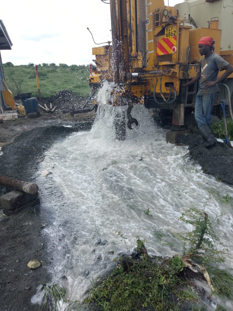
Drilling is charged per metre, so each additional 50 metres can add several hundred thousand shillings in drilling and casing cost. Depth also affects pump size, power consumption and long-term running costs. Deeper pumping requires a more powerful pump and more energy per cubic metre of water.
Drilling too shallow risks missing the main aquifer or ending up with low yield and seasonal failure. Drilling too deep can waste money and, in some areas, reach water of poorer quality. The goal is to match depth to the hydrogeological model.
Nairobi: Deep Volcanic Aquifers
Nairobi sits on thick sequences of volcanic rocks, including lavas, tuffs and volcanic ash deposits that were erupted from the Rift Valley and highland volcanoes, overlying older basement rocks at depth. Groundwater occurs in fractured and weathered zones within these layers, often at significant depth. Layers of clay-rich paleosols (ancient buried soils) and compact tuffs can act as barriers, so productive aquifers may be separated by low-permeability horizons.
In practice, Nairobi boreholes are commonly drilled to 150 to 300 metres, and published contractor examples cite 180-metre boreholes as typical for cost estimation. Depths vary strongly between areas such as Karen, Runda, Eastlands, Embakasi and Westlands, because the thickness and character of the volcanic layers differ.
Static water levels can be tens of metres below the surface, and in some areas well over 100 metres. Yields range widely from under 1 to over 20 cubic metres per hour, which is why a survey informed by local borehole records is so important. Nairobi also has dense borehole use, so interference between neighbouring boreholes can influence both depth and sustainable yield.
Kiambu: Between the Highlands and the Plateau
Kiambu County lies on the volcanic highland slopes and plateaus north and west of Nairobi, with elevation and geology changing quickly across short distances. Areas such as Thika, Ruiru, Juja, Limuru and Kikuyu have different aquifer settings. Rainfall is relatively high in the upper zones, supporting recharge, while the lower, drier plateau areas have deeper water levels.
Typical borehole depths in Kiambu are often in the 100 to 250 metre range, with shallower boreholes possible in favourable valleys and deeper ones in upland areas with thick volcanic cover. Yields tend to be moderate to good where fractured lavas or weathered volcanic zones are intersected, but variability is high. Because Kiambu hosts farms, estates and fast-growing residential areas, demand is rising and sustainable yield assessment is important.
Published contractor information suggests drilling costs in Kiambu may differ from Nairobi price lists, so request itemised quotations and compare like for like.
Nakuru: The Rift Floor and Escarpments
Nakuru County spans the floor of the Great Rift Valley, the surrounding escarpments and volcanic highlands. The geology includes volcanic lavas, pyroclastics and lake sediments, cut by many faults. Groundwater flows from recharge areas on the Mau and Bahati highlands toward the rift floor.
Typical borehole depths in Nakuru are often 100 to 300 metres, with deeper holes where thick volcanic or sedimentary cover exists. Rift floor boreholes can have good yields where fault zones and fractured volcanics are tapped, but depth is not the only concern. Water quality is critical in Nakuru. Research on groundwater in Nakuru County has recorded fluoride levels ranging from 0.5 to as high as 72 milligrams per litre, compared with the World Health Organization guideline of 1.5 milligrams per litre. The study found higher fluoride on the hot rift floor and lower concentrations in the cooler, wetter escarpment recharge zones. Water in lower-lying Rift Valley basins also commonly shows elevated sodium and salinity.
For this reason, borehole depth and location in Nakuru should be planned with water quality in mind. Sometimes a shallower or deeper aquifer will have different chemistry, and siting closer to the escarpments may reduce fluoride risk. Our fluoride article discusses causes and treatment options.
Nanyuki: Mount Kenya’s Foothills
Nanyuki lies on the north-western foothills of Mount Kenya and the Laikipia plateau, where volcanic rocks from Mount Kenya overlie older basement rocks. Recharge from the mountain supports groundwater, but conditions differ between the slopes, the plateau and the drier areas to the north.
Borehole depths around Nanyuki commonly range from about 80 to 250 metres, with some shallower and some deeper depending on the position relative to the mountain and the thickness of volcanic cover. Yields can be good where fractured volcanic rocks or weathered basement are intersected, but variable layering and fracture-controlled flow mean results can change quickly over short distances. Because many farms, conservancies and institutions rely on boreholes in this area, careful siting and sustainable yield assessment matter.
Summary of Indicative Depth Ranges
| Area | Typical depth range (m) | Main geological setting | Key considerations |
|---|---|---|---|
| Nairobi | 150 to 300 | Thick volcanic sequence over basement | Deep water levels, layered aquifers, high borehole density |
| Kiambu | 100 to 250 | Volcanic highlands and plateau | Large variation by area, rising demand |
| Nakuru | 100 to 300 | Rift floor volcanics and sediments | Fluoride and salinity risk, fault zones |
| Nanyuki | 80 to 250 | Mount Kenya volcanics over basement | Recharge from mountain, fracture control |
These are broad, indicative ranges for planning only. Actual depth at your site could be shallower or deeper.
What Controls Depth at Your Plot?
- Position in the landscape. Valley floors often have shallower water tables than ridges and hilltops.
- Rock type and structure. Fractured, weathered or porous zones are more productive than massive rock.
- Thickness of overlying material. Thick volcanic cover means deeper aquifers.
- Recharge conditions. Higher rainfall and permeable soils sustain shallower water levels.
- Local abstraction. Heavy pumping nearby can lower water levels and force deeper drilling.
- Water quality requirements. You may need to reach a deeper, fresher aquifer or avoid a shallow contaminated one.
- Required yield. A large demand may need thicker aquifer penetration and a deeper hole.
How a Hydrogeologist Estimates Depth
The estimation process typically includes:
- Reviewing nearby borehole logs for water strike depth, static water level and yield.
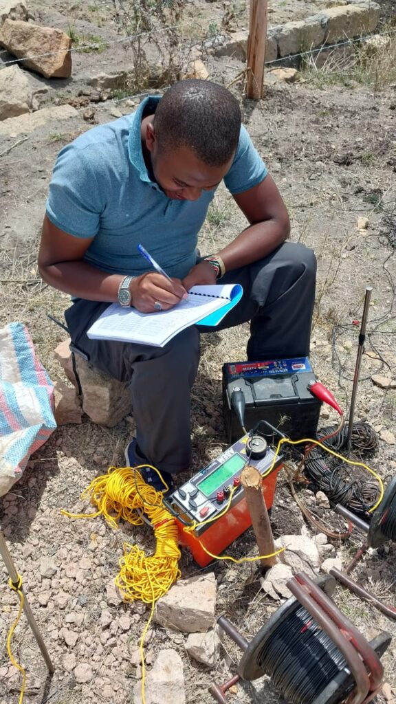
- Interpreting geophysical data, such as VES, to identify the depth of aquifer layers.
- Considering the regional geology and structure.
- Applying judgement and uncertainty. A good report states an expected depth range (for example, 150 to 200 metres) rather than a single number, and explains what could cause deviations.
Your driller will usually continue drilling until the geologist or design says the target aquifer has been adequately penetrated, which is why supervision is valuable.
Budget Implications
At typical Nairobi-area rates of KSh 6,500 to KSh 9,500 per metre for drilling, plus casing, gravel packing and development, a 150-metre borehole might cost around KSh 1.2 to 1.8 million, and a 250-metre borehole well over KSh 2 million, before equipping. Because depth is uncertain, many contracts specify a rate per metre with a provisional depth, and your final cost depends on the actual depth drilled. Build a contingency of 15 to 25 percent into your budget.
Practical Tips
- Commission a survey first to get a depth estimate for your specific site.
- Ask neighbours for borehole logs or approach WRA for records, since nearby data are very informative.
- Insist on a drilling log recording rock types and water strikes.
- Plan for drawdown. Set the pump at a depth below the expected pumping water level with a safety margin.
- Do not stop drilling arbitrarily at a water strike if the design calls for greater aquifer thickness, and do not continue indefinitely without hydrogeological justification.
- Check water quality at the end, as quality may influence whether you accept the borehole or deepen it.
Frequently Asked Questions
Is a deeper borehole always better? No. Depth should match the aquifer. Deeper boreholes cost more and may reach poorer-quality water.
Can two neighbouring plots need very different depths? Yes, especially in fractured or layered rocks.
What if I hit water at 60 metres in an area where boreholes are normally 150? It could be a shallow perched aquifer, which may be seasonal or limited in yield. A hydrogeologist can advise whether to continue to a deeper, more reliable aquifer.
Does depth guarantee yield? No. Yield depends on aquifer properties, not depth alone.
Do regulations limit depth? The authorisation may specify a proposed depth and require compliance with conditions. Discuss changes with your hydrogeologist and WRA before exceeding approved depth.
Conclusion
Boreholes in Nairobi, Kiambu, Nakuru and Nanyuki are commonly drilled to roughly 100 to 300 metres, but the right depth for your plot depends on local geology, water levels, water quality and your required yield. Use regional ranges for early planning, then rely on a hydrogeological survey and nearby records for your actual design.
For site-specific depth estimates and borehole design, contact Reg. Geol. Mbugua Githae (MGSK) through consult.innercoregeoconsultants.co.ke.