 Skip to content

Hillsides offer views, cooler air, and sometimes cheaper land, which is why more homes, hotels, schools, and roads are being built on slopes across Kenya, from the Central Highlands and the Rift escarpments to the hills of Kisii, Nandi, Kericho, Elgeyo-Marakwet, and the slopes around Nairobi. But slopes are not static. Under the right combination of rain, geology, and human interference, they move, sometimes slowly as creep and sometimes suddenly as landslides.
A slope stability assessment is the engineering process of determining whether a slope is safe, what could make it fail, and what to do about it. This article explains the process in plain language.
Why Slopes Fail
A slope stays in place when the resisting forces (soil or rock strength, friction, cohesion, roots) exceed the driving forces (gravity pulling the mass downhill, plus extra loads and water pressure). Failure occurs when the balance tips.
Common triggers in Kenya include intense or prolonged rainfall, which saturates soil, adds weight, and raises pore water pressure; steep cutting at the toe of a slope, which removes support; loading the crest with buildings, fill, or water tanks; removal of vegetation, which weakens root reinforcement and increases erosion; leaking pipes and uncontrolled drainage; weathered or weak rock; and seismic shaking. Often, several factors combine. Landslides during heavy rains in parts of western and central Kenya, including the 2019 event in West Pokot, have shown how deadly saturated slopes can be.
Types of Slope Failure
Engineers recognise several movement types. Shallow slides and debris flows involve the surface layer of weathered soil sliding down in wet conditions. Rotational slides occur in thick clayey soils along a curved failure surface. Translational slides follow a planar weak layer, such as a clay seam or a joint in rock. Rockfalls and topples occur on steep rock faces with unfavourable fractures. Creep is slow downslope movement that tilts trees, fences, and walls and cracks pavements. Identifying the likely mechanism guides the analysis and the remedy.
Stage One: Desk Study and Site Reconnaissance
The assessment begins by reviewing geological maps, topographic data, rainfall records, aerial or satellite imagery, and any history of landslides. Site reconnaissance looks for warning signs: tension cracks near the crest, bulging at the toe, leaning trees or poles, hummocky ground, seepage or springs, old landslide scars, and cracked buildings or roads. Mapping these features helps define the unstable area and its boundaries.
Remote sensing and digital elevation models support a rapid assessment of slope angles and terrain, particularly in large or inaccessible areas.
Stage Two: Subsurface Investigation
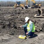
Subsurface data show what is below the surface. Boreholes, trial pits, and in-situ tests identify the soil and rock layers, the depth to weathered or competent rock, groundwater levels, and the presence of weak layers. Samples are tested for classification and shear strength, as strength is the single most important property for stability analysis. Geophysical methods can help map layer boundaries and groundwater. In active slides, inclinometers and piezometers can be installed to measure movement at depth and water pressures over time.
Stage Three: Defining Soil and Rock Parameters
For soils, the key parameters are the cohesion, the angle of internal friction, and the unit weight, along with pore water pressure conditions. Effective strength parameters are used for long-term stability, and residual strength is relevant for slopes with previous movement. For rock slopes, the orientation, spacing, persistence, and roughness of joints and bedding planes control stability, assessed through structural mapping and kinematic analysis.
Stage Four: Stability Analysis and Factor of Safety
Stability is expressed as a factor of safety (FoS), the ratio of resisting forces to driving forces. A value of 1.0 means the slope is on the verge of failure. For permanent slopes, design practice commonly requires values of about 1.3 to 1.5 or higher, depending on consequences and the reliability of the data. Higher values are used where failure would endanger life or critical infrastructure.
Analysis methods include limit equilibrium methods (such as Bishop and Janbu, using slices of soil over a trial failure surface), numerical modelling (finite element or finite difference methods) for complex cases, and rock slope kinematic analysis. Engineers test different scenarios: dry conditions, heavy rainfall with a high water table, earthquake loading, and the effect of new buildings or cuts.
Stage Five: Design Measures to Improve Stability
If the slope is unstable or the planned construction would make it so, several measures are available:
- Re-grading or benching: flattening the slope or forming terraces to reduce driving forces.
- Drainage: surface drains to divert runoff, subsurface drains and horizontal drains to lower the water table, and sealing of cracks and leaking services.
- Retaining structures: gabion, masonry, or reinforced concrete walls, soil nailing, anchored walls, and piles to provide support.
- Reinforced soil: geogrids or other reinforcement to steepen slopes safely.
- Vegetation and bio-engineering: deep-rooted grasses, shrubs, and trees to reduce erosion and add root strength.
- Avoidance: relocating the building footprint away from unstable ground or setting it back from the crest and toe.
Often a combination works best, with drainage forming the foundation of most solutions.
Foundations on Slopes
Buildings on slopes need foundations that avoid sliding and creep. Common solutions include stepped footings, piles extended below the potential failure surface, and retaining walls with adequate drainage. Foundations should not be placed on loose fill or on the unstable surface layer. The weight of buildings and fill at the crest should be limited or accounted for in the analysis, while excavation at the toe should be avoided or properly supported.
Construction Practice on Hillsides
Many hillside failures occur during construction. Good practice includes limiting the extent of open cuts, supporting excavations promptly, protecting exposed slopes from rainfall, installing drainage early, compacting fill in layers, and avoiding stockpiling soil at the crest. Work should be scheduled with the weather in mind, and monitoring should continue during and after construction. Any signs of cracking or movement should prompt immediate review by the engineer.
Regulatory and Safety Considerations
Building on steep or unstable land is often restricted in planning rules, and setbacks from riverbanks, cliffs, and steep slopes may apply. Compliance with county planning requirements and engineering standards is essential. Early engagement with an engineering geologist or geotechnical engineer, before land purchase if possible, helps avoid buying a plot that cannot be developed safely.
Frequently Asked Questions
How steep is too steep? There is no universal limit, because stability depends on soil, rock, water, and slope height. A site-specific assessment is required.
Can planting trees alone stabilise a slope? Vegetation helps with shallow stability and erosion, but deep-seated problems need engineering measures.
What are early warning signs? Cracks at the crest, leaning poles or trees, new springs, bulging at the toe, and sticking doors in buildings on the slope.
Risk Mapping and Early Warning
Slope stability is not only about individual sites. At the community and county scale, landslide hazard mapping combines slope angle, geology, rainfall, land use, and past events to identify susceptible zones. Such maps guide planning decisions: where to build, where to restrict development, and where to invest in drainage and protection. Early warning approaches include monitoring rainfall thresholds, observing ground cracks, and training communities to recognise warning signs. During prolonged heavy rain, residents of steep slopes should be ready to evacuate if cracks, new springs, or muddy water appear.
Case Illustration: A Hillside House Plot
Consider a plot on a 25-degree slope in the Kenyan highlands, with weathered volcanic soils and a seasonal spring. The owner wants a two-storey house with a terrace. A stability assessment finds that the soil is weak when saturated, groundwater rises during rains, and the planned cut at the toe would reduce support.
The engineer might recommend relocating the building slightly uphill and away from the spring, constructing a drained retaining wall at the toe of the cut, installing subsurface drains to lower the water table, using piled or stepped foundations, and controlling roof and surface water. The measures add cost, but they transform an unsafe plot into a stable building site. Without them, one rainy season could cause cracks, tilting, or a slide.
Maintenance of Slopes After Construction
Slope stability needs ongoing care. Keep drains and culverts free of debris, repair cracks in surface drains, maintain vegetation, avoid dumping soil or waste on slopes, and inspect retaining walls for tilting, bulging, or blocked weep holes. After heavy rain, check for new cracks or seepage. Adding new loads, such as extensions or water tanks, requires review by an engineer. Regular maintenance is far cheaper than emergency repairs after failure.
Key Takeaways
The main lessons are straightforward. Slopes fail when water, steepness, weak ground, and human disturbance combine. Assessment identifies these ingredients, calculates safety margins, and guides drainage, support, and foundation choices. For anyone buying or developing hillside land in Kenya, early specialist advice is a wise investment, since the cost of stabilising a slope after failure usually far exceeds the cost of designing for stability from the start.
Conclusion
Slope stability assessment turns a risky hillside into a manageable site. By understanding geology, water, and soil strength, calculating a factor of safety, and designing drainage, support, and foundations accordingly, engineers can build safely on slopes. In Kenya’s rainy, hilly landscapes, ignoring slope stability is a gamble with lives and property, while a proper assessment is a practical way to build with confidence.



