Skip to content
Over the past decade, Kenya’s Rift Valley lakes—Baringo, Bogoria, Nakuru, Naivasha, Elementaita, Magadi, and others—have experienced an unprecedented rise in water levels. This expansion has submerged schools, homes, hotels, farmlands, roads, and wildlife habitats. In some cases, lake surfaces have more than doubled, and formerly separate lakes like Baringo and Bogoria are now dangerously close to merging.
Understanding the causes of this phenomenon is not only important for planning and mitigation but also for protecting communities and ecosystems that depend on these lakes.
This article explores the scientific, environmental, and human-driven factors contributing to the rising water levels in the Rift Valley.
- Increased Rainfall Linked to Climate Change
One of the most significant causes is the overall increase in rainfall across East Africa.
- a) Stronger Indian Ocean Dipole (IOD) Events
The Indian Ocean Dipole refers to the temperature difference between the Western and Eastern Indian Ocean. When the western side is warmer:
- East Africa experiences heavy rainfall
- The rains become more intense and prolonged
In recent years, several strong positive IOD events have raised rainfall amounts beyond normal.
- b) Unpredictable Weather Patterns
Climate change has intensified:
- Torrential rains
- Out-of-season rainfall
- More frequent wet years
As a result, huge volumes of rainwater flow into the lakes.
- Reduced Evaporation Rates
Under normal circumstances, Rift Valley lakes lose a lot of water through evaporation. But this balance has shifted.
What’s happening?
- Increased cloud cover
- Cooler temperatures
- Higher humidity
- Reduced sunlight intensity
These conditions slow down evaporation, meaning the lakes retain more water.
- Rise in Groundwater Recharge
Hydrologists have discovered that water levels in some Rift Valley lakes are rising not just from the surface, but also from underground.
Why?
- Heavy rainfall infiltrates deep into the soil
- Aquifers recharge at a faster rate
- Lakes connected to underground aquifer systems receive excess water from below
This makes the water level rise even if surface inflow remains constant.
- Tectonic Activity and Geological Movements
The Rift Valley lies on a major tectonic zone. Movements deep within the earth can:
- Shift underground drainage pathways
- Block natural outlets where water used to escape
- Create new underground connections that channel water into lakes
- Change groundwater pressure
These slow, natural geological processes can raise lake levels over time.
- Land-Use Changes and Environmental Degradation
Human activities around catchment areas have significantly altered how water behaves in the landscape.
- a) Deforestation
Forests in areas like:
- The Mau Forest Complex
- Aberdare Ranges
- Cherang’any Hills
have been heavily degraded. Reduced tree cover means:
- Less water absorption
- Increased runoff
- Soil erosion
More water flows into the lakes instead of being captured by vegetation.
- b) Urbanization and Soil Compaction
Paved and compacted surfaces reduce infiltration. Rainwater flows rapidly into rivers and eventually into the lakes.
- c) Wetland Encroachment
Wetlands act as natural sponges. When they are destroyed:
- They can no longer filter or hold water
- Runoff increases dramatically
- Siltation and Sedimentation of Lake Basins
Soil erosion from farmlands and degraded hillsides leads to increased sediment entering lakes.
Effects of siltation:
- Lake bottoms rise
- Water storage capacity decreases
- Even a normal volume of inflow causes water levels to rise
This “shallowing” effect is a major contributor to flooding around lakes.
- Increased River Inflows
Major rivers such as:
- Molo River (into Lake Nakuru)
- Malewa and Gilgil Rivers (into Lake Naivasha)
- Perkerra and Molo Rivers (into Lake Baringo)
have experienced:
- Higher flow volumes
- Longer flooding periods
This significantly increases the amount of water entering the lakes annually.
- Natural Cycles of Lake Expansion and Contraction
Geological and environmental records show that Rift Valley lakes naturally undergo:
- Expansion
- Contraction
- Drying and refilling cycles
These cycles may take decades or centuries. The current expansion may be part of a longer natural cycle, amplified by modern climate impacts.
Impacts of Rising Lake Levels
The effects are widespread and severe:
- Displacement of Communities
Thousands of families have lost homes due to flooding in:
- Baringo
- Nakuru
- Naivasha
- Bogoria
- Loss of Farmland
Productive agricultural land has been submerged, causing:
- Reduced food production
- Loss of livelihoods
- Damage to Infrastructure
Flooding has destroyed:
- Roads and bridges
- Schools, hospitals, and police stations
- Electricity lines
- Loss of Wildlife Habitats
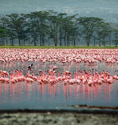
Lake Nakuru National Park and Lake Bogoria Ramsar Site have seen:
- Flamingo nesting grounds destroyed
- Wildlife displacement
- Changes in vegetation
- Increased Human–Wildlife Conflict
Wild animals are pushed closer to settlements as their habitats shrink.
Conclusion
The rising water levels in Kenya’s Rift Valley lakes are the result of a complex combination of climate change, increased rainfall, reduced evaporation, groundwater recharge, tectonic activity, and human-driven land degradation. These lakes are interconnected both on the surface and underground, meaning that changes in climate and land-use patterns have far-reaching effects.
Understanding these causes is necessary for:
- Planning resettlement
- Protecting communities
- Conserving biodiversity
- Designing sustainable water-management strategies
As climate change continues to influence rainfall patterns, Kenya must adapt scientifically, socially, and environmentally to prevent future disasters.