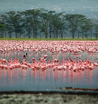
Over the past decades, many lakes in Kenya’s Rift Valley have experienced significant rises in water levels. Concurrently, geological research and recent events show renewed volcanic and tectonic activity in the broader East African Rift System (EARS), including the recent eruption of Hayli Gubbi in Ethiopia (2025). This paper examines whether there is a plausible scientific relationship between such volcanic/tectonic events and hydrological changes in Rift Valley lakes. We review existing literature on tectonics-hydrology coupling in rift basins; examine mechanisms by which volcanic or magmatic activity might influence groundwater flow, fault permeability, and subsurface drainage; and assess whether recent data support these mechanisms. While direct causation remains unproven, evidence suggests that tectonic/volcanic processes can modify subsurface outflow, potentially contributing to rising lake levels — especially when combined with climate-driven increased rainfall and land use changes. We conclude that volcanic/tectonic activity is a plausible contributing factor, meriting further targeted hydrological and geophysical investigation.
- Introduction
Kenya’s Rift Valley lakes — including Lake Baringo, Lake Nakuru, Lake Naivasha, and others — have shown remarkable increases in water levels in recent years. Flooding has displaced communities, submerged farms and infrastructure, and disrupted ecosystems. Many analyses attribute the rise primarily to increased rainfall, land-use changes and siltation.
However, a body of geological research suggests that the hydrology of Rift lakes is intimately linked with tectonic and magmatic processes. In particular, studies show that shifts in crustal stress regimes — due to plate movements, faulting, or magmatic intrusions — can modify subsurface permeability and groundwater flow, thereby influencing how water accumulates or drains in rift basins.
Compounding this, recent months have seen renewed volcanic activity in the Ethiopian segment of the Rift: the 2025 eruption of Hayli Gubbi marks a rare Holocene-age eruption in a previously dormant volcano.
This paper explores whether there is a plausible link between such volcanic/tectonic events and the anomalous lake-level rises in Kenya’s Rift Valley, by reviewing mechanisms, evidence, and research gaps.
- Background — Rift Lakes, Hydrology & Geology
2.1 Rift Lake Hydrology
Many Rift Valley lakes are endorheic basins — they lack surface outflow, meaning their water balance depends on rainfall and river/stream inflow, evaporation, and subsurface outflow (seepage into aquifers or fault systems).
For example, Lake Baringo receives inflows from rivers and seasonal streams but relies on subterranean discharge and evaporation for loss, not a visible outlet.
2.2 Rift Geology and Tectonics
The East African Rift System is an active continental rift — a zone where the African tectonic plate is gradually splitting into two. This process is associated with faulting, crustal stretching, and magmatic activity.
Volcanic eruptions, magma intrusions, and fault movements periodically alter the underground structure: they can open, close, or reorient fractures and faults, modify permeability, or create subsurface barriers or conduits. These changes can influence how groundwater flows — whether it drains out of a basin, accumulates, or is redirected.
Historical geological records show that volcanic activity has helped shape Rift lakes: in some cases, volcanic deposits or tectonic uplift have blocked drainage outlets, causing lakes to expand or change drainage basins.
- Mechanisms by Which Volcanic or Tectonic Activity Could Affect Lake Levels
Here we outline how volcanic/tectonic phenomena might influence hydrological behavior and thereby contribute to lake-level changes.
3.1 Modification of Subsurface Outflow / Aquifer Permeability
- Magmatic intrusions or fault movements can compress or shift fault zones, reducing permeability along natural groundwater outflow pathways. This may limit subsurface drainage, trapping more water in the lake basin. Several geologists have proposed this mechanism to explain rising levels when tectonic stress increases.
- Conversely, when fault lines widen or open, lakes might drain more easily; historical fluctuation in lake levels appears to reflect these tectonic cycles.
Thus, a renewed tectonic phase — such as that associated with renewed rifting or volcanic activity — may shift the lakes from a draining to a filling regime.
3.2 Aquifer Pressurization and Groundwater Recharge Changes
- Volcanic activity can influence the subsurface hydrogeology. For instance, heat from magma can modify groundwater flow paths, create impermeable layers (ash, tuff, lava flows), or raise water pressure in aquifers — potentially causing increased seepage into lakes.
- Also, tectonic uplift or subsidence may alter hydraulic gradients, affecting groundwater inflows and outflows. In rift basins, even small changes in subsurface geometry can have outsized impacts on hydrology.
3.3 Sedimentation and Basin Geometry Alteration from Volcanic Deposits
- Volcanic eruptions deposit ash, lava, and pyroclastic materials: these can settle into drainage channels or subsurface conduits, clogging outflow paths and effectively “plugging” natural underground drainage, reducing water loss from lake basins.
- Additionally, uplift or subsidence associated with volcanic/tectonic events can distort basin shape, potentially increasing the volume or storage capacity of lakes.
3.4 Interaction with Rainfall and Surface Water Input
- Volcanic/tectonic processes may act in combination with climatic factors. When increased rainfall (climate-driven) coincides with reduced subsurface outflow (tectonics-driven), the result could be a pronounced rise in lake levels — more water in, less draining out.
- This synergy may help explain why Rift lakes have experienced dramatic rises in recent years despite episodic dry seasons.
- Recent Volcanic Activity — The Case of Hayli Gubbi and Regional Seismicity
In November 2025, Hayli Gubbi — a shield volcano in Ethiopia’s Afar region — erupted for the first time in recorded history. The eruption produced large ash plumes and released significant volcanic material.
Moreover, the broader segment of the rift has recently seen increased seismic and magmatic activity: several volcanoes (e.g., in the Main Ethiopian Rift) have exhibited unrest, including magma intrusions, fault cracking, and seismo-volcanic crises.
These events underscore that the East African Rift remains geologically active — with potential to alter subsurface hydrology over large spatial scales.
Notably, a past study linked changing lake levels (in EARS lakes) with changing crustal stress states and magmatic activity, demonstrating that climate-driven hydrological changes can influence tectonics and volcanic behavior — suggesting a bidirectional coupling between hydrology and magmatism.
Thus, recent eruptions and seismic activity may have disturbed the geological and hydrological equilibrium across the Rift — raising plausibility that some of the rising lakes in Kenya respond not only to rainfall/land-use factors — but also to bigger geophysical changes.
- Case Analysis: Kenyan Rift Lakes & Recent Trends
5.1 Observed Lake-Level Rise
Multiple Rift Valley lakes in Kenya have expanded dramatically in recent years. For instance, Lake Baringo has grown significantly since 2010 — its area increasing from ~130 km² to over 200 km² at times, submerging homes, roads, lodges, and vegetation.
Scientific assessments attribute much of the rise to increased rainfall, land-use changes, catchment degradation (deforestation, soil erosion), and siltation leading to reduced capacity and increased surface runoff.
5.2 Geological Context — Rift Floor & Faulted Terrain
All Rift lakes lie within the structurally faulted terrain of the Eastern Rift; their basins and drainage regimes are shaped by tectonic and magmatic history.
Some geologists argue that the recent hydrological changes coincide with a tectonic cycle currently at its peak, where regional crustal stresses compress groundwater outflow pathways, reducing subterranean drainage and forcing water to accumulate in lakes.
5.3 Plausibility of a Link with Recent Volcanic Activity
Given the renewed volcanic/seismic activity in nearby segments of the Rift — notably, Ethiopia’s eruption of Hayli Gubbi and other magma intrusions — it’s plausible that:
- Subsurface fault permeability and groundwater pathways have been altered.
- Some underground outflow channels have been partially or fully blocked by fault shifting, lava flows, or ash deposits.
- Aquifer recharge and flow regimes may have changed, increasing inflow or reducing discharge.
When combined with increased rainfall and surface runoff, these changes could contribute significantly to rising lake levels.
- Limitations, Uncertainties, and Research Gaps
While the hypothesis of a volcanic/tectonic influence on lake level rise is plausible, there are significant caveats:
- Direct, site-specific data are limited. We lack continuous geophysical monitoring (groundwater flow, fault permeability, subsurface discharge) for most Kenyan Rift lakes.
- Temporal correlation ≠ causation. That volcanic eruptions occurred recently does not automatically mean they caused lake rises. Climatic and land-use changes remain strong explanatory factors.
- Spatial separation. Volcanoes like Hayli Gubbi are located in the northern/central Ethiopian Rift; whether structural effects propagate sufficiently to influence southern Rift lakes in Kenya requires detailed modeling.
- Complex hydrological cycles. Lakes respond to multiple interacting inputs (rain, rivers, groundwater, evaporation, sedimentation). Isolating one factor among many is intrinsically difficult.
- Lag times. Subsurface changes may take years or decades to manifest as lake-level changes; thus, recent eruptions might influence future, not current, lake behavior.
Therefore, while the hypothesis is scientifically defensible, it remains speculative until confirmed by targeted studies.
- Recommendations for Further Research
To test the hypothesis more robustly, we recommend:
- Establishing geophysical monitoring systems around key Rift lakes — including groundwater flow sensors, piezometers, seismic and strain gauges.
- Hydrogeological modeling that incorporates recent tectonic/magmatic events, fault maps, aquifer geometry, and climate/land-use data to simulate water balance under different scenarios.
- Comparative studies between Rift lakes in “active” tectonic segments and “quieter” segments to assess whether lakes near recent volcanic zones show different hydrological behavior.
- Paleohydrological and sediment core analyses to reconstruct historic lake level fluctuations and correlate with known volcanic/tectonic episodes.
- Interdisciplinary collaboration — involving geologists, hydrologists, climatologists, and local stakeholders — to integrate data from climate, land use, and geology.
- Conclusion
The rising water levels of Rift Valley lakes in Kenya have largely been attributed to climatic shifts (increased rainfall), land-use change, catchment degradation, and siltation. However, given the active geological context of the East African Rift — a zone of ongoing tectonics and magma dynamics — it is scientifically plausible that recent volcanic or tectonic activity has contributed by altering subsurface drainage pathways, aquifer behavior, and fault permeability, thereby reducing ground outflow and helping lakes accumulate more water.
While current evidence remains circumstantial and indirect, the hypothesis warrants serious further investigation — especially because understanding the full set of drivers is critical for effective planning, mitigation, and sustainable management of lake basins, human settlements, and ecosystems in the Rift region.