Skip to content
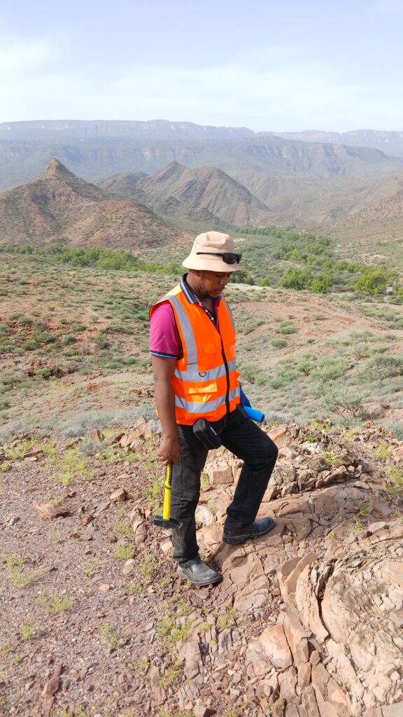
Mineral exploration has always been a game of narrowing odds. A century ago, that meant geologists walking ridgelines with hand lenses and compasses, mapping outcrops one step at a time. Today, before a single boot hits the ground, exploration teams can scan hundreds of square kilometers from orbit, flagging the handful of square kilometers worth a closer look. Remote sensing hasn’t replaced fieldwork — it has made fieldwork dramatically more targeted, and that shift has changed the economics of exploration itself.
Why Satellites Matter in Exploration
Exploration budgets are finite, and ground campaigns are expensive. Drilling a single deep hole can cost tens of thousands of dollars; helicopter-supported geochemical sampling in remote terrain costs more still. Every dollar spent exploring ground that turns out to be barren is a dollar that could have gone toward a prospective target. Remote sensing exists to solve exactly this allocation problem: it lets explorers rank ground before committing expensive resources to it.
Satellites do this by detecting patterns invisible to the naked eye — subtle mineralogical signatures, structural lineaments, vegetation stress, and thermal anomalies — across enormous areas, repeatedly, and at a fraction of the cost of airborne or ground surveys.
The Core Techniques
Multispectral and Hyperspectral Imaging
Different minerals absorb and reflect light in distinctive ways across the electromagnetic spectrum. Iron oxides, clay minerals, and hydrothermal alteration products each leave a spectral fingerprint that sensors like Landsat 8/9’s OLI, Sentinel-2’s MSI, and hyperspectral platforms such as EnMAP or PRISMA can detect. Because many ore deposits — particularly porphyry copper and epithermal gold systems — are surrounded by broad zones of hydrothermal alteration, mapping these alteration halos from space is often the fastest way to identify a system worth investigating, even when the ore body itself is buried.
Radar and InSAR
Synthetic Aperture Radar penetrates cloud cover and vegetation canopy to reveal structural features — faults, fracture zones, and lineaments — that control where mineralizing fluids historically moved through the crust. Structural corridors mapped this way often correlate strongly with known deposit trends, making radar data a key layer in target generation, especially in tropical or perennially cloudy terrain where optical imagery is unreliable.
Thermal Infrared
Thermal bands can highlight variations in rock composition and, in some settings, subtle surface expressions related to underlying mineralization or associated hydrothermal activity. While less central to hard-rock exploration than spectral and structural data, thermal imagery adds a useful corroborating layer, particularly when integrated with geothermal exploration workflows.
Digital Elevation Models and Terrain Analysis
SRTM, ASTER GDEM, and newer high-resolution DEMs let geologists analyze drainage patterns, slope, and terrain roughness — all of which can indicate underlying rock type and structural control. Terrain analysis is often the first, cheapest layer applied in a target-generation workflow, since it requires no specialized sensor beyond what’s already freely available.
From Data to Drill Targets: The Typical Workflow
- Regional screening — Broad-area multispectral and DEM analysis identifies zones with favorable geology, structure, and alteration signatures.
- Anomaly mapping — Spectral indices (iron oxide ratios, clay ratios, hydroxyl absorption features) are calculated to isolate alteration zones from background geology.
- Structural interpretation — Radar and DEM-derived lineament maps identify faults and fracture intersections, which frequently host higher-grade mineralization.
- Integration and ranking — Anomalies are layered with existing geochemical, geophysical, and geological data to rank targets.
- Ground truthing — Only the highest-ranked targets receive field mapping, sampling, and eventually drilling.
This funnel approach is what makes remote sensing so valuable economically: it compresses a search area that might once have taken years of fieldwork to characterize into a focused shortlist in a matter of weeks.
What Remote Sensing Can — and Cannot — Tell You
It’s worth being direct about the limits here, because overselling remote sensing is a common mistake in exploration marketing. Satellite data identifies surface and near-surface expressions of geological processes. It cannot see through thick soil cover, dense vegetation canopy in all cases, or overburden of more than a few meters in most spectral applications. It cannot directly detect ore grade, tonnage, or depth. What it provides is a probability map — an efficient way to prioritize where the more expensive, ground-truthed exploration tools (geochemistry, geophysics, drilling) should be deployed first.
In heavily vegetated or deeply weathered terrain — much of tropical East Africa included — remote sensing works best in combination with airborne geophysics and targeted soil geochemistry, rather than as a standalone tool.
Regional Relevance: East Africa and the Rift System
The East African Rift presents a particularly interesting case for remote sensing applications. Its combination of active tectonics, exposed basement geology in rift-flank areas, and a mix of arid and vegetated terrain means multispectral and radar techniques each have zones where they perform exceptionally well. Structural lineament mapping along the rift has proven useful not only for mineral targeting but for geothermal exploration, since many of the controlling structures that channel hydrothermal fluids to the surface are the same fault systems relevant to base and precious metal mineralization elsewhere along the rift margins.
Practical Takeaways for Exploration Teams
- Treat remote sensing as a first-pass filter, not a final answer — it reduces search area, it doesn’t replace verification.
- Combine spectral, structural, and terrain layers rather than relying on any single dataset; integrated interpretations consistently outperform single-technique approaches.
- Budget for ground truthing from the outset — the value of remote sensing is only realized once anomalies are checked against real outcrop and soil data.
- In cloud-prone or vegetated regions, prioritize radar-derived structural data over optical spectral data, which will be limited by canopy and atmospheric interference.
Remote sensing won’t find an ore deposit on its own. What it does is make sure that when boots finally hit the ground, they’re standing in the right place.