Skip to content

GeoAI (geospatial artificial intelligence) is the application of artificial intelligence, particularly machine learning and deep learning, to spatial and earth science data. In geology, GeoAI means using algorithms that learn patterns from data to help with tasks that geologists have traditionally done by eye, by hand and by experience: classifying rocks, mapping structures, interpreting geophysical surveys, predicting where minerals or groundwater occur, estimating resources, monitoring hazards and extracting knowledge from reports.
GeoAI is not a single tool. It is a family of methods combined with geospatial technologies such as GIS, remote sensing, geophysics and databases. It does not replace geological understanding. It amplifies it, by processing more data, faster and more consistently than a human can, and by revealing complex patterns that are hard to see.
Why Geology Is Ready for AI
Geoscience has several characteristics that make it a natural fit for AI:
- Massive and growing data volumes. Satellite archives, airborne geophysical surveys, drill-hole databases, core photographs, geochemical datasets, seismic data and sensor networks generate enormous amounts of information.
- Complex, non-linear relationships. Mineral systems and groundwater systems involve many interacting factors, which classical linear methods struggle to capture.
- Repetitive interpretation tasks. Logging core, picking structural features and classifying rocks take large amounts of skilled time.
- Large legacy archives. Geological surveys and companies hold decades of scanned maps and reports whose knowledge is hard to access.
- Pressure for faster, cheaper decisions. Exploration and resource development need to reduce risk and cost.
At the same time, geology has features that make AI hard: data are often sparse, biased, noisy and spatially autocorrelated, labelled examples are limited (there are few known deposits compared with the vast number of barren locations), and the underlying processes operate over millions of years. These challenges shape how GeoAI must be done.
Key AI Techniques Used in Geoscience
Classical machine learning. Algorithms such as random forests, support vector machines, gradient boosting and logistic regression learn relationships between input features (for example geophysical and geochemical values) and a target (for example mineral occurrence or rock type). They work well with tabular data and moderate dataset sizes and provide measures of feature importance.
Deep learning. Neural networks with many layers learn features automatically from raw data. Convolutional neural networks (CNNs) excel at images, so they are used for satellite imagery, thin-section photographs, core images and geophysical grids. Recurrent and transformer architectures handle sequences, such as well logs or time series. Autoencoders and generative models can compress, denoise and simulate data.
Unsupervised learning. Clustering and dimensionality reduction (for example k-means, self-organising maps, principal component analysis and t-SNE or UMAP) find natural groupings in data without labels, useful for geochemical domains, lithological units and anomaly detection.
Computer vision. Detecting and segmenting features in images, such as mapping outcrops, faults, mining footprints, landslide scars, fractures in drone imagery or minerals in microscope images.
Natural language processing and large language models (LLMs). Extracting information from geological reports, scanned maps, publications and logs, turning unstructured text into searchable, structured knowledge, and assisting with literature review and drafting. Used carefully, LLMs can help geologists query large document archives.
Physics-informed and hybrid models. Approaches that combine data-driven learning with physical laws and geological constraints, for example in geophysical inversion or groundwater flow modelling, aim to produce results that are consistent with known physics and less prone to nonsensical predictions.
Reinforcement learning and optimisation. Used in some applications such as drilling optimisation and survey design.
How AI Is Changing Geological Interpretation
1. Faster, more consistent geological mapping. Models trained on satellite imagery, DEMs, geophysical data and existing maps can predict lithology and structure across unmapped areas, producing predictive geological maps that guide field mapping. Deep learning can also extract structures and features from imagery, speeding up tasks such as lineament detection (see our lineament article). Geologists then verify and refine the output in the field, making mapping campaigns more efficient.
2. Automated analysis of drill core and rock samples. Computer vision can classify lithology, estimate rock quality, detect veins and fractures and identify minerals from core photographs, hyperspectral core scans or thin sections. This reduces the time spent on logging, increases consistency between loggers and allows quick re-interpretation of legacy core images.
3. Smarter mineral exploration targeting. Machine learning integrates geology, structure, geochemistry, geophysics and remote sensing into prospectivity maps that rank areas by their likelihood of hosting a deposit. See our article on machine learning for mineral prospectivity mapping. Exploration companies are also experimenting with AI-assisted target generation and automated analysis of vast datasets.
4. Geophysical data processing and interpretation. AI is used to denoise data, automate the picking of seismic horizons and faults, accelerate inversion, classify geophysical anomalies and infer subsurface properties from multiple datasets. In groundwater work, machine learning can combine resistivity, borehole logs and other data to predict aquifer properties.
5. Hydrogeology and groundwater prediction. ML models predict groundwater potential zones, borehole yield, depth to water and water quality, using geology, lineaments, rainfall, soil, topography and borehole records. They also forecast groundwater levels from climate and abstraction data, and help detect anomalies in monitoring data. See our groundwater potential mapping article. In regions where fluoride and salinity vary spatially, models trained on borehole chemistry data can help map risk, although they require good data and field confirmation.
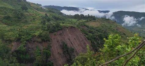
6. Natural hazard and geotechnical assessment. AI helps map landslide susceptibility, flood hazard, subsidence and earthquake-related effects, and supports slope monitoring using satellite radar and sensor data. In geotechnical engineering, ML predicts soil properties from limited tests and helps characterise ground conditions.
7. Mine and project operations. Applications include grade control, predictive maintenance, ore sorting, blast optimisation and environmental monitoring, increasingly using sensors, drones and real-time data.
8. Knowledge extraction and decision support. NLP and LLM tools can search and summarise thousands of exploration reports, digitise historic logs and maps and answer questions about a project’s data. This is valuable in countries where valuable legacy data sits in paper archives.
9. Remote sensing at scale. Deep learning classifies land cover, detects artisanal mining, maps surface minerals from hyperspectral imagery and monitors environmental change over large areas.
A Typical GeoAI Workflow
Good GeoAI follows a disciplined process:
- Define the problem and the geological model. What question are you answering, and what geological processes control it? AI works best when guided by a clear conceptual model.
- Collect and prepare data. Gather imagery, geophysical grids, geochemistry, geology and training labels. Clean, georeference and standardise.
- Engineer features. Create inputs that represent geological processes, such as distance to faults, lineament density, alteration indices and geochemical ratios. Feature design based on geological knowledge often matters more than choosing a complex algorithm.
- Create training and test data. Split data properly, taking spatial autocorrelation into account (see below).
- Train and tune models. Try several algorithms and compare.
- Validate rigorously. Use independent test data, spatial cross-validation and metrics appropriate to imbalanced datasets.
- Interpret and explain. Examine which features drive predictions, check whether results make geological sense and quantify uncertainty.
- Field-test the predictions. Ground-truth selected predictions through mapping, sampling or drilling.
- Iterate and update as new data arrive.
- Document and archive the data, code and assumptions for reproducibility.
Real Benefits
- Speed: tasks that took weeks can be done in hours.
- Scale: analysis of entire countries or basins rather than selected areas.
- Consistency: reducing variability between human interpreters.
- Integration: combining many data types simultaneously.
- Discovery of subtle patterns: relationships that are not obvious to the eye.
- Cost reduction: faster screening and better targeting can reduce unproductive field work and drilling.
- Preservation of knowledge: digitising and structuring legacy information.
Risks, Limitations and Pitfalls
AI in geology comes with serious caveats, and responsible practitioners emphasise them:
Poor or biased data. A model learns whatever is in the data, including errors and biases. Known mineral deposits are concentrated where people have explored, so models may learn exploration history rather than geology. Groundwater models trained on boreholes located near roads and settlements may not represent remote areas.
Small training sets and class imbalance. There may be only a handful of known deposits against millions of barren pixels, which makes training and evaluation tricky and can produce misleadingly high accuracy scores.
Spatial autocorrelation and data leakage. Nearby locations are similar, so randomly splitting data into training and test sets can overstate performance. Spatial block cross-validation gives a more honest evaluation.
Overfitting. Complex models can memorise the training data and fail on new areas.
Lack of interpretability. Some models behave as black boxes. Geologists need to understand why a model predicts what it does, and explainable AI methods (such as feature importance and SHAP values) help, but do not remove the need for judgement.
Extrapolation beyond training conditions. A model trained in one terrain may fail in another with different geology, climate or data characteristics.
False confidence. Attractive, high-resolution prediction maps can imply more certainty than exists. Uncertainty must be shown.
Hallucination and errors in language models. LLMs can generate plausible but incorrect statements, including invented references or numbers. Outputs must be checked against sources.
Data security and confidentiality. Exploration data are commercially sensitive. Care is needed when using cloud tools and external AI services.
Ethical and regulatory issues. Responsible use includes transparency, respect for data licences, and avoiding misuse of models for reporting that must meet standards such as professional codes for public reporting of exploration results. Professional geologists remain accountable for the interpretations they sign.
Skills gap. Effective GeoAI needs people who understand both geology and data science.
The Geologist’s Role in the Age of AI
AI does not replace the geologist. It changes the work. Routine tasks may be automated, while the value of geological reasoning, field observation, critical thinking and integration of evidence increases. The best results come from teams in which geologists define the questions, curate and interpret the data and challenge the model, while data scientists build and validate the algorithms.
Practical advice for geologists:
- Learn the basics of data science, including statistics, Python or R and machine learning concepts.
- Keep geological principles at the centre. Use AI to test and refine geological hypotheses, not to bypass them.
- Be sceptical. Ask how a model was trained, validated and tested, and where it might fail.
- Insist on field validation.
- Invest in good data management. Data quality is the foundation of every successful AI project.
- Start with small, well-defined projects and build up.
GeoAI in Africa and Kenya
Africa has vast, underexplored geological terrain, limited legacy data and a growing need for efficient, low-cost exploration, which makes GeoAI attractive. Open satellite data, free software and cloud platforms lower barriers. Opportunities include:
- Mineral prospectivity mapping in greenstone belts and mobile belts using open geophysical and remote sensing data.
- Groundwater potential and borehole siting in basement and volcanic terrains, supporting water access.
- Water quality risk mapping, such as fluoride in the Rift Valley, where data exist from borehole testing.
- Hazard mapping for landslides and floods.
- Digitisation of legacy reports and maps held by geological surveys and companies.
- Artisanal mining monitoring with satellite imagery.
Challenges include data scarcity and fragmentation, limited computing infrastructure in some settings, and the need for training and local capacity. Collaboration between universities, geological surveys, companies and consultants can help build local expertise and share data responsibly.
Getting Started with GeoAI
For a geologist or organisation starting out:
- Audit your data. What do you have, in what format and quality? Digitise and standardise key datasets.
- Pick a pilot project with clear value and available data, such as a groundwater potential map for a county or a prospectivity model for a licence area.
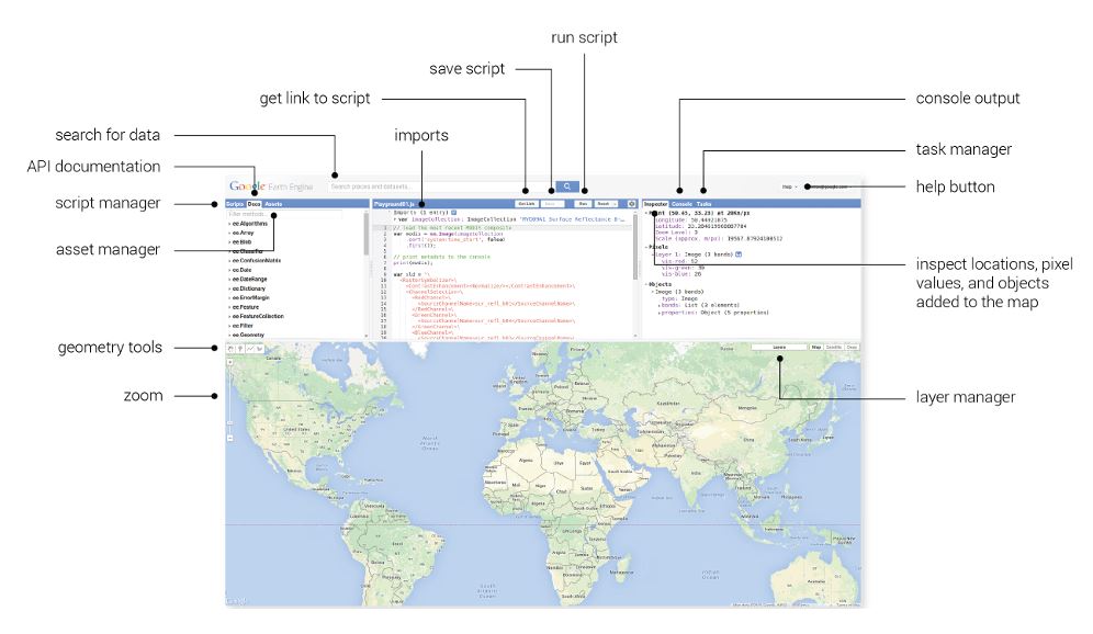
- Use accessible tools. Python with libraries such as scikit-learn, TensorFlow or PyTorch and GeoPandas, together with QGIS and Google Earth Engine, provides a powerful, largely free toolkit.
- Partner with data scientists or train staff.
- Validate and document. Establish standards for testing, uncertainty and reporting.
- Scale gradually, integrating successful methods into routine workflows.
Frequently Asked Questions
Will AI replace geologists? No. It automates tasks and augments decision-making, but geological expertise, field skills and judgement remain essential.
Do I need a lot of data to use AI? More data generally helps, but there are techniques for small datasets, such as simpler models, data augmentation, transfer learning and incorporating geological knowledge. Be careful about claims of high accuracy with tiny datasets.
Is GeoAI only for big companies? No. Open data, open-source software and cloud tools make it accessible to consultants, universities and small companies.
Can ChatGPT-style tools interpret geology? Language models can help summarise literature, draft reports and explain concepts, but they cannot replace expert interpretation of data and can make errors. Verify everything.
How do I know if an AI model is reliable? Check the data quality, validation approach (including spatial cross-validation), performance on independent areas, interpretability and agreement with geological understanding, and test predictions in the field.
Conclusion
GeoAI is changing how geological data are processed and interpreted, from mapping and core logging to mineral targeting, groundwater prediction and hazard assessment. Used with sound geological reasoning, high-quality data, rigorous validation and honest communication of uncertainty, it can make geoscience faster, more scalable and more insightful. Used carelessly, it can mislead. The future belongs to geologists who combine deep earth science knowledge with data skills.
For GIS, remote sensing and data-driven geological and hydrogeological services, contact Reg. Geol. Mbugua Githae (MGSK) through consult.innercoregeoconsultants.co.ke.