Across East Africa, groundwater quietly supports far more of daily life than most people realize. It supplies drinking water to millions of households outside major urban centers, irrigates smallholder farms during dry seasons, and increasingly serves as a critical water source for mining, geothermal, and industrial operations. Yet compared to surface water resources, groundwater remains poorly characterized across much of the region, making rigorous resource evaluation an increasingly urgent priority as demand continues to grow.
Why Groundwater Evaluation in East Africa Is Distinct
East Africa’s geology presents a genuinely complex hydrogeological landscape. The region spans everything from the volcanic terrain of the Rift Valley, with its fractured lava flows and pyroclastic deposits, to ancient crystalline basement rocks across much of the surrounding plateau, to sedimentary basins along coastal areas and around major lake systems. Each of these geological settings produces fundamentally different aquifer characteristics, storage capacities, and recharge behaviors, meaning that groundwater evaluation methods effective in one setting may need significant adaptation elsewhere in the region.
Climate variability adds a further layer of complexity. Much of East Africa experiences highly seasonal rainfall patterns, with groundwater recharge concentrated into relatively short wet season periods. Increasing climate variability, including more erratic rainfall and prolonged drought periods in some areas, has made understanding long-term groundwater sustainability an even more pressing concern than it was a generation ago.
Key Aquifer Systems Across the Region
Understanding groundwater resources in East Africa requires recognizing the distinct aquifer systems present across different geological settings. In volcanic terrain along the Rift Valley, groundwater is often stored and transmitted through fractures and vesicles in lava flows, as well as within more permeable pyroclastic and sedimentary interbeds. These volcanic aquifers can be highly productive but also highly variable, with productivity often controlled more by the presence of specific fracture networks than by broader geological patterns.
Basement rock aquifers, found across much of the East African plateau, present a different challenge entirely. These ancient crystalline rocks have essentially no primary porosity, meaning groundwater exists almost exclusively within secondary fractures and weathered zones near the surface. Boreholes in basement terrain can vary dramatically in productivity over very short distances, depending on whether they intersect a productive fracture zone, making borehole siting in these areas particularly dependent on skilled geophysical investigation rather than simple trial drilling.
Sedimentary basin aquifers, found in coastal areas and around major lake basins, often offer more predictable, laterally continuous aquifer units, though these can be vulnerable to issues like saline intrusion in coastal zones or contamination from surface activities in more densely populated basin areas.
Field Methods for Groundwater Resource Evaluation
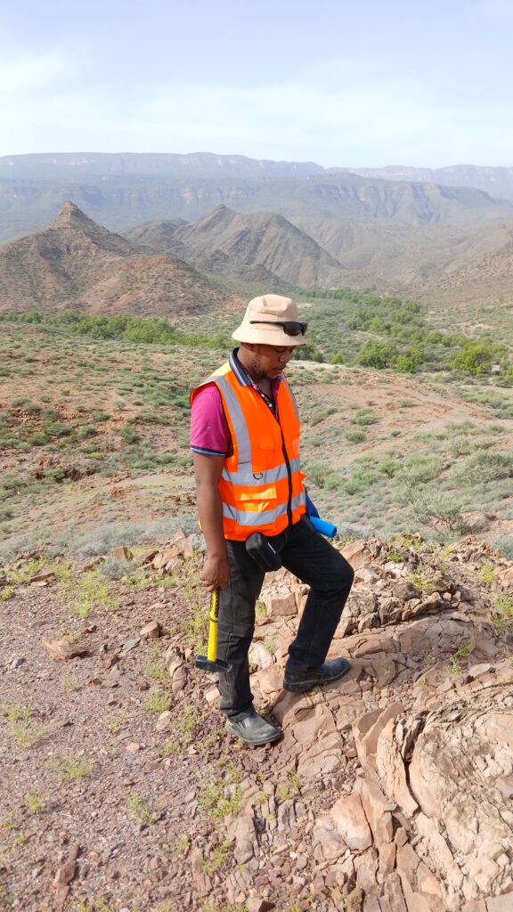
Rigorous groundwater evaluation combines several complementary field methods. Geological mapping and remote sensing analysis, often using satellite imagery to identify lineaments and structural features associated with fracture zones, provide an initial framework for identifying areas likely to host productive aquifers.
Geophysical surveys, particularly electrical resistivity and electromagnetic methods, play a central role in siting boreholes with a reasonable chance of success, especially in basement and volcanic terrains where aquifer productivity is closely tied to specific structural features that aren’t visible at the surface. These methods help identify zones of weathered or fractured rock, as well as variations in groundwater salinity that can affect water quality.
Test drilling and pumping tests remain the gold standard for confirming aquifer productivity and characteristics identified through geophysical surveys. Properly conducted pumping tests, where a well is pumped at a controlled rate over an extended period while water levels are monitored, provide essential data on aquifer transmissivity and storage properties needed for sustainable yield estimation.
Water quality sampling and analysis rounds out field investigation, since groundwater suitability depends not just on quantity but on chemical characteristics like salinity, fluoride content, and the presence of other naturally occurring or anthropogenic contaminants that can affect its suitability for drinking, irrigation, or industrial use.
Estimating Sustainable Yield
One of the most technically challenging aspects of groundwater resource evaluation is estimating sustainable yield: how much water can be extracted from an aquifer system over the long term without causing unacceptable depletion or environmental impacts. This requires understanding not just aquifer storage and productivity, but also recharge rates, which in much of East Africa depend heavily on seasonal rainfall patterns and land surface conditions that affect infiltration.
Groundwater balance studies, which quantify inputs (primarily rainfall recharge) against outputs (natural discharge plus extraction), provide a framework for sustainable yield estimation, though data limitations across much of the region mean these estimates often carry significant uncertainty. This uncertainty underscores the importance of ongoing groundwater level monitoring, which provides direct evidence of whether current extraction rates are sustainable or whether aquifer levels are showing long-term declining trends that indicate over-extraction.
Data Gaps and Institutional Challenges
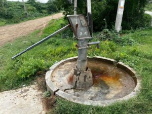
Despite growing demand for groundwater resources across the region, comprehensive groundwater monitoring networks remain limited across much of East Africa compared to more developed groundwater management regions elsewhere in the world. Many boreholes, particularly smaller community water supply boreholes, lack the ongoing monitoring needed to track long-term aquifer behavior, making regional-scale groundwater management planning genuinely challenging.
Building more robust national and regional groundwater monitoring networks, along with strengthening the institutional capacity to manage and interpret this data effectively, represents one of the most significant opportunities for improving groundwater resource management across the region going forward. Several national and regional initiatives have made progress on this front in recent years, though substantial gaps remain, particularly in more remote areas where monitoring infrastructure is costly to establish and maintain.
Balancing Competing Demands
As groundwater demand grows from multiple sectors simultaneously- domestic water supply, agricultural irrigation, and increasingly industrial uses including mining and geothermal operations- effective resource evaluation increasingly needs to account for cumulative impacts across multiple users sharing the same aquifer system, rather than evaluating each new groundwater development in isolation.
This is particularly important in areas experiencing rapid growth in groundwater-dependent economic activity, where multiple boreholes drilled by different users without coordinated resource assessment can lead to unanticipated interference effects, reduced yields, or in extreme cases, permanent aquifer depletion that affects an entire community’s water security.
The Path Toward Better Groundwater Management
Improving groundwater resource evaluation across East Africa depends on continued investment in both the technical methods and institutional frameworks needed for sustainable management. This includes expanding systematic geological and hydrogeological mapping, particularly in less-studied basement and sedimentary terrains, strengthening groundwater monitoring networks, and building local technical capacity capable of conducting rigorous resource assessments without excessive reliance on external expertise.
For a region where groundwater increasingly underpins both community water security and major economic development, including mining and geothermal energy, getting this resource evaluation right isn’t just a technical exercise. It’s foundational infrastructure for the region’s continued development, one that deserves the same level of rigor and sustained investment that’s increasingly being directed toward the surface energy and mineral resources that groundwater assessment so often supports.