Skip to content


Kenya sits on one of the most geologically active and diverse landscapes on Earth. The East African Rift System slices through the country from north to south, the ancient Archaean Nyanza Craton hosts greenstone gold belts in the west, and the Neoproterozoic Mozambique Belt underlies much of the east and coast. This variety shapes where we find groundwater, minerals, geothermal steam, and stable ground for construction. A geological consultant interprets that complexity so that investors, developers, farmers, and government agencies make decisions based on evidence rather than guesswork.
This article explains what geological consultancy involves, which services it covers, how projects are run, and how to choose a competent consultant in Kenya.
What Is Geological Consultancy?
Geological consultancy is the professional application of earth science to practical problems. Consultants study rocks, soils, structures, and water to answer questions such as: Is there a mineral deposit here? Will this slope remain stable? Where should a borehole be drilled? Is this land safe to build on?
Unlike academic research, consultancy is client-driven and decision-focused. The output is usually a technical report, map, or model that supports a business, engineering, or regulatory decision.
Core Services Offered by Geological Consultants
Most consultancies cover several overlapping fields:
- Mineral exploration and prospecting: Identifying and evaluating gold, base metals, industrial minerals, gemstones, and construction materials.
- Geological mapping: Producing surface and structural maps that show rock types, faults, folds, and alteration zones.
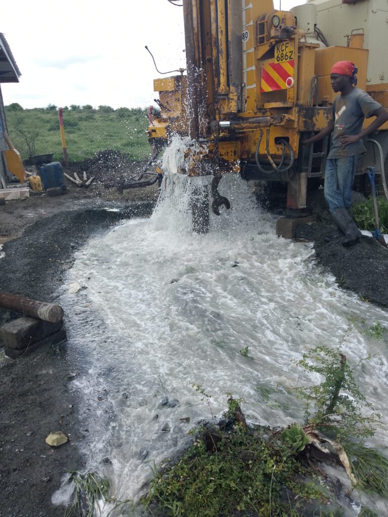
- Hydrogeology: Locating and assessing groundwater, siting boreholes, and evaluating aquifers.
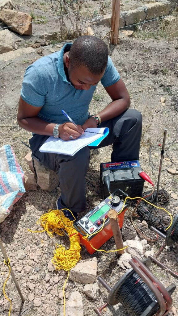
- Geophysical surveys: Using electrical, magnetic, gravity, and seismic methods to see beneath the surface.
- Geotechnical and engineering geology: Assessing ground conditions for foundations, roads, dams, and towers.
- Geothermal exploration: Evaluating heat resources for power generation and direct use.
- Remote sensing and GIS: Using satellite imagery and spatial analysis to guide field programmes.
- Due diligence and reporting: Independent technical review of projects, licences, and resource claims.
How a Typical Geological Project Is Structured
Good consultancy follows a staged workflow that controls cost and risk.
Stage 1: Desk study. The consultant reviews existing geological maps, Geological Survey records, satellite imagery, aerial photographs, previous drilling logs, and published research. This stage often answers half the questions at very low cost.
Stage 2: Field reconnaissance. Geologists visit the site to verify desk findings, observe outcrops, and collect initial samples or measurements.
Stage 3: Detailed investigation. Depending on the objective, this may include detailed mapping, soil or rock geochemistry, geophysical surveys, trenching, drilling, or test pumping.
Stage 4: Interpretation and modelling. Data are integrated into maps, cross-sections, and three-dimensional models. Uncertainty is quantified rather than hidden.
Stage 5: Reporting and recommendations. The final report presents findings, limitations, and clear next steps, such as drill targets, borehole depths, or engineering design parameters.
Why Local Geological Knowledge Matters
Geology is highly site-specific. Groundwater behaviour in the volcanic rocks of the Rift Valley differs sharply from that in the crystalline basement rocks of Ukambani or the sedimentary basins of the north-east. Gold in the Kakamega–Vihiga greenstone belt is controlled by different structures than mineralisation in the Migori belt or the Mozambique Belt.
A consultant with long local experience understands these regional controls, typical failure modes, and practical constraints such as access, seasonal flooding, and community relations. That knowledge reduces the number of unsuccessful boreholes, poorly targeted exploration holes, and costly foundation redesigns.
Regulatory Context in Kenya
Geological work in Kenya operates within a legal framework. Key instruments include the Mining Act, 2016 for prospecting and mining licences, the Water Act, 2016 for borehole drilling permits and groundwater abstraction authorisation through the Water Resources Authority, and the Environmental Management and Co-ordination Act for environmental impact assessment. Geothermal resources fall under the Energy Act and related regulations.
A qualified consultant helps clients understand which permits apply, prepares technical sections of applications, and ensures that fieldwork meets statutory requirements. Working with registered professionals also improves credibility with banks, insurers, and regulators.
Who Needs a Geological Consultant?
- Landowners and farmers who need reliable water through correctly sited boreholes.
- Real estate developers who require ground and groundwater information before purchasing or building.
- Mining and exploration companies seeking independent technical evaluation.
- Contractors and engineers needing geotechnical data for design.
- Investors and lenders who want independent verification before committing capital.
- Government and NGOs running water supply, infrastructure, or resource programmes.
The Value of Independent Advice
Geological outcomes involve uncertainty, and the cost of being wrong can be large. A failed borehole may cost hundreds of thousands of shillings. An undetected weak zone beneath a foundation can lead to structural distress. An overstated mineral resource can mislead investors for years.
Independent consultants have no commercial interest in selling drilling or equipment, so their recommendations focus on technical merit. Their reports also create an auditable record that supports financing, insurance, and dispute resolution.
How to Choose a Geological Consultant in Kenya
Use the following checklist when evaluating providers:
- Qualifications and registration. Look for geoscience degrees, professional membership, and relevant registration. For resource reporting, ask whether team members can act as Competent Persons under recognised codes such as JORC.
- Relevant project experience. Ask for examples in your type of geology and region, and request references.
- Transparent methodology. A good consultant explains which methods will be used, why, and what limitations apply.
- Quality of reporting. Review a sample report. It should contain clear maps, data tables, uncertainty statements, and actionable recommendations.
- Equipment and data handling. Check that instruments are calibrated and that raw data are archived.
- Clear scope and pricing. Fixed deliverables, timelines, and cost structure prevent disputes.
- Health, safety, and environmental practice. Field safety standards and environmental awareness indicate professionalism.
Common Mistakes Clients Make
- Hiring a driller before obtaining a hydrogeological survey.
- Choosing the cheapest quote without comparing scope.
- Skipping the desk study to “save time.”
- Ignoring seasonal effects when interpreting water or ground conditions.
- Treating a geological report as a formality rather than a design input.
Avoiding these mistakes usually saves more money than any discount negotiated on fieldwork.
Trends Shaping Geological Consultancy
The profession is changing quickly. Satellite remote sensing, drone-based surveys, machine-learning-assisted target generation, and cloud-based GIS now allow faster, cheaper screening of large areas. Kenya’s growing interest in critical minerals, geothermal expansion, and groundwater security for drylands is also raising demand for integrated, multi-disciplinary geological services.
Conclusion
Geological consultancy turns the complexity of Kenya’s geology into practical, bankable decisions. Whether you are drilling a borehole, evaluating a prospect, or designing a foundation, the right consultant reduces risk, saves cost, and supports regulatory compliance. Start with clear objectives, insist on evidence-based methods, and choose a team with proven regional experience.
Innercore Geoconsultants Services Limited provides integrated geological consultancy across Kenya and East Africa, spanning mineral exploration, hydrogeology, geophysics, geotechnical investigation, geothermal studies, and remote sensing. Contact the team to discuss your project and receive a tailored scope of work.