Skip to content

A shear zone is a relatively narrow, tabular zone in which rock has been deformed more intensely than the surrounding rock, with movement parallel to the zone’s walls. Think of a deck of cards: if you push the top of the deck sideways while holding the bottom, the cards slide past each other. In rock, this sliding is accommodated by distributed deformation instead of a single clean break.
Shear zones range from millimetres to kilometres in width and can extend for hundreds of kilometres. They differ from simple faults in that deformation is often spread across a band, producing new fabrics, rather than being concentrated on one fracture surface.
Brittle, Ductile, and Brittle-Ductile Shear Zones
The style of a shear zone depends on depth, temperature, and strain rate.
Brittle shear zones form at shallow depths where rock is cold and breaks. They contain fault gouge, breccia, and fractures.
Ductile shear zones form at greater depths where heat allows rock to flow without fracturing. They produce fabrics such as mylonite, a fine-grained, strongly foliated rock with stretched minerals, and schist.
Brittle-ductile shear zones form in the transition range, where the rock alternates between flowing and fracturing as stress builds and is released. This is the setting favoured by many orogenic gold systems, because fracturing creates openings while heat and fluid flow help transport and deposit gold.
The Orogenic Gold Model
The majority of shear-hosted gold deposits belong to the orogenic gold class, so called because they form during mountain-building events (orogenies) when crust is compressed and heated. In the commonly accepted model, metamorphism of rocks at depth releases hot, low-salinity fluids rich in water and carbon dioxide, carrying dissolved gold, silica, and sulphur. These fluids rise along major crustal structures, often through hundreds to thousands of metres of crust, until conditions change and gold is deposited.
Typical deposition occurs at mid-crustal depths and temperatures in the broad range of a few hundred degrees Celsius. The fluids precipitate quartz veins, often with carbonate minerals and sulphides such as pyrite and arsenopyrite, and alter the surrounding wallrock. Gold may occur as free particles in quartz or locked in sulphide minerals.
Because so many such deposits share features, geologists treat the shear zone as a district-scale control and the local geometry of the shear as the deposit-scale control.
Why Shear Zones Concentrate Gold
Several mechanisms combine.
Permeability. Shear zones fracture and re-fracture, creating connected pathways. Even ductile zones can have fluid flow along grain boundaries and dilatant microfractures.
Fluid focusing. Fluids move along the path of least resistance. Major shear zones can capture fluid from large volumes of rock and funnel it upward.
Fault-valve behaviour. In some models, fluid pressure builds beneath a sealed shear zone until it exceeds the rock’s strength, causing rupture and a surge of fluid through the fault. The pressure then drops, minerals precipitate, and the system reseals. Repeating this cycle builds thick vein systems.
Chemical contrasts. Gold is deposited where fluids react with certain host rocks, such as iron-rich basalts, banded iron formations, or carbonaceous sediments, which destabilise gold-bearing complexes.
Rheological contrasts. The boundary between strong and weak rocks concentrates strain and creates dilation, providing space for veins to form.
Where Within the Shear Zone Is Gold Found?
Gold is rarely uniform along a shear zone. High-grade zones, called ore shoots, localise at particular sites.
Dilational jogs and bends. When a strike-slip shear zone steps sideways or bends, the geometry can open space (a releasing bend or dilational jog). Fluids rush into these low-pressure sites and precipitate quartz and gold.
Fold hinges and fold-shear intersections. Where a shear zone cuts a fold, or at hinge zones of folded layers, openings and fracture networks develop.
Lithological contacts. Gold often concentrates along contacts between contrasting rocks, such as between basalt and sediments, or along the margins of intrusions.
Splays and intersections. Splays off a main shear and intersections of structures of different orientations create fracture-dense volumes with high fluid flow.
Shoot plunge. Ore shoots commonly plunge parallel to the intersection of structures or to stretching lineations, so recognising that direction helps predict where mineralisation continues at depth.
Recognising Shear Zones in the Field
Field geologists use several clues.
Foliation intensity. Rocks inside a shear zone show a stronger planar fabric than the surrounding rock, with minerals flattened and aligned.
Mylonitic fabrics. Fine-grained, banded rocks with stretched quartz and feldspar grains indicate high strain.
Shear sense indicators. Features such as S-C fabrics, asymmetric porphyroclasts, drag folds, and offset veins reveal the direction of movement (for example, dextral or sinistral, meaning right-lateral or left-lateral).
Stretching lineations. Linear fabrics on foliation surfaces show the direction of transport, and their orientation controls shoot plunge.
Quartz veining and alteration. Quartz veins parallel to or crosscutting the foliation, and alteration minerals such as sericite (fine white mica), chlorite, carbonate, and sulphides, mark hydrothermal activity.
Topographic expression. Shear zones often form linear valleys, ridges, or breaks in slope, and may show up as lineaments on satellite images.
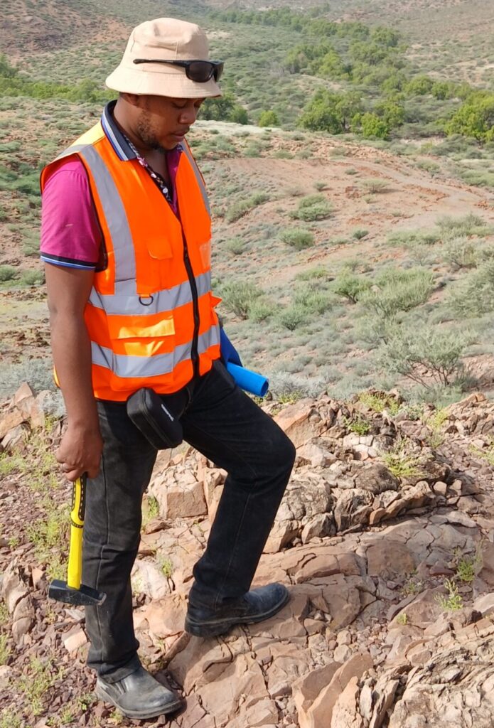
Weathering and artisanal workings. In tropical Africa, deep weathering may hide fresh rock, but artisanal mining pits and old workings often follow shear-hosted veins, providing clues about the structure beneath.
Geochemical and Geophysical Signatures
Shear-hosted gold systems leave signals that complement field observations. Soil and stream sediment geochemistry may show gold with pathfinder elements such as arsenic, antimony, tungsten, and bismuth. Rock chip sampling across a shear zone gives alteration and grade trends. Magnetic surveys can map shear zones because deformation and alteration change magnetic mineral content, often producing linear anomalies or offsets. Radiometric surveys may reveal potassium enrichment from alteration. Induced polarisation and resistivity can detect sulphides and silicification, and electromagnetic methods help map conductive structures.
Examples from East Africa
The Archean Lake Victoria Greenstone Belt, spanning Tanzania, Uganda, and Kenya, hosts numerous shear-hosted gold deposits. In Kenya, gold occurs in greenstone belts such as the Kakamega-Vihiga, Migori, and Nyanza areas, where deformed volcanic and sedimentary rocks are cut by shear zones and quartz veins, and where historical and artisanal mining have exploited vein systems. In the Mozambique Belt, deformed metamorphic terrains also show gold associated with shear structures. Regional shear zones, including the large Aswa shear zone in northern Uganda and northwest Kenya, record long histories of deformation that influenced later basin and rift formation.
How Explorers Target Shear-Hosted Gold
A typical programme proceeds in stages. First, regional compilation of geology, geophysics, and satellite data identifies major shear corridors. Second, geological mapping and structural measurements define the geometry and kinematics of the shear zone. Third, geochemical sampling highlights anomalies along the corridor. Fourth, structural analysis identifies dilational sites and predicts shoot plunge. Fifth, trenching and pitting expose bedrock, and drill holes are designed perpendicular to the ore-controlling structures. Finally, drill results are fed back into the structural model, refining targets.
Common Pitfalls
Common errors include assuming that a strong shear zone automatically carries gold, when many are barren. Another is drilling parallel to the dominant foliation and missing steeply dipping veins. Over-interpreting lineaments without field checks wastes time. Failing to recognise multiple deformation phases can lead to misjudging the timing of mineralisation relative to structure. Finally, ignoring weathering effects such as the leaching or enrichment of gold near the surface can distort grade expectations.
Frequently Asked Questions
Are all gold deposits in shear zones? No. Other deposit types exist, such as porphyry, epithermal, placer, and carbonate-hosted systems, but shear-related orogenic gold is among the most important.
Does a wider shear zone mean more gold? Not necessarily. Grade depends on fluid flux, chemical traps, and structural geometry, not width alone.
How deep can shear-hosted gold extend? Many systems extend for kilometres down-dip, with ore shoots continuing along their plunge.
Drilling Shear-Hosted Gold: Orientation and True Width
Because shear-hosted veins and ore shoots are often steeply dipping and strongly elongated along a plunge direction, drill hole design matters as much as target selection. Holes should cross the dominant foliation and vein orientation at a high angle, so that intercepts approximate true width and the structure is not missed. A hole drilled parallel to a steeply dipping vein can return a misleadingly long, low-grade intercept or miss the vein completely.
Geologists therefore record the orientation of every vein and shear intercept in oriented core where possible, convert downhole widths to true widths, and update the structural model after each fence of holes. Over time, this feedback loop reveals shoot plunge, offsets by later faults, and changes in alteration intensity, which together guide step-out drilling and resource estimation. Good structural logging of core, including foliation, veins, and shear sense, is therefore a core part of any shear-hosted gold programme.
Conclusion
Shear zones are the highways along which gold-bearing fluids once travelled, and their geometry determines where gold was left behind. Understanding brittle-ductile deformation, ore-shoot controls, kinematics, and alteration gives explorers a framework for finding deposits in places like the greenstone belts of western Kenya and the wider Lake Victoria region. With good structural mapping, careful sampling, and well-oriented drilling, shear zones become not just geological features but clear exploration targets.