Skip to content

Structural geology is the study of the three-dimensional geometry of rock bodies and the deformation that produced it. It asks practical questions. How are the rocks oriented? Where are they broken, and in which direction did blocks move? Were they folded, and which way do the fold axes plunge? What stresses acted on the region, and in what sequence?
The word “structure” covers any feature produced by deformation: folds, faults, joints and veins, foliations (planar fabrics such as schistosity and cleavage), lineations (linear fabrics such as stretching lineations), and shear zones. A structural geologist measures these features in the field, plots and analyses them, and builds a model of how the rock mass has evolved.
The Core Vocabulary
A few terms appear constantly. Strike is the compass direction of a horizontal line on a tilted surface, and dip is the angle of maximum inclination below horizontal. Together they describe the orientation of a bed, fault, vein, or foliation. Stress is the force per unit area acting on rock, and strain is the resulting change in shape or volume. Brittle deformation produces fractures and faults in cold, shallow rock, while ductile deformation produces folds and flowing fabrics in hot, deep rock. Between them lies the brittle-ductile transition, a depth range, often around 10 to 15 kilometres in typical continental crust, where many hydrothermal mineral systems are active.
Why Structure Controls Mineralisation
Most metallic mineral deposits form when hot, metal-bearing fluids move through the crust and deposit minerals where conditions change. Three ingredients are needed: a source of metals and fluids, a pathway for the fluids to travel, and a trap where deposition occurs. Structures often provide the second and third ingredients.
Pathways. Faults, shear zones, and fracture networks are permeable channels in otherwise tight rock. Large fluid volumes can flow rapidly along them, especially when the rock is repeatedly broken by earthquakes and then resealed by mineral deposition, a process sometimes called fault-valve behaviour.
Traps. Deposition is favoured where fluid pressure drops suddenly, temperature changes, or fluids react with chemically favourable host rocks. Structural settings that produce such conditions include dilational jogs and releasing bends along faults, the hinge zones of folds where space opens between layers, intersections between different structures, and contacts between strong and weak rocks that localise strain.
Because ore deposits are so often structurally controlled, finding the right structural setting narrows the search from a whole region to a few promising targets.
Structures and Common Deposit Types
Orogenic gold. Many of the world’s great gold provinces, including the Archean greenstone belts, are structurally controlled. Gold-bearing quartz veins and alteration halos concentrate along shear zones and fault splays. Dilational sites, fold hinges, and rock contrasts are common ore shoots. In East Africa, the greenstone belts of the Lake Victoria region, including areas of western Kenya such as the Kakamega-Vihiga and Migori belts, are explored with this model in mind.
Base metals and VMS. Volcanogenic massive sulphide deposits form on the seafloor but are later folded and faulted, so structural analysis is needed to restore the original geometry and to follow repeated or displaced ore horizons.
Porphyry and epithermal systems. Intrusion-related deposits are often aligned along regional fault corridors, with veins and breccias developing in fracture networks around intrusions.
Pegmatites and gemstones. In Kenya’s Mozambique Belt, pegmatite and gemstone occurrences such as those of the Taita-Taveta region are linked to tectonic settings and structural zones that guided magma and fluid emplacement.
Geothermal systems. Although not a mineral deposit in the traditional sense, geothermal fields in the Kenya Rift, such as Olkaria and Menengai, are controlled by faults and fracture permeability, showing how structure governs fluid flow in the crust.
Groundwater and hydrogeology. Fracture zones control the productivity of boreholes in crystalline rocks, which is why structural mapping also benefits water exploration.
Key Structural Elements Explorers Look For
Shear zones are tabular zones of concentrated deformation, ranging from centimetres to kilometres wide. They are covered in more detail in the companion article on shear zones and gold.
Faults are fractures with displacement. Strike-slip faults move blocks sideways, normal faults pull the crust apart, and thrust faults push one block over another. Each has characteristic associated structures.
Folds record shortening of layered rock. Anticlines are arch-shaped and synclines are trough-shaped, and fold hinges, limbs, and axial planes help locate potential ore traps.
Fold-fault intersections and structural corridors. Where multiple structures overlap, permeability and fluid focusing are enhanced. Many deposits cluster in such corridors.
Veins and fracture networks. Orientation, density, and crosscutting relationships tell geologists about stress conditions during mineralisation.
How Structural Geologists Work
The workflow combines several scales of data.
Regional interpretation. Geologists begin with published geological maps, satellite imagery, digital elevation models, and geophysical data such as magnetics and radiometrics. Magnetic data are especially useful because they map faults, dykes, and contacts even beneath cover.
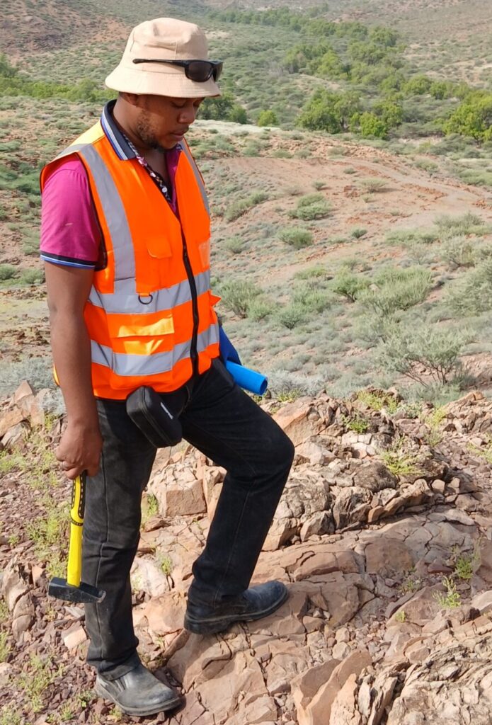
Field mapping and measurement. Geologists walk traverses, recording the orientation of foliations, bedding, veins, faults, and lineations with a compass-clinometer or a digital mapping app. They note kinematic indicators, such as offset markers and slickensides, that show the direction of movement.
Data analysis. Measurements are plotted on stereonets and rose diagrams to identify dominant orientations and fold axes, and to determine stress and strain directions.
Cross-sections and 3D modelling. Maps and drilling data are combined into cross-sections and three-dimensional models that predict where structures and ore zones extend at depth.
Targeting. Structural models are integrated with geochemistry and geophysics to rank targets and plan drill holes at the best angle to intersect the target structure.
Why Structural Knowledge Saves Money
Drilling is the largest cost in exploration. A hole drilled parallel to a steeply dipping vein may miss it entirely or intersect only a thin sliver, while one drilled across it gives a true thickness. Misreading the dip, the plunge of an ore shoot, or the displacement across a fault can lead to holes that stop short of or pass beneath ore. Structural understanding helps place holes more effectively, interpret results correctly, and estimate resources more reliably.
It also reduces risk in mine planning. Faults and shear zones affect ground stability, water inflows, and dilution. A mine designed with a good structural model is safer and more efficient.
Structural Geology in Kenya and East Africa
Kenya’s geology is a rich structural laboratory. The Archean Nyanza Craton in the west, with its greenstone belts, hosts gold systems controlled by shear zones and folds. The Neoproterozoic Mozambique Belt crosses central and eastern Kenya, with intensely deformed metamorphic rocks, shear zones, and thrusts hosting gemstones, graphite, and other minerals. The East African Rift System superimposes younger faulting and volcanism, shaping basins, geothermal fields, and mineral resources such as soda ash, fluorspar, and diatomite. Older basement structures often influence the location and orientation of rift faults, so deciphering the structural inheritance is key.
Common Mistakes to Avoid
Several pitfalls recur. Treating a mineral occurrence as an isolated point rather than part of a structural system leads to poor targeting. Ignoring the sequence of deformation events can cause confusion between older and younger structures. Relying only on satellite lineaments without field validation risks chasing roads, fences, and drainage lines. Collecting too few structural measurements, or measuring only the most visible features, gives biased results. Finally, failing to integrate structure with geochemistry and geophysics wastes information that could sharpen targets.
Getting Started: Practical Tips
If you are new to the field, start by learning to measure strike and dip correctly, record observations systematically, and plot data on a stereonet. Read the geology of your project area in published reports, and study how known deposits in similar settings are structurally controlled. Work alongside an experienced structural geologist where possible, and always cross-check remote sensing interpretations with field evidence.
Frequently Asked Questions
Is structural geology only for hard-rock mining? No. It is also used in oil and gas, geothermal energy, groundwater, engineering geology, and natural hazard assessment.
Do I need advanced software? Not at the start. A compass-clinometer, notebook, GPS, and a free stereonet program are enough to begin, while GIS and 3D modelling tools become useful as projects grow.
Can structure alone find a deposit? No, but it greatly improves the odds when combined with geochemistry, geophysics, and sound geological reasoning.
Conclusion
Structural geology explains how rocks have been deformed and, crucially, how that deformation controls the movement of fluids and the location of mineral deposits. For explorers in Kenya and East Africa, from the greenstone belts of the west to the Mozambique Belt and the Rift Valley, structural insight turns a regional search into targeted drilling. Investing in structural mapping and interpretation early in an exploration programme is one of the most cost-effective decisions a project can make.