Skip to content

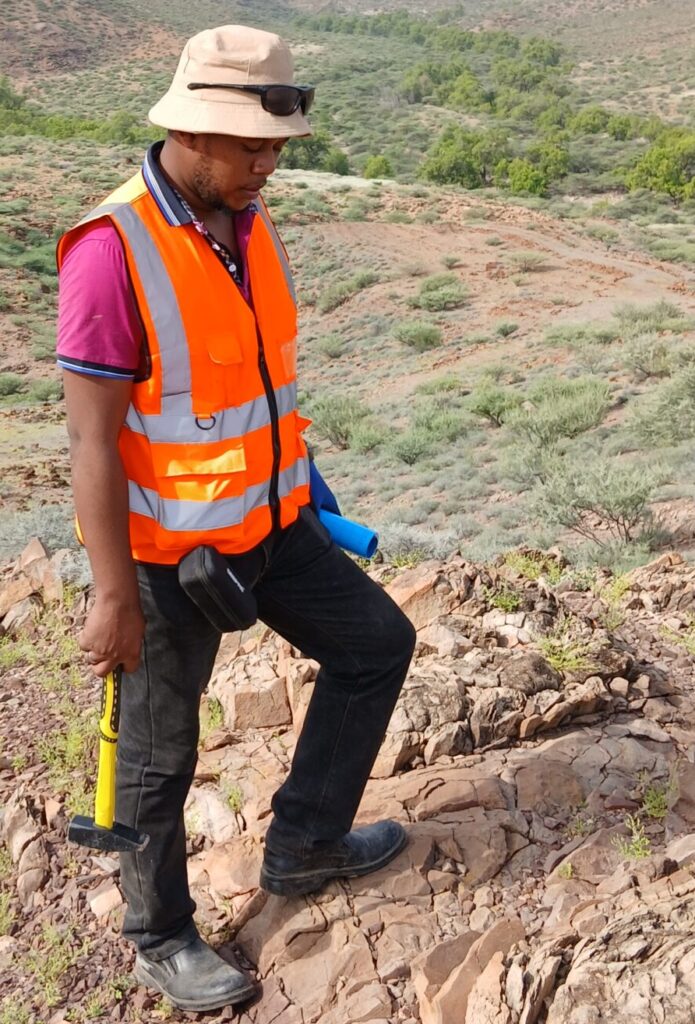
A craton is an ancient, stable block of continental crust. Western Kenya lies on the northern margin of the Archaean Tanzanian Craton, which also underlies northern Tanzania and part of Uganda. Archaean means older than about 2.5 billion years. Within the craton are greenstone belts, elongated sequences of metamorphosed volcanic and sedimentary rocks surrounded by granites. In Kenya these belts are often referred to the Nyanzian and Kavirondian systems (sometimes called supergroups), and they are the main hosts of known gold.
Shanta Gold, which holds licences in the area, places its West Kenya deposits within the Lake Victoria Goldfields and the Busia-Kakamega Greenstone Belt of the Neoarchean Tanzania Craton. Red Rock Resources describes the Migori Greenstone Belt as part of the Nyanzian supergroup and a northern extension of the gold-rich Tanzanian craton. These company descriptions are useful summaries, but they are not independent peer review.
Nyanzian and Kavirondian rocks in brief
The Nyanzian is the older unit, dominated by metamorphosed volcanic rocks (metavolcanics) and associated iron-rich cherts. Work on the Kakamega-Kapsabet area, published in a university thesis from South Eastern Kenya University, describes Nyanzian andesites, rhyolites, agglomerates and tuffs, interpreted as island-arc volcanism, with iron-rich cherts marking the top of the youngest Nyanzian rocks and the end of submarine volcanism.
The Kavirondian is the younger unit, mainly metamorphosed sediments (metasediments): conglomerates, greywackes, sandstones and mudstones that unconformably overlie the Nyanzian. The thesis interprets them as turbidites, sediments deposited by underwater density flows in fore-arc and back-arc basins. Granitoids (granite-like intrusive rocks) later intruded both units. Regional metamorphism was largely greenschist facies, a low to moderate grade of metamorphism, with local higher-temperature zones near granite contacts.
Gold in these rocks is mostly of the orogenic type, deposited from hydrothermal fluids that moved along faults and shear zones during deformation. The USGS summary of this deposit class notes that such deposits favour Archaean granite-greenstone belts, are controlled by major fault systems, and show carbonate alteration and quartz veining.
Migori: a Neoarchean belt with varied gold styles
The Migori Greenstone Belt in southwest Kenya runs roughly northwest to southeast from the Tanzanian border towards the Winam Gulf of Lake Victoria. A 2026 paper by Mitchell and co-authors describes it as a Neoarchean succession of mainly metavolcanic Nyanzian rocks and mainly metasedimentary Kavirondian rocks, about 20 km wide and 80 km long, bounded by granites, with greenschist metamorphism and amphibolite facies close to granite contacts. According to the authors, gold occurs in steeply dipping quartz reefs that follow the strike of the belt, in oblique quartz veins, in banded iron formation (BIF), and as disseminations in tuffaceous rocks. They link the mineralisation to sulphides including pyrite, pyrrhotite and arsenopyrite, and propose that fluids associated with the Migori Granite circulated through the volcano-sedimentary succession. They report that the main gold-bearing phase is electrum, a natural gold-silver alloy.
Red Rock Resources, a company active in the belt, describes a project area of about 245 square kilometres where gold is concentrated in and around shear zones with quartz-carbonate veining, and also in BIF and volcanogenic massive sulphide (VMS) occurrences. Historical mining at Macalder, a VMS deposit, ran from the 1930s to the 1970s for copper and gold, according to the company, and its tailings are now being evaluated for residual gold. The company’s disclosures report resources along the Mikei Shear Zone and in the Macalder tailings. Resource numbers are updated by companies from time to time, so consult the latest announcement and the Competent Person’s statement rather than relying on a figure quoted in a blog.
The Mitchell paper adds that most current mining in Migori is artisanal or small-scale, concentrated near the Migori Granite contact, with Kilimapesa (working a banded iron formation) described as the only major mine. A 2010 company report on the Rongo project in the Kanango area similarly noted that the licence area covered Nyanzian metavolcanics and granites near the northern contact of the Kinjere Granite, with alluvial cover hindering mapping and quartz-veined fault structures as the target. Together these sources show a recurring pattern: gold clusters near granite contacts and along shear zones, in several host rock types.
Why gold grain size matters in Migori
The Mitchell paper offers an unusually detailed look at the gold itself. Using scanning electron microscopy of thousands of grains, the authors found that the vast majority of grains by count are very fine, yet by weight most of the gold sits in coarser grains. That difference matters. Artisanal sluice boxes and mercury amalgamation recover coarse particles reasonably well but lose much of the fine gold, and the authors report that shaking tables could do better. For explorers, this is a reminder that assays, metallurgical tests and processing design must reflect the real size distribution of gold, and for communities it highlights health risks from mercury and benefits of mercury-free methods.
Kakamega: the Kakamega Dome and the Busia-Kakamega belt
Further north, the Kakamega area has a long history of small-scale gold mining, which has attracted public attention in recent years. The geology differs in detail from Migori. The Kakamega-Kapsabet thesis describes a roughly 1,330 square kilometre area at the boundary between the Archaean Nyanza segment of the Tanzanian Craton and the Neoproterozoic Mozambique Mobile Belt, a younger orogenic belt of high-grade metamorphic rocks. The boundary is marked by the Nandi fault and shear zone, which the thesis describes as 7 to 15 km wide. The author identifies multiple deformation events from Archaean to Tertiary time and notes that Kavirondian turbidite-hosted gold is associated with smoky quartz veins, while sulphide mineralisation occurs near granitoid plutons and is hosted in both Nyanzian volcanics and Kavirondian turbidites.
Shanta Gold’s West Kenya Project provides modern detail about the same wider region. The company describes gold hosted by sheared, pillowed to massive basalts lying between ultramafic volcanics and conglomerates on one side and carbonaceous mudstones and sandstones on the other. Mineralisation occurs in quartz and quartz-carbonate veinlets within shear zones, classified as an orogenic shear-zone-hosted vein system. The Isulu and Bushiangala deposits sit in the Liranda Corridor, a 12 km structural trend on the eastern limb of the Kakamega Dome. The company states that both its Ramula-Mwibona and Isulu-Bushiangala deposits have NI 43-101-compliant resource estimates, a feasibility study was completed in 2025, and financing and resettlement planning were planned areas of focus for 2026. As these are company statements, project status should be confirmed from current filings.
Vihiga: what can and cannot be said
Vihiga County lies between Kakamega and Kisumu, in the same general region of Western Kenya. In the sources reviewed for this article, no detailed, publicly accessible geological study or company disclosure was found that describes Vihiga’s gold geology specifically. The Kakamega-Kapsabet thesis does not mention Vihiga, and the company sources focus on Migori and the Kakamega Dome. It would therefore be inappropriate to state specific deposit types, grades or resources for Vihiga here.
What can be said is general: the greenstone and granitoid geology of the Nyanzian and Kavirondian systems extends across parts of Western Kenya, and small-scale gold workings have been reported in several counties. Anyone interested in Vihiga should consult the State Department for Mining and its geological survey records, check the Mining Cadastre for existing licences, and commission field verification by a qualified geologist before drawing conclusions. Hearsay about “rich ground” without sampling data and a Competent Person’s report should be treated cautiously.
Structural and alteration controls common to the three areas
Despite local differences, several themes recur across the region.
- Shear zones and faults as pathways. Gold sits within or beside deformed zones where fluids were focused. In Kakamega the Nandi fault system and local shears are important; in Migori, strike-parallel reefs and the Mikei Shear Zone are described.
- Granite contacts and intrusions. In Migori, mineralisation clusters near the Migori Granite; in Kakamega, sulphide mineralisation is associated with granitoid plutons.
- Multiple host rocks. Gold occurs in volcanic rocks, sediments and iron formation, so exploration cannot focus on a single lithology.
- Quartz-carbonate veining and sulphides. Veins with pyrite, arsenopyrite and other sulphides are recurring targets, matching the generic orogenic gold model.
- Cover and weathering. Alluvium, soils and weathered rock hide bedrock, which is why geochemistry, trenching and geophysics (such as airborne magnetic surveys to map structure) are used.
Exploration status, licensing and responsible approaches
Western Kenya’s gold potential attracts both small-scale miners and companies. Mining rights are governed by the Mining Act, 2016, and applications are handled online through the Cadastre. Licence conditions, including environmental compliance and landowner or community consent, apply, and details can change, so confirm them with the State Department for Mining. Artisanal and small-scale miners are an important part of the sector, and responsible exploration involves respectful engagement, safety, and fair treatment of land rights.
Conclusion and key takeaways
Gold deposits in Western Kenya are rooted in the Archaean greenstone belts of the Tanzanian Craton, where orogenic processes along shear zones and granite contacts concentrated gold in quartz veins, iron formation and altered volcanic and sedimentary rocks. Migori and Kakamega have published geological descriptions and active project disclosures; Vihiga is less documented in the sources reviewed.
- Nyanzian volcanics and Kavirondian sediments host most known gold.
- Shear zones, quartz-carbonate veins, sulphides and granite contacts are key controls.
- Gold grain size and style affect both exploration and artisanal recovery.
- Verify company resource figures, licence status and any Vihiga claims with current official and independent sources.
Frequently asked questions
What rocks host gold in Western Kenya? Mainly metamorphosed volcanic rocks of the Nyanzian and metamorphosed sediments of the Kavirondian, as well as iron formation, cut by quartz veins and shear zones near granite intrusions.
Is there a gold belt in Kenya linked to Tanzania’s Lake Victoria Goldfields? Company and academic sources place Migori and the Kakamega-Busia area within the same wider Archaean greenstone terrain as the Lake Victoria Goldfields, although each area has its own geology.
Is there a proven gold deposit in Vihiga? The sources reviewed did not document one. Confirm with the State Department for Mining and an independent geologist.
Can anyone prospect for gold in Western Kenya? Prospecting requires the appropriate licence or permit under the Mining Act, 2016, and landowner or community consent where applicable. Check current requirements with the authorities.
References and further reading
- Mathu: Petrology and tectonic evolution of the Kakamega-Kapsabet area (South Eastern Kenya University repository)
- Mitchell et al. 2026, Neoarchean gold grain size and artisanal mining in Migori, Kenya (NERC Open Research Archive)
- Migori Gold Project (Red Rock Resources)
- West Kenya Project (Shanta Gold)
- Exploration at Rongo gold field project in Kenya’s Lake Victoria greenstone belt (African Review, 2010)
- USGS Open-File Report 03-077, gold vein deposit models
- Mining Act No. 12 of 2016 (National Mining Corporation, Kenya)
- Mining ministry phases out manual licence registrations (Kenyans.co.ke)