Skip to content
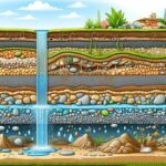
Groundwater is, by its nature, invisible from the surface — which has historically made finding it one of hydrogeology’s more uncertain exercises, often reliant on drilling exploratory boreholes and hoping for the best. Remote sensing hasn’t solved that fundamental problem (satellites still can’t literally see through rock to water), but it has transformed how confidently hydrogeologists can identify where groundwater is likely to be found, dramatically improving the odds before a single borehole is drilled.
Why Groundwater Exploration Needs Remote Sensing
Traditional groundwater exploration relied heavily on surface geological mapping, local hydrological knowledge, and increasingly on ground-based geophysical surveys like electrical resistivity — each valuable, but each also slow and limited in spatial coverage. In regions with sparse existing hydrogeological data, which describes much of rural East Africa, this made siting a successful borehole partly a matter of informed guesswork, with failure rates on exploratory boreholes historically running uncomfortably high in some areas.
Remote sensing changes the economics of this process by allowing hydrogeologists to rapidly screen large areas for the surface and near-surface indicators that correlate with groundwater presence, concentrating expensive ground investigation — resistivity surveys, test drilling — on the highest-probability zones.
What Remote Sensing Actually Detects
It’s worth being precise about the mechanism here, because “satellites find water” oversimplifies what’s really happening. Remote sensing doesn’t detect groundwater directly in most applications; it detects surface proxies that correlate with groundwater presence, recharge potential, or aquifer boundaries.
Structural and Lineament Mapping
Fractures, faults, and geological contacts often control groundwater flow paths, particularly in hard-rock (crystalline basement) terrain where groundwater moves almost exclusively through fracture networks rather than through the rock matrix itself. Satellite imagery and radar data allow hydrogeologists to map these structural lineaments across large areas, and intersections of multiple lineaments are frequently identified as priority borehole siting targets, since fracture intersections tend to have higher transmissivity than single fractures alone.
Land Cover and Vegetation Analysis
Vegetation vigor, particularly during dry seasons, can indicate areas with shallower water tables or greater soil moisture retention. Multispectral vegetation indices like NDVI (Normalized Difference Vegetation Index) are used to identify persistently green areas that stand out against surrounding drier vegetation, which can suggest access to a shallow water source.
Geomorphological and Drainage Analysis
Terrain data helps identify alluvial fans, buried paleo-channels, and floodplain deposits — geomorphological features frequently associated with productive shallow aquifers, since these settings typically contain coarser, more permeable sediment than surrounding areas.
Thermal Infrared Analysis
Surface temperature variations can, in some settings, indicate areas of higher soil moisture or shallow groundwater discharge, since water-saturated ground typically shows different thermal behavior than dry surrounding soil, particularly visible in early morning thermal imagery before solar heating equalizes surface temperatures.
GRACE Satellite Gravity Data
At a much larger scale, NASA’s GRACE and GRACE-FO satellite missions measure tiny variations in Earth’s gravitational field caused by changes in water mass — including large-scale groundwater storage changes. While too coarse in resolution for local borehole siting, GRACE data has become an important tool for regional and continental-scale groundwater trend monitoring, tracking long-term aquifer depletion or recharge across major aquifer systems worldwide.
Integrating Remote Sensing with Ground Geophysics
The critical limitation to understand: remote sensing identifies where groundwater is more likely to occur, but it cannot determine aquifer depth, saturated thickness, water quality, or expected yield. Those parameters require ground-based methods — most commonly electrical resistivity surveys, which measure how subsurface materials conduct electrical current (saturated, permeable zones typically show distinctly different resistivity signatures than dry or impermeable rock).
The most effective and cost-efficient workflow combines both: remote sensing identifies and ranks candidate zones across a wide area, and ground geophysics is then deployed selectively at the highest-ranked sites to confirm depth, thickness, and likely yield before committing to drilling. This staged approach has been shown, across numerous hydrogeological studies, to significantly improve borehole success rates compared to drilling based on surface geology or local knowledge alone.
Application in East African Hydrogeology
This integrated approach is particularly valuable across East Africa’s varied hydrogeological settings. In crystalline basement terrain — which underlies much of the region — groundwater occurrence is overwhelmingly structurally controlled, making lineament mapping from radar and optical imagery especially useful for siting boreholes in fractured basement aquifers. In rift-associated sedimentary basins, geomorphological analysis of paleo-drainage and alluvial deposits helps identify buried permeable zones. And across the region’s semi-arid areas, where groundwater represents a disproportionately critical water source, the cost savings from improved targeting have direct implications for community water access programs, where every failed borehole represents both wasted funds and delayed access to safe water.
Practical Guidance for Hydrogeological Consultants
- Use structural lineament mapping as a first-pass filter in basement terrain, prioritizing fracture intersections and zones of structural complexity over isolated single fractures.
- Incorporate seasonal NDVI comparisons where surface vegetation exists, looking specifically for anomalous persistence through dry periods rather than absolute greenness.
- Always pair remote sensing targeting with ground geophysics before finalizing a borehole site — remote sensing narrows the search; it does not replace depth and yield confirmation.
- For regional water resource planning, consider GRACE-derived storage trend data as a complementary large-scale monitoring layer, particularly for tracking long-term sustainability of heavily utilized aquifer systems.
The Bottom Line
Remote sensing has turned groundwater exploration from a largely surface-geology-and-local-knowledge exercise into a data-driven targeting process. It doesn’t eliminate uncertainty — no single tool can — but by narrowing the search area to structurally and geomorphologically favorable zones before ground geophysics and drilling begin, it meaningfully improves the odds of siting a successful, productive borehole on the first attempt.