Skip to content
Ore doesn’t deposit itself randomly. Faults, fractures, folds, and shear zones create the pathways and traps that control where mineralizing fluids move and where economic deposits ultimately form. Structural geology mapping — the systematic documentation of these features — is one of the most fundamental tools in resource exploration, providing the geological framework that ties together everything else in an exploration program, from remote sensing anomalies to geochemical results.
This guide covers what structural geology mapping involves, why it’s central to exploration success, and how modern tools have expanded what’s possible in the field.
Why Structure Controls Mineralization
Most economic mineral deposits are structurally controlled to some degree. Faults and fractures create zones of enhanced permeability that allow mineralizing fluids to migrate through otherwise impermeable rock. Fold hinges can create structural traps where fluids concentrate. Shear zones often localize deformation in ways that create the pressure and chemical gradients needed for mineral precipitation.
This means that understanding the structural history of a region — which faults are active, how they relate to each other, and when they formed relative to mineralizing events — is often just as important as understanding the rock types themselves. Two areas with identical lithology can have vastly different exploration potential depending on their structural setting.
Core Components of Structural Mapping
Fault and Fracture Mapping
Identifying and characterizing fault systems is usually the starting point of structural analysis. This includes documenting fault orientation, sense of movement (normal, reverse, strike-slip), displacement magnitude where measurable, and relative timing compared to other structures and mineralizing events. Fracture density and orientation patterns are also documented, since fracture networks often serve as the plumbing system for mineralizing fluids even where discrete faults aren’t obvious.
Fold Geometry
Where rocks have been folded, geologists document fold axis orientation, plunge, and vergence (the direction folds appear to lean), along with the relationship between folding and other structural features. Fold hinges, particularly in competent rock units, can create dilational zones favorable for mineral accumulation.
Foliation and Lineation
In metamorphic and highly deformed terrains, foliation (planar fabric) and lineation (linear fabric) record the strain history of the rock. Mapping these fabrics helps geologists reconstruct deformation events and understand how the rock has been strained over geological time — information that’s often critical for interpreting orogenic gold systems and similar structurally hosted deposits.
Shear Zones
Shear zones — narrow zones of concentrated deformation — are frequently associated with mineralization, particularly in orogenic gold and some base metal systems. Mapping shear zone geometry, kinematics (the direction and style of movement), and internal fabric helps geologists understand fluid flow pathways and identify the most prospective portions of a shear system.
Structural Chronology
Perhaps most critically, structural mapping aims to establish the relative and, where possible, absolute timing of different structural events. Understanding which structures formed before, during, or after mineralization is essential for interpreting whether a given structure is likely to have controlled ore deposition or is simply a later, unrelated feature.
Field Mapping Methods
Traditional Outcrop Mapping
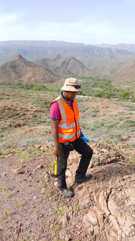
Despite advances in remote and digital methods, direct outcrop observation remains the foundation of structural geology. Geologists measure structural orientations using a compass-clinometer or digital equivalent, document cross-cutting relationships, and record detailed field notes and sketches that capture context a single measurement can’t convey.
Drill Core Structural Logging
For subsurface structural information, oriented drill core provides critical data unavailable from surface mapping alone. Structural logging of core involves measuring the orientation of bedding, foliation, fractures, and veins relative to the core’s known orientation, allowing geologists to reconstruct three-dimensional structural geometry at depth.
Remote and Digital Mapping Tools
Modern structural mapping increasingly incorporates digital tools that complement traditional fieldwork:
- Structure-from-motion photogrammetry and terrestrial LiDAR scanning allow geologists to capture detailed 3D models of outcrops and extract structural measurements remotely, particularly valuable for steep or inaccessible exposures.
- Satellite and aerial lineament analysis, derived from imagery and digital elevation models, helps identify regional structural trends that may not be fully exposed at the surface, providing context for how local structures fit into the broader regional framework.
- Digital field mapping applications running on tablets allow geologists to record structural data directly into GIS-compatible formats in the field, streamlining the transition from raw observation to interpreted map.
Geophysical Integration
Geophysical methods — magnetics, gravity, and induced polarization surveys — are frequently used alongside structural mapping to trace structures beneath cover or through areas with limited outcrop exposure, since many structural features have distinct geophysical signatures even where they aren’t directly visible at surface.
Building the Structural Model
Individual measurements only become useful once synthesized into a coherent structural model — a geological interpretation that explains how observed structures relate to each other in space and time, and how they might control mineralization.
This typically involves:
- Compiling all structural data into a georeferenced database, combining surface mapping, drill core logging, and remote sensing lineament data.
- Constructing stereonet analyses to identify dominant structural orientations and populations, helping distinguish genuinely significant trends from scattered, less meaningful measurements.
- Interpreting cross-cutting relationships to establish relative structural chronology.
- Integrating with geochemical and alteration data to identify which structures show spatial and temporal association with mineralization.
- Producing 3D structural models, increasingly built in dedicated geological modeling software, that allow the structural framework to be visualized and tested against drilling results as an exploration program progresses.
From Structural Model to Exploration Target
The ultimate purpose of structural mapping in an exploration context is targeting. A robust structural model helps exploration teams identify where structural permeability, favorable geometry, and geochemical or alteration evidence coincide — often the strongest indicators of where mineralization is likely to be concentrated.
This is particularly valuable in brownfield exploration around existing deposits, where understanding the structural controls on known mineralization can guide the search for additional, structurally analogous targets nearby, as well as in greenfield exploration, where regional structural analysis can help prioritize entire districts before detailed, resource-intensive work begins.
Why Experienced Structural Interpretation Matters
Structural geology is as much an interpretive skill as it is a data collection exercise. Two geologists looking at the same outcrop or drill core can reach meaningfully different conclusions depending on their experience with similar deposit styles and tectonic settings. Misinterpreting structural chronology or overlooking a subtle but significant fabric can lead exploration programs astray, wasting time and budget on structurally unfavorable ground.
Partnering with a geoconsulting team experienced in structurally controlled deposit styles relevant to your target commodity and region can materially improve the quality of exploration targeting, turning structural data from a descriptive exercise into a genuine predictive tool.
Looking to strengthen the structural framework behind your exploration program? Contact our geoscience team to discuss a structural mapping approach tailored to your project’s geology and stage.