Skip to content


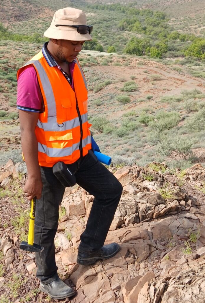
Soil geochemical sampling is one of the cheapest and most effective ways to find hidden mineral deposits. A geologist collects small soil samples on a grid, sends them to a laboratory and maps the results to find areas with unusually high metal content. These are called anomalies. In East Africa, where thick weathered soils hide the bedrock, careful soil sampling can show where to trench or drill. This guide covers how to plan, collect and interpret soil geochemical surveys, with a focus on gold.
Understand Residual and Transported Cover
Residual soil formed in place from the rock below it. It usually carries a signal from the bedrock, so anomalies sit close to the source. Transported cover was moved by rivers, wind or slope wash and sits on top of the local rock. A soil sample from transported cover may reflect rocks somewhere else entirely.
Before sampling, map which type you are dealing with. Use outcrop, pits, road cuts and landforms. Anomalies above transported cover need cautious interpretation, and sometimes a different method such as auger drilling.
Know the Challenges of Tropical Lateritic Terrain
East Africa has deep tropical weathering. Over millions of years, rain and heat leached and re-deposited elements, forming laterite (iron-rich crust) and thick saprolite (rotted rock). Gold may be dispersed, depleted at the surface or concentrated in particular horizons. A study of gold exploration in tropical terrains emphasises understanding weathering, regolith and soil formation before interpreting geochemistry, and it recommends combining geological, geochemical and geophysical data.
The practical message is simple: first learn the regolith, then sample.
Run an Orientation Survey First
An orientation survey is a small pilot test over a known mineralised zone, or a likely one. It answers practical questions: which soil horizon works best, which size fraction, which elements and which laboratory method. Run lines across known mineralisation and compare options. Orientation surveys cost little compared with a full programme and can prevent a whole season of unusable data.
Design the Grid and Spacing
Grid design follows the target. Lines should cross the expected strike of mineralisation at right angles. For first-pass work, common spacing might be 100 to 400 m between lines and 25 to 50 m between samples along the line, then tightening to 50 by 12.5 m or similar over anomalies. Choose spacing so that your smallest target is crossed by at least two lines and a few samples. Use GPS for every point and record the location in the field, not later.
Choose Sample Depth, Horizon and Size Fraction
Sample the same horizon everywhere. This matters more than which horizon you choose. Many projects sample the B horizon or a defined depth, often 20 to 40 cm, avoiding the dark organic top layer. Remove surface leaves and roots. In laterite areas, orientation work may show that a particular horizon is best.
For size fraction, many gold programmes sieve to minus 80 mesh (finer than about 177 microns) because fine material holds more of the signal and is more uniform. Your orientation survey should confirm this. Collect enough weight for the lab, typically a few hundred grams to a kilogram after sieving, following the laboratory’s guidance.
Collect Samples Consistently
Use clean tools, new sample bags and a clear numbering system. Brush tools between sites. Record on a field sheet the soil colour, texture, horizon, depth, regolith type, slope, vegetation and any signs of disturbance. Photograph the pit. These notes later explain odd results. Keep sample bags dry and send them to the lab promptly.
Compare Assay Methods
The laboratory method changes what you see.
- Fire assay is the standard for total gold. It uses a lead flux to collect gold from a larger sample and gives reliable results. It is more costly.
- Aqua regia digestion with ICP analysis dissolves a partial amount of many elements at low cost, including pathfinders. It is widely used for soil surveys, but gold in refractory minerals may not fully dissolve.
- Partial or selective extractions, such as MMI from SGS, target the loosely held, mobile metal ions in soil. SGS says the technique can help in deeply weathered lateritic terrain by distinguishing displaced anomalies from those linked to primary mineralisation. These claims come from the provider’s own case studies and should be tested in your own orientation survey.
- Portable XRF (pXRF) gives fast, cheap on-site readings of metals like arsenic, lead and copper. It is good for pathfinders and screening, but not accurate enough for low-level gold.
Pick one main method for the whole survey and keep it constant. Switching methods mid-project makes datasets hard to combine.
Use Pathfinder Elements
Gold itself is patchy and may give erratic results. Pathfinder elements are chemically associated with gold and are usually easier to detect over a larger area. For orogenic gold, the common set is arsenic, antimony, tungsten and bismuth, along with silver, copper and sometimes lead and zinc. A multi-element anomaly that lines up over several pathfinders is more convincing than a single high gold value.
Apply Strict QA/QC
Quality assurance and quality control (QA/QC) protects you from bad data. Insert, at a steady rate such as about one in every 20 samples:
- Blanks, barren material that should return near-zero, to detect contamination.
- Certified standards, samples with a known value, to check lab accuracy.
- Field duplicates, a second sample taken at the same place, to measure natural variability and sampling precision.
Plot control results on charts as results arrive. If a standard fails or a blank is high, ask the lab to re-run the batch before moving on. Keep the insertion order hidden from the lab, using normal-looking sample numbers.
Level the Data and Set Anomaly Thresholds
Data from different batches, laboratories or soil types may be offset. Data levelling adjusts these differences, using repeat samples or overlapping lines. Do it carefully, and record what you did.
An anomaly threshold separates background from anomalous values. Statistical methods look at the distribution of the data, for example by plotting cumulative probability graphs and picking breaks, and many geologists set thresholds from percentiles. Thresholds should reflect the geology, not just the numbers. Treat any single-point anomaly with caution and look for lines or clusters.
Contour and Map the Results
Plot values as coloured dots first, so each sample can be seen. Gridded or contoured maps are useful for broad patterns, but smoothing may invent trends where there are few data. Overlay the results on geology, structure and magnetics. A gold anomaly that parallels a mapped shear zone and has arsenic with it is a high-priority follow-up.
For perspective, Linear Gold has reported soil anomalies of up to 236 ppb gold in the Migori sector of Kenya. This is a company-reported figure, and what counts as a significant anomaly always depends on local background.
Follow Up with Trenching and Auger Drilling
After defining anomalies, infill the sampling for better resolution. Then move to trenching or hand or power auger drilling to sample the saprolite and reach below transported cover. Trenches allow geologists to map veins and structures directly. Only after these steps should diamond or reverse circulation drilling be planned.
Avoid Common Pitfalls
- Artisanal mining and human activity: spoil, processing sites and mercury or cyanide use can contaminate soil with gold or other metals. Record all disturbance and avoid or flag such samples.
- Rainfall: heavy rain can move soils and wet samples, delaying drying and sieving. Plan fieldwork for drier periods where possible.
- Termite mounds: termites bring up material from depth, which can help or confuse. Avoid mixing mound and normal soil, and record where mounds are sampled.
- Inconsistent sampling: different people, depths or tools introduce noise that looks like geology.
- Ignoring cover: always interpret anomalies in the light of regolith.
Remember the licence side too. Under Kenya’s Mining Act 2016, prospecting licences require a work programme, so soil sampling should be part of a documented plan.
Conclusion
Good soil geochemistry rests on understanding the regolith, running an orientation survey, sampling consistently, choosing an appropriate assay, applying strict QA/QC and interpreting results with geology. Done well, it narrows a large licence area into a few drill-ready targets at low cost.
Sources and Further Reading
- Gold exploration in tropical and sub-tropical terrains with special emphasis on Central and Western Africa (Rhodes University)
- SGS Minerals: Application of MMI geochemistry in deeply weathered lateritic environments
- Geochemical exploration in areas affected by tropical weathering: an industry perspective
- Geochemical soil survey for Au exploration in the Kenieba District, Mali
- Kenya mining overview (Mayer Brown)