Skip to content

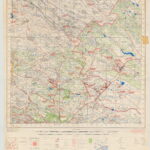
A topographic map is a detailed, accurate representation of the shape of the land surface and the features on it. Unlike a simple road map, a topographic map shows relief (the ups and downs of the terrain) usually with contour lines, along with natural features such as rivers, streams, wetlands, vegetation boundaries and rock outcrops, and man-made features such as buildings, roads, fences, power lines and pipelines.
Topographic maps are foundational products. Almost every serious land-based project begins with one: construction and civil engineering, road and rail design, dam and water supply design, drainage and flood studies, mining and quarry planning, solar and wind farm layout, estate development, agricultural and irrigation design, geological mapping and environmental assessment. If the base map is wrong, every design decision that follows is built on bad information.
Topographic map production services supply this base map, either as a standalone product or as part of a larger project. This article explains how topographic maps are produced, the choices that affect cost and quality, the legal context in Kenya and how to select a provider.
Key Elements of a Topographic Map
Contours. Lines joining points of equal elevation. The contour interval (vertical spacing) depends on terrain and purpose, for example 0.25 m or 0.5 m for detailed site design on flat ground, 1 m to 2 m for typical engineering and estate projects, and 5 m to 10 m or more for regional mapping in steep or mountainous terrain. Closely spaced contours indicate steep slopes, and widely spaced contours indicate gentle slopes.
Spot heights and benchmarks. Specific elevation points, including survey control points, to which the map is tied.
Planimetric features. Roads, tracks, buildings, boundaries, fences, drainage lines, culverts, utilities, trees and other features, represented with standard symbols.
Coordinate grid and projection. The map is tied to a defined coordinate system, such as UTM, so that it can be integrated with other spatial data. In Kenya, projects must be clear about the datum and projection used and, where relevant, the relationship to national control.
Scale and accuracy statement. The map scale (for example 1:500, 1:1,000, 1:2,500, 1:5,000) and a statement of horizontal and vertical accuracy.
Title block and legend. Project name, date, surveyor, datum, coordinate system, contour interval, symbols and revision history.
How Topographic Maps Are Produced: The Main Methods
Several survey technologies can produce topographic data, and a good provider will recommend the method that fits the project’s size, terrain, accuracy needs and budget.
1. Conventional ground survey: total station and levelling. A surveyor measures horizontal and vertical angles and distances to points on the ground with a total station, and uses differential levelling for precise heights. This is the traditional method and remains excellent for small sites, detailed engineering surveys and areas with dense vegetation or structures where aerial methods struggle. It is accurate but slow and labour-intensive for large areas.
2. GNSS surveying (GPS): static, RTK and PPK. Global Navigation Satellite System (GNSS) receivers determine positions from satellites. Real-time kinematic (RTK) and post-processed kinematic (PPK) techniques achieve centimetre-level accuracy when correctly set up with a base station or correction network, and are widely used for control points, boundaries and topographic detail in open terrain. Accuracy is reduced under dense canopy or near tall buildings.
3. Drone (UAV) photogrammetry. Drones capture overlapping aerial photographs, and software reconstructs a 3D model, orthomosaic (a distortion-corrected aerial image) and a digital surface model (DSM), from which a digital terrain model (DTM) and contours can be derived. With good ground control, drone surveys can achieve accuracies suitable for many engineering and planning applications, and they cover large areas quickly and at lower cost than ground methods. They need clear flying conditions, appropriate regulatory approvals and careful vegetation handling. See our drone mapping article.
4. Airborne and drone LiDAR. LiDAR (light detection and ranging) emits laser pulses and records their returns. In vegetated terrain, some pulses reach the ground, so LiDAR can produce bare-earth terrain models beneath tree canopy, which photogrammetry cannot. It is the preferred method for forested corridors, steep vegetated slopes and high-precision terrain work, though equipment and processing cost more.
5. Satellite and aerial imagery and global DEMs. For regional or reconnaissance mapping, satellite-derived DEMs (such as SRTM, ALOS and commercial products) and imagery provide contours and base maps at coarser accuracy. They are valuable for preliminary studies but usually not adequate for detailed engineering design.
6. Mobile and terrestrial laser scanning. Vehicle-mounted or tripod-based scanners capture dense 3D data for roads, buildings, quarries and outcrops.
7. Combined approaches. Many projects blend methods, for example drone photogrammetry for open ground, ground survey for vegetated areas and structures, and GNSS for control. Combining methods gives efficiency and reliability.
The Production Workflow
Step 1: Define requirements. The provider clarifies the purpose, project boundary, required scale and contour interval, accuracy, features to be mapped (buildings, utilities, trees), coordinate system, deliverable formats and deadlines. A clear brief prevents costly rework.
Step 2: Reconnaissance and planning. Review existing maps, imagery, title and boundary information, existing control points and access. Plan control points, flight plans or survey lines, and logistics.
Step 3: Establish control. Set out ground control points (GCPs) and benchmarks with known coordinates and heights, tied to the national or project control network using GNSS or conventional methods. Control is the backbone of accuracy and consistency.
Step 4: Data acquisition. Collect field data by total station, GNSS, drone or LiDAR, according to the plan, with quality checks in the field. Take extra care in complex areas such as steep banks, drainage lines, structures and spot elevations at critical points (for example culverts and inverts, when needed).
Step 5: Processing.
- For ground survey: reduce measurements, adjust networks and build a terrain model from the points and breaklines.
- For photogrammetry: align images, build the point cloud, generate the orthomosaic and surface model, and classify ground points.
- For LiDAR: calibrate, classify ground returns and build the DTM. Then create the digital terrain model (DTM) or triangulated irregular network (TIN) and generate contours.
Step 6: Feature extraction and drafting (digitising). Planimetric features are digitised or drawn from survey data and orthomosaics, with correct layers and symbols. Contours are smoothed and annotated, with index contours labelled with elevations.
Step 7: Quality control and accuracy assessment. Check against independent control points not used in processing, review contour behaviour in difficult areas, verify annotations and compare overlapping datasets. Report achieved accuracy.
Step 8: Field verification (where needed). Check critical features and areas of doubt, such as vegetated zones, in the field.
Step 9: Final map production and deliverables. Prepare plotted maps and digital files in the agreed formats and scales, along with a survey report and metadata.
Step 10: Review and revision. Address client comments, finalise and archive.
Typical Deliverables
- Topographic plans at the agreed scale, in PDF and printed form.
- CAD files (DWG or DXF) for engineers and architects.
- GIS files (shapefile, GeoPackage, GeoJSON) with layers and attributes.
- Digital terrain model (GeoTIFF, XYZ or LandXML) for design software.
- Orthomosaic image (GeoTIFF) when drone or aerial methods are used.
- Contour files at the specified interval.
- Point cloud (LAS or LAZ) if relevant.
- Control point list with coordinates, heights and descriptions.
- Survey report describing method, equipment, control, accuracy and any limitations.
Request the file formats your designers need at the outset.
Accuracy: What the Numbers Mean
Accuracy specifications should be stated, not assumed. Key concepts:
- Horizontal accuracy: how close mapped positions are to their true positions.
- Vertical accuracy: how close mapped heights are to true heights. For contours, vertical accuracy is typically the more demanding requirement, because the contour interval implies a height precision. As a general principle, the vertical accuracy of a map should be a fraction of the contour interval.
- Relationship to scale: A 1:1,000 map has finer detail and tighter accuracy expectations than a 1:10,000 map.
- Influence of method and terrain: Dense vegetation, steep slopes, water bodies and shadows affect achievable accuracy for aerial methods.
Different applications need different accuracy. Preliminary planning may tolerate metre-level vertical accuracy, whereas drainage design on flat terrain or foundations may require centimetre-level accuracy. Tell your provider what decisions the map will support.
Legal and Professional Context in Kenya
Topographic mapping intersects with several areas of Kenyan regulation. This overview is general and not legal advice, so confirm requirements for your project with the relevant authorities and a licensed professional.
Survey law and licensed surveyors. Land surveying in Kenya is regulated, and cadastral surveys and boundary-related work must be carried out by licensed surveyors under the Survey Act and the oversight of the professional regulatory framework. If your project involves boundaries, subdivision, title documents or land registration, you need a licensed surveyor, and the work must follow the approved procedures and be lodged with the appropriate survey authority. Topographic surveys used as engineering design inputs are also commonly carried out or certified by registered surveyors, and many clients and approving bodies expect this.
National mapping and control. The Survey of Kenya is the national mapping agency and holds the national geodetic control network and official topographic map series. Tie your project to the correct control and coordinate system, and ask your provider about the datum and projection used. Official maps and data may be subject to licensing and access conditions.
Drone regulations. Drone surveys fall under civil aviation rules administered by the Kenya Civil Aviation Authority. Requirements typically include registration, operator approvals and compliance with flight restrictions, and certain areas and activities may need additional clearance. Because rules change, confirm the current requirements with the authority and make sure your provider holds the necessary permissions.
Land owner and community consent. Obtain access permission, and notify neighbours and local authorities where appropriate.
Environmental and planning approvals. Topographic maps often support applications to county planning authorities and environmental bodies. Maps should meet the submission standards required.
A reputable provider will tell you which of these apply to your project and how they are being handled.
Cost Factors
Costs vary widely, so beware of one-size-fits-all numbers. The main cost drivers are:
- Area size and shape.
- Terrain and vegetation. Dense bush, steep slopes and difficult access increase time.
- Accuracy and detail level, including contour interval and scale.
- Method. Ground surveys cost more per hectare for large areas, drone surveys are efficient over large open areas, and LiDAR is costlier but valuable in vegetated terrain.
- Control requirements, including tying to national control.
- Features to be mapped, such as buildings, utilities, trees and drainage details.
- Deliverables, such as CAD drawings, DTMs and reports.
- Mobilisation and travel, especially for remote sites.
- Regulatory and permit costs.
- Timeline.
Typically, survey firms quote on a per-hectare, per-day or lump-sum basis. Request an itemised proposal and compare scope, accuracy and deliverables rather than headline price alone. Very low quotes may signal poor control, no accuracy checks or omission of necessary deliverables.
Choosing a Topographic Mapping Provider
Look for:
- Appropriate licensing and registration for the type of survey, and relevant professional standing.
- Relevant experience with projects like yours, and sample outputs.
- Modern equipment, such as survey-grade GNSS, total stations, calibrated drones and processing software, together with a clear explanation of how accuracy will be achieved and checked.
- A documented quality control process and an accuracy report.
- Clear deliverables in formats you can use.
- Understanding of your end use, for example whether the map will feed into road design, drainage, estate layout or a geological project.
- Compliance with aviation and other regulations for drone work.
- Transparent pricing and timelines.
- Data security and ownership terms.
- Good communication and references.
For geoscience projects, a provider who also understands geology, hydrology and GIS can add value, for example by integrating geological mapping, structural data, borehole locations and drainage analysis with the topographic base.
Common Mistakes to Avoid
- Using a free satellite DEM or an online map for detailed design decisions.
- Not specifying the coordinate system and datum, leading to misalignment with other data.
- Skipping ground control on a drone survey and assuming the GPS in the drone is accurate enough.
- Choosing too coarse a contour interval for the design purpose.
- Failing to include key features such as utilities, culverts, trees or drainage lines.
- Ignoring vegetation effects on drone-derived elevation models.
- Hiring unlicensed operators for work that legally requires a licensed surveyor.
- Not checking accuracy results before using the map for design.
Integrating Topographic Maps with Geoscience Work
Topographic data are the foundation for many geological and hydrogeological analyses:
- Hydrogeology: drainage, catchment and recharge analysis, and borehole siting in relation to terrain and flow paths.
- Geotechnical investigations: slope stability assessment, cut and fill estimates and foundation planning.
- Geological mapping: a base for plotting outcrops, structures and sample locations, and for interpreting structural geomorphology.
- Mining and quarrying: pit and stockpile surveys, volume calculations and haul road design.
- Hazard assessment: flood modelling and landslide susceptibility.
- Renewable energy: solar farm layout and wind resource assessment.
Using consistent coordinate systems and a single high-quality base reduces errors across disciplines.
Frequently Asked Questions
What is the difference between a topographic survey and a cadastral survey? A topographic survey maps terrain and features for design and planning. A cadastral survey determines legal land boundaries and must be done by licensed surveyors under the survey law.
How accurate is a drone topographic survey? With proper ground control, good flight planning and processing, drone surveys can reach centimetre-level to few-centimetre accuracy in open terrain, but results depend on conditions, equipment and methods. Vegetation limits ground visibility.
What contour interval should I choose? It depends on terrain and purpose. Flat sites for drainage design often need fine intervals (for example 0.25 m to 0.5 m), while larger sites may use 1 m or 2 m. Discuss with your engineer.
How long does a topographic survey take? From days for small sites to weeks for large or complex projects, including processing and quality control.
Can I use Google Earth contours for design? No. Online elevation data are not accurate enough for engineering design and do not meet professional survey standards.
Do I need to give the surveyor existing maps? Yes. Share title deeds, previous surveys, plans and any known control points.
Conclusion
Topographic map production is the first and often most important step in a land-based project. The right method, accurate control, careful processing, quality checks and compliance with legal requirements give you a base map that engineers, planners, geologists and hydrologists can rely on. Define your purpose and accuracy needs up front, choose a qualified provider and insist on clear deliverables and an accuracy statement.
For topographic mapping support integrated with geological, hydrogeological and GIS analysis, contact Reg. Geol. Mbugua Githae (MGSK) through consult.innercoregeoconsultants.co.ke. Where your project requires licensed survey work, we can coordinate with registered surveyors.