Skip to content

Western Kenya has been a gold-producing region for close to a century. Prospectors worked the Kakamega goldfield in the 1930s, and artisanal miners continue to dig quartz veins and weathered rock across Kakamega, Vihiga and Migori counties today. Beneath this long history lies a geological story that connects Kenya to some of the largest gold camps in Africa. Understanding that story is the starting point for any serious exploration programme.
This article outlines the regional geology, the style of gold mineralisation, the known gold districts of Migori, Kakamega and Vihiga, and the exploration methods best suited to the terrain.
The Regional Setting: The Tanzania Craton and Its Greenstone Belts
Western Kenya forms the northeastern edge of the Tanzania Craton, a very old block of continental crust assembled mostly in the Archaean, roughly 2.5 to 3.0 billion years ago. Across the border in Tanzania, the same craton hosts the Lake Victoria Goldfields, including mines such as Geita, North Mara and Bulyanhulu. These mines have produced many millions of ounces of gold and place the Kenyan portion of the craton in a highly prospective setting.
Within the craton are greenstone belts, elongated zones of folded and metamorphosed volcanic and sedimentary rocks surrounded by granitoids. In Kenya these are grouped into two broad rock successions:
- The Nyanzian Supergroup, dominated by metamorphosed basalts, andesites and felsic volcanic rocks, with intercalated banded iron formation and chert horizons.
- The Kavirondian Supergroup, younger sedimentary rocks such as conglomerates, sandstones and greywackes, deposited in basins that formed as the volcanic belts were uplifted and eroded.
Granites and granodiorites intrude both successions. Later regional deformation folded the belts and created major shear zones, which are the main plumbing system through which gold-bearing fluids once moved.
How Gold Formed: The Orogenic Gold Model
Most gold in the Kenyan greenstone belts is classified as orogenic gold, a deposit type found in metamorphic belts around the world. In this model, hot, watery fluids rich in carbon dioxide and low in salt were generated deep in the crust during mountain-building events. These fluids rose along large faults and shear zones and deposited gold, together with quartz, carbonate and sulphide minerals, where pressure and chemistry changed.
The key characteristics of orogenic gold systems are consistent worldwide:
- Mineralisation is strongly controlled by structures such as shear zones, faults and fold hinges.
- Gold occurs in quartz veins and in altered wallrocks adjacent to them.
- Alteration minerals include sericite, carbonate, chlorite and silica, and sulphides such as pyrite and arsenopyrite are common.
- The deposits can extend for hundreds of metres down plunge, often well beyond the depth of historic workings.
This model tells an explorer where to look: along structurally complex zones within or at the margins of greenstone belts, particularly where rock types of contrasting strength are juxtaposed.
The Kakamega Goldfield
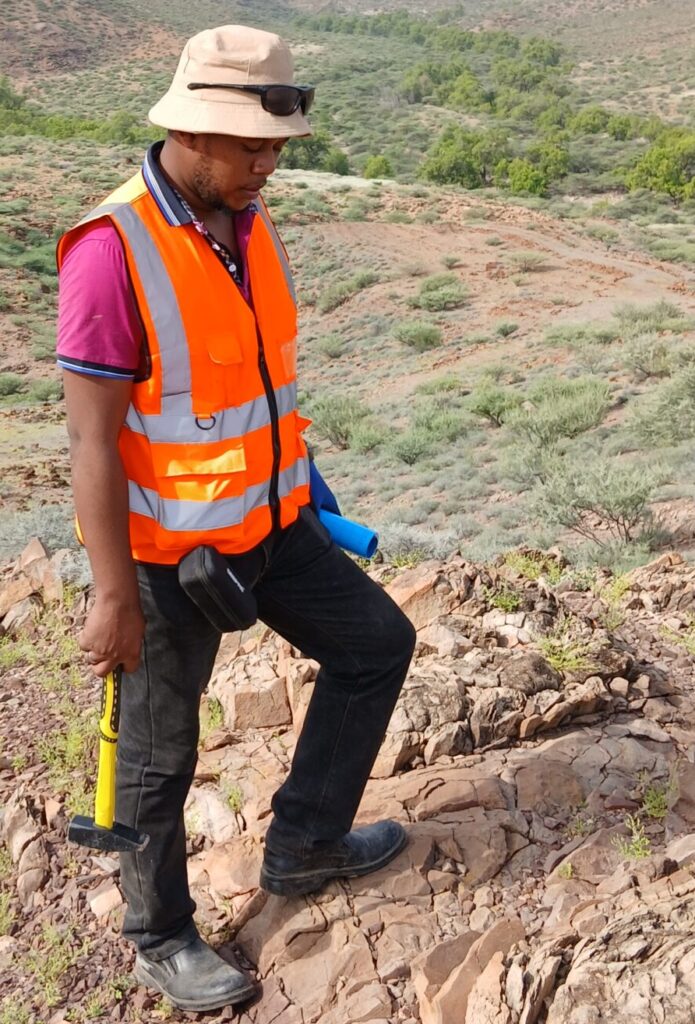
The Kakamega–Vihiga greenstone belt is the best-known gold district in Kenya. Historic mining took place at localities such as Rosterman, Lirhanda and Bushiangala, and modern artisanal activity is widespread around Ikolomani, Isulu and nearby villages.
Gold in this district is largely hosted in quartz veins and sheared metavolcanic and metasedimentary rocks. Veins are commonly steeply dipping and occur in swarms, with alteration envelopes in which the host rock has been bleached and impregnated with fine sulphide. Weathering is deep, and near-surface gold is often free in iron-stained quartz and saprolite, which explains why shallow artisanal digging has been productive and why sampling by pits is common.
For explorers, the key questions are how continuous the veins are along strike and at depth, whether higher-grade shoots are controlled by specific structural intersections, and whether larger bulk-tonnage zones of disseminated mineralisation exist around the vein systems.
Vihiga: The Southern Continuation
Vihiga County lies at the southern end of the Kakamega–Vihiga belt, where greenstone rocks continue beneath varying thicknesses of soil, laterite and weathered cover. Granitoid intrusions and sedimentary rocks of the Kavirondian succession occur alongside volcanic units, creating the lithological contrasts that favour gold deposition.
Because outcrop is limited and deep tropical weathering is typical, exploration in Vihiga relies heavily on soil geochemistry, ground geophysics and trenching rather than on traditional outcrop mapping alone. Magnetic surveys can trace structures and rock units beneath cover, while induced polarisation can detect disseminated sulphides associated with gold-bearing alteration. Artisanal workings are valuable indicators of where mineralisation exists, though they only show where gold was shallow and easy to reach, not where the largest deposits lie.
Migori and the Southwestern Greenstone Belts
The Migori greenstone belt in southwestern Kenya is a second major gold district. It is geologically continuous with the Tanzanian belts to the south, including the area that hosts the North Mara mine near the border. Volcanic and sedimentary sequences of Nyanzian and Kavirondian type are intruded by granitoids, and banded iron formation and mafic volcanic rocks are important host units.
Historic mining in the area includes the Macalder mine, which produced copper and some gold and demonstrates that base-metal mineralisation also occurs in the belt. Gold is mined by artisanal and small-scale miners at numerous localities across Migori County, and further south and west in the Transmara and Lolgorien area of neighbouring Narok County, where greenstone rocks and gold workings also occur.
Recent Gazette notices show that prospecting licence applications of several hundred square kilometres have been lodged across Migori, Homa Bay and Kisii counties, confirming strong commercial interest in the belt. Explorers should expect competition for ground and should check the online cadastre carefully before planning work.
Controls on Mineralisation
Across all three districts, a handful of geological controls recur.
Shear zones and faults. Regional shears act as conduits for fluids. Gold often sits where shears bend, split or intersect, because these dilatant sites open space for veins to form.
Lithological contrast. Competent rocks such as granite, banded iron formation and massive volcanics fracture brittlely, while weaker schists and sediments deform in a ductile manner. Boundaries between them concentrate strain and fluid flow.
Banded iron formation. Iron-rich layers react chemically with gold-bearing fluids, causing sulphide and gold deposition. Several gold systems in greenstone belts worldwide are hosted in or beside iron formation.
Intrusive contacts. Granitoid margins can host quartz veins and alteration, and may have supplied heat that drove fluid circulation.
Exploration Methods Suited to Western Kenya
The tropical landscape shapes how exploration should be carried out.
- Airborne and ground magnetics map greenstone lithologies, banded iron formation and structures. Because Kenya lies close to the magnetic equator, specialist processing is needed to avoid distortions in the data.
- Soil geochemistry is the workhorse method, often with gold plus pathfinder elements such as arsenic, silver, bismuth and tungsten. Care must be taken to distinguish residual soils from transported cover and to allow for contamination near artisanal workings.
- Induced polarisation and resistivity help detect sulphide-bearing zones and map weathering and structure beneath cover.
- Trenching and pitting expose bedrock and veins, providing continuous samples and structural measurements.
- Structural mapping of vein orientation, shear sense and fold geometry guides drill hole design.
- RC and diamond drilling test targets at depth once surface work has defined them.
Opportunities and Cautions
Western Kenya offers an attractive combination of well-understood regional geology, known gold occurrences, close analogues in neighbouring Tanzania, and good road access in many areas. Much of the ground has seen only shallow, localised work, so deeper and larger systems remain largely untested.
At the same time, explorers must be realistic. Historic production figures and anecdotal grades should not be mistaken for mineral resources. Artisanal activity, dense settlement, small land holdings and community expectations require careful engagement and land-access planning. Licensing and permitting must follow the Mining Act, 2016, and any programme should begin with a thorough desk study and a staged budget.
Conclusion
The gold deposits of Migori, Kakamega and Vihiga belong to the same broad family as those in the Lake Victoria Goldfields of Tanzania. Archaean greenstone belts, major shear zones and orogenic gold systems provide a strong geological framework, and modern exploration techniques are well suited to testing them. The most successful programmes will be those that combine structural geology, soil geochemistry and geophysics before drilling, work transparently with communities and follow a disciplined, staged approach from target generation to resource definition.