Finding a commercially viable geothermal resource is not as simple as spotting a hot spring and drilling nearby. Behind every successful geothermal power plant lies years of careful exploration work, layering multiple scientific methods on top of one another to build a reliable picture of what’s happening thousands of meters underground. For developers, investors, and governments, understanding these exploration methods isn’t just academic interest, it’s essential for managing risk and capital in a sector where a single exploratory well can cost several million dollars.
Why Geothermal Exploration Is Inherently High-Risk
Unlike oil and gas exploration, which has benefited from decades of standardized seismic imaging techniques, geothermal exploration deals with fractured rock, complex fluid chemistry, and reservoirs that don’t always announce themselves clearly at the surface. A geothermal system can be hidden entirely beneath layers of rock with no visible surface manifestation at all. This is why exploration typically proceeds in stages, starting with low-cost, non-invasive surveys and only moving to expensive drilling once multiple independent lines of evidence point to the same conclusion.
Stage One: Surface Reconnaissance and Geological Mapping
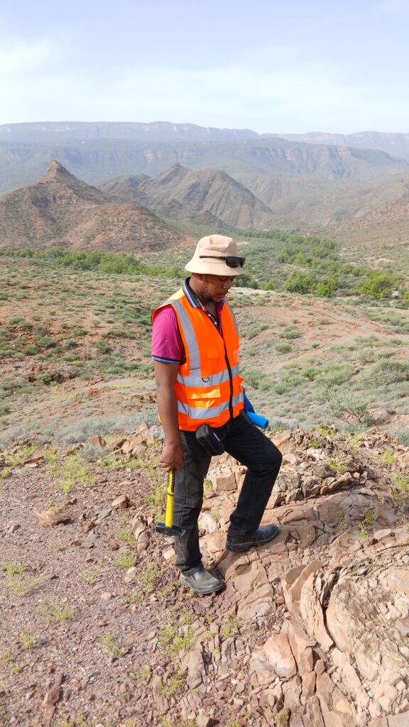
The earliest phase of any geothermal exploration program involves geological mapping and reconnaissance. Geologists study the regional tectonic setting, mapping faults, fractures, and volcanic features that might indicate pathways for heat and fluid movement. In rift environments like the East African Rift, this involves identifying young volcanic centers, fault systems, and areas of recent tectonic activity, all of which can serve as indicators of elevated subsurface heat flow.
Surface manifestations such as hot springs, fumaroles, steaming ground, and altered rock (rock that has been chemically changed by hydrothermal fluids) are documented and sampled. Their locations, temperatures, and flow rates are recorded as some of the first tangible clues about what might be happening below.
Geochemical Surveys
Once surface features are identified, geochemists collect water and gas samples from springs and fumaroles for laboratory analysis. The chemical composition of these fluids can reveal a surprising amount about the reservoir feeding them. Geothermometers, which are chemical formulas based on the concentration of specific elements like silica or the ratio of certain ions, allow scientists to estimate the temperature of the reservoir at depth, even without ever drilling into it.
Isotope analysis adds another layer of insight, helping determine the origin of the water, whether it’s meteoric (derived from rainfall), magmatic, or a mixture of sources, and how it moves through the subsurface system. Gas geochemistry, particularly the ratios of gases like carbon dioxide, hydrogen sulfide, and helium, can also hint at the depth and character of the heat source driving the system.
Geophysical Methods: Seeing Beneath the Surface
Geophysical surveys form the backbone of subsurface characterization in geothermal exploration, since they allow scientists to infer what’s happening underground without drilling.
Resistivity surveys are among the most important tools in the geothermal explorer’s toolkit. Hot, mineralized geothermal fluids conduct electricity much more readily than cooler, unaltered rock. By measuring how electrical current passes through the subsurface using methods like magnetotellurics (MT) or transient electromagnetics (TEM), geoscientists can map zones of low resistivity that often correspond to the clay cap overlying a geothermal reservoir, as well as the reservoir itself. This has become one of the most reliable indirect indicators of a productive geothermal system.
Gravity surveys measure tiny variations in the Earth’s gravitational field caused by differences in rock density underground. Geothermal systems are often associated with structural features, like faulted or fractured zones, that show up as subtle gravity anomalies, helping to refine the location of potential drilling targets.
Magnetic surveys detect variations in the magnetic properties of subsurface rocks. Since hydrothermal alteration tends to destroy magnetic minerals in rock, areas of reduced magnetic intensity can point toward zones that have been affected by hot fluid circulation over geological time, even if there’s no visible surface expression today.
Seismic methods, including microseismic monitoring, are used to detect small earthquakes associated with fluid movement through fractures. While less commonly used in early-stage exploration compared to oil and gas settings, seismic techniques are increasingly valuable for characterizing fracture networks and monitoring reservoir behavior once a field is in production.
Integrating the Data: Conceptual Modeling
None of these methods work in isolation. Skilled geoconsultants integrate geological, geochemical, and geophysical data into what’s known as a conceptual model of the geothermal system. This model represents the best current understanding of where the heat source is, how fluids move through the reservoir, where the permeable zones lie, and where the most promising drilling targets are located. Conceptual models are continuously refined as new data comes in, and they form the basis for decisions about where to site exploratory wells.
Stage Two: Exploratory Drilling
Once a conceptual model has identified promising targets, the project moves into exploratory drilling, the most expensive and highest-risk phase of the entire process. Slim wells, which are narrower and cheaper than full production wells, are often drilled first to confirm the presence of a productive reservoir before committing to full-scale development wells. Data gathered during drilling, including rock cuttings, temperature logs, and pressure measurements, are used to validate or revise the conceptual model.
Well Testing: Confirming Commercial Viability
Once a well has been drilled, it must be tested to determine whether it can sustain commercial production. Well testing typically involves flowing the well for an extended period, sometimes weeks, while measuring flow rate, pressure, temperature, and fluid chemistry. This data is used to estimate the productivity of the well and, by extension, the broader reservoir.
Interference testing, where one well is monitored while a nearby well is flowed or injected, helps establish the degree of connectivity between wells and provides insight into overall reservoir behavior. This information feeds directly into reservoir engineering models used to forecast how the field will perform over its operational lifetime, often 25 years or more.
Why Integrated Expertise Matters
Every stage of geothermal exploration, from the first geological reconnaissance survey to the final well test, requires specialized expertise and careful coordination between different scientific disciplines. Missteps at any stage, whether misreading a resistivity anomaly or misinterpreting geochemical data, can lead to costly drilling failures. This is precisely why experienced geoconsulting teams, with integrated capabilities across geology, geochemistry, geophysics, and reservoir engineering, are so critical to de-risking geothermal projects and giving developers and investors the confidence to move forward.
For regions like the East African Rift, where geothermal potential is enormous but exploration budgets are often constrained, getting this exploration sequence right is not just good practice; it’s what determines whether a promising geological setting becomes a producing power plant or an expensive lesson in what not to do next time.