Skip to content

A borehole is a long-term asset, and its success is largely decided before the drilling rig arrives. Borehole siting is the process of selecting the best location, and estimating the expected depth, yield, and water quality at that location. In a country with highly variable geology, siting by guesswork, by water diviners alone, or by simply copying a neighbour’s borehole carries a real risk of drilling a dry or low-yielding hole.
What Is Borehole Siting?
Borehole siting is a scientific assessment that uses geological, hydrogeological, and geophysical information to pick drilling points with the highest probability of success. A good siting report does not merely name a spot. It explains why that spot was chosen, what is expected beneath it, and what depth and construction are recommended.
Why Siting Matters
A typical borehole project involves drilling, casing, development, pump testing, pump and tank installation, and power supply. Siting is usually a small part of the total budget, yet it influences all the rest. A poorly sited hole can waste the entire investment, while a well-sited one can provide decades of service.
Factors Considered in Borehole Siting
Geology. Rock type and structure determine how water is stored and transmitted. Fractured zones, weathered basement, volcanic contacts, and sand and gravel layers are common targets.
Topography and drainage. Valley floors and lower slopes tend to collect recharge, and many productive sites occur near drainage lines or at the intersection of lineaments. However, flood risk and contamination must be considered.
Recharge and catchment. The area contributing water to the aquifer influences long-term sustainability.
Existing boreholes and wells. Records of depth, yield, and water quality nearby provide valuable calibration. Interference with neighbouring boreholes should also be avoided.
Water quality risks. Proximity to pit latrines, septic systems, waste sites, livestock areas, and industrial sources should be avoided. Natural risks such as high fluoride or salinity should be assessed from regional data and, where needed, tested in nearby sources.
Access and logistics. The rig must reach the site, and the borehole should be located where the water will be used or can be piped economically.
Legal constraints. Distances from boundaries, riparian areas, and protected zones may apply, and permits must be secured.
Siting Methods
Geological and structural assessment. Mapping of outcrops, weathering depth, fractures, and lineaments provides the framework.
Remote sensing. Imagery analysis highlights lineaments and geomorphological features.
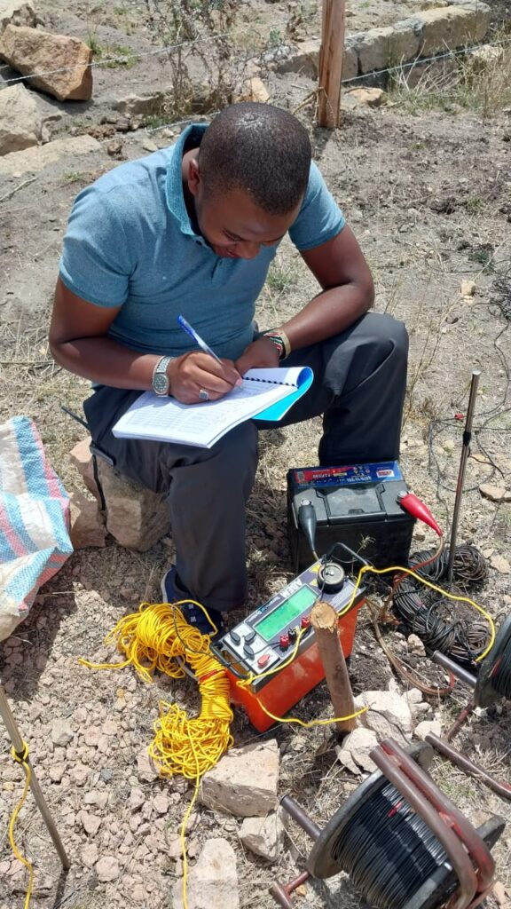
Electrical resistivity methods. VES and ERT are the most widely used geophysical tools for borehole siting, as they measure how well the ground conducts electricity, which responds to water content, clay, and fracturing.
Electromagnetic and magnetic methods. Useful for confirming faults and dykes or for areas where electrical contact is poor.
Integration and ranking. Results are combined to rank candidate sites, usually with a primary site and one or two alternatives.
A Note on Water Divining
Traditional dowsing is widely used, but scientific tests have not shown that it performs better than chance. Professional siting relies on measurable data. Where local knowledge is valuable, such as seasonal springs and historic wells, a hydrogeologist can incorporate it as evidence rather than as a replacement for investigation.
What a Good Siting Report Contains
- Location map with coordinates and site description.
- Geological and hydrogeological summary.
- Geophysical data, interpretation, and sections.
- Ranked drilling sites and justification.
- Recommended depth, expected water strike zones, and likely yield range.
- Water quality considerations.
- Borehole design recommendations, including casing and screens.
- Notes on permitting and monitoring.
From Siting to a Working Borehole
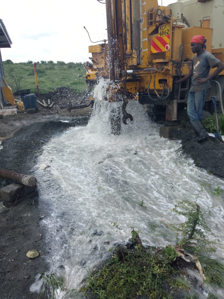
After siting, the process usually continues with authorisation from the Water Resources Authority, drilling by a licensed contractor, borehole development, a pumping test, water quality analysis, and equipping. Supervision by a hydrogeologist during drilling ensures that the borehole is constructed according to the design, that water strikes are logged properly, and that the contractor follows standards.
How Siting Improves Cost Efficiency
- Reduces the chance of dry or low-yield holes.
- Helps choose appropriate depth rather than drilling excessively.
- Informs pump sizing, preventing over- or under-sizing.
- Provides documentation required by regulators and financiers.
Common Mistakes
- Drilling first and asking questions later.
- Placing the borehole beside a septic system or livestock pen.
- Using a single resistivity sounding as the only evidence.
- Ignoring seasonal conditions when interpreting results.
- Assuming that a neighbour’s yield applies to your plot.
Conclusion
Borehole siting is the most cost-effective step in any water project. Scientific siting, based on geology and geophysics, increases the chance of success and ensures that the borehole is designed to match local aquifer conditions.
Innercore Geoconsultants Services Limited offers professional borehole siting, geophysical surveys, and drilling supervision across Kenya. Contact us before you drill, and give your project the best chance of success.