Skip to content

Most people picture mining as a pit, a shaft or a processing plant. Those are the end of a very long chain. Before any ore is mined, a deposit has to be found, tested, measured, costed and permitted. Understanding how mineral exploration works helps landowners, investors, students and community leaders judge claims they hear about a “new discovery”, and it explains why most exploration projects never become mines. This article walks through the stages from first prospecting to a feasibility study, defines the technical terms as they appear, and notes how Kenya’s licensing system fits around the technical work. It is general information, not legal or investment advice.
What exploration is trying to achieve
Exploration is a sequence of decisions made with incomplete information. At every stage a team spends money to reduce uncertainty, then decides whether the remaining uncertainty and the likely economics justify spending more. A mineral deposit is a natural concentration of a mineral that is interesting; it becomes an ore deposit only when it can be mined and processed at a profit. That economic test depends on grade (the concentration of the metal, for gold often given in grams per tonne), tonnage (how much material there is), depth, metallurgy (how easily the metal can be recovered), infrastructure, metal price, taxes, and social and environmental conditions.
Industry summaries describe exploration as a long and uncertain activity. One mining-industry overview notes that few prospects lead to profitable mines and that exploration can run from a few years to decades, while planning and development can take up to a decade more. The stages below are therefore best seen as filters. Each one removes weaker targets so that money concentrates on the best.
Stage 1: Desktop study and target selection
Work begins at a computer rather than in the field. Geologists collect published geological maps, national survey data, satellite imagery, old company reports, historical mine records, and geophysical and geochemical datasets. They ask a basic question: does this area have the right ingredients for the mineral being sought?
For gold in a greenstone belt (an ancient volcanic and sedimentary sequence, folded and altered by heat and pressure), the ingredients include a suitable rock sequence, large faults or shear zones that can channel fluids, and signs of alteration. Geologists build a deposit model, a simplified description of how a deposit type forms and what it looks like, and use it to rank areas. A model for orogenic gold, for example, emphasises major fault and shear systems, carbonate alteration and quartz veining in deformed terrains, as described in USGS descriptive models.
In Kenya, this stage also includes checking land and licence status. The Mining Act, 2016 and its regulations are administered by the State Department for Mining, and in April 2024 the ministry announced that licence applications would be handled through an online mining cadastre rather than manually. Whether an area is already held by someone else, lies in a protected area, or sits on community or private land can decide whether a project is feasible before any fieldwork starts. These details change, so confirm them with the Mining Cadastre and the relevant authority.
Stage 2: Reconnaissance and prospecting
Reconnaissance is a broad, low-cost look at a large area. Prospecting narrows the focus to areas that survived the desktop study. Typical activities include:
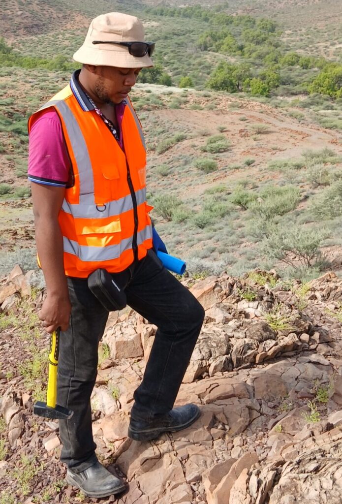
- Geological mapping, recording rock types, structures, veins and alteration on the ground.
- Stream-sediment and soil sampling, where samples are collected on a grid or along drainage lines and analysed for the target metal and associated “pathfinder” elements. A gold anomaly in soil may point to a source upslope.
- Rock-chip sampling, collecting pieces of outcrop or float for assay.
- Remote sensing and regional geophysics, such as aeromagnetic surveys that map faults and rock contacts from the air.
- Talking to local miners and residents, since artisanal pits can reveal where mineralisation reaches the surface.
Under Kenya’s Mining Act, 2016, a reconnaissance licence is available for a limited term and area, while a prospecting licence gives stronger exploration rights. According to the Act text published by the National Mining Corporation, a reconnaissance licence lasts at most two years and is not renewable, and a prospecting licence is granted for up to three years, with limited renewals and compulsory area reductions at renewal. Applicants must submit a work programme, evidence of technical and financial capacity, local employment and procurement plans, and an environmental plan. Fees, area limits and procedures can be amended, and the Act has regulations beneath it, so check the current text and the Cadastre before relying on any figure.
Stage 3: Target definition with geochemistry and geophysics
If prospecting produces promising anomalies, the programme becomes more detailed. Geochemical grids are tightened, trenches are dug to expose bedrock, and ground geophysics is added. Geophysics measures physical properties of the ground, such as magnetism, electrical resistivity and chargeability, density, and natural radioactivity. Different methods answer different questions:
| Method | What it measures | Typical use |
|---|---|---|
| Magnetics | Variations in rock magnetism | Mapping faults, contacts, iron-rich rocks |
| Induced polarisation (IP) | How well the ground stores electrical charge | Detecting disseminated sulphide minerals |
| Resistivity | How strongly the ground resists current | Mapping quartz veins, clay or weathered zones |
| Gravity | Small differences in rock density | Regional structure, dense bodies |
| Radiometrics | Natural radiation from potassium, thorium, uranium | Alteration and lithology mapping |
Geophysics rarely finds gold directly. It helps interpret geology so that drill holes are placed with more confidence. A case study of gold exploration under thick tropical weathering found that magnetic, IP and electromagnetic surveys provided useful information on rock type, structure and alteration, although transported soil and laterite cover could confuse some readings. That is a useful reminder for East and West Africa, where weathering can be deep and results must be interpreted carefully.
The output of this stage is a ranked list of drill targets, each with a geological reason for drilling it.
Stage 4: Drilling and sampling
Drilling is the first time the deposit is sampled at depth, and it is where costs rise sharply. Common methods include:
- Auger and aircore drilling, which are shallow and fast, used to test weathered cover and geochemical anomalies.
- Reverse circulation (RC) drilling, which brings up rock chips through a hollow rod using compressed air, giving many samples quickly.
- Diamond (core) drilling, which cuts a cylinder of rock that geologists can log, photograph, split and assay. Core shows veins, faults and textures that chips cannot.
Quality control matters as much as the drilling. Teams insert blanks, certified standards and duplicate samples, use accredited laboratories, keep a secure chain of custody and survey the drill holes so their positions are known. A single dramatic intercept (a drilled interval with high grade) is not a deposit. Patterns across many holes are.
Stage 5: Resource definition and estimation
If drilling confirms continuity, closer-spaced drilling builds a Mineral Resource estimate. Under internationally recognised reporting codes such as the JORC Code, resources are divided by confidence. Inferred resources have the lowest confidence: geological evidence suggests continuity but does not confirm it. Indicated resources are reliable enough to apply economic and technical assumptions. Measured resources have sampling close enough to confirm both geological and grade continuity and support detailed mine planning.
Public reports under these codes must be prepared by or under the direction of a Competent Person, a suitably experienced professional who belongs to a recognised professional body and has relevant experience of the deposit type. The principles behind the codes are transparency, materiality and competence, meaning that investors and communities should receive clear, complete reports based on competent work. Canada’s NI 43-101 uses a similar structure through “Qualified Persons”. A resource is not yet a reserve; it only says what is in the ground, not what can be economically extracted.
Alongside this, metallurgical test work examines how the gold or other metal can be recovered, whether by gravity separation, flotation or cyanide leaching, and baseline environmental and social studies begin.
Stage 6: Scoping, pre-feasibility and feasibility studies
Once there is a resource, engineers and economists test whether it could become a mine. These studies go from rough to detailed:
- Scoping study (also called a preliminary economic assessment, PEA): a first look at possible mining and processing options and a rough business case. It uses wide margins of error and often includes Inferred resources.
- Pre-feasibility study (PFS): compares several mining scenarios, with more engineering and cost detail. Under the JORC Code a pre-feasibility study is the minimum level of study that supports declaring an Ore Reserve, which is the part of a resource that can be mined economically after applying modifying factors such as mining losses, processing recovery, costs and permits.
- Definitive or bankable feasibility study (DFS/FS): the most detailed study, estimating capital and operating costs, returns and payback so that lenders and investors can decide on financing.
Industry commentators stress that passing any single study does not mean a mine will be built. Permits, financing and community agreements are all still required. A real Kenyan example of a project moving through this chain is the West Kenya Project in Lake Victoria Goldfields, where the company reports resource estimates compliant with NI 43-101 and a completed feasibility study in 2025, with financing and resettlement planning described as the focus for 2026. Company statements like this are promotional in nature, so readers should check independent filings.
Permits, environment and communities along the way
Technical work runs in parallel with legal and social work. In Kenya, prospecting licence applications must include an environmental plan, and the Act requires consent from landowners or community land authorities before rights over private or community land can be granted. Larger projects must also prepare environmental and social impact assessments and, for large-scale mining, community development agreements. Ignoring community engagement is one of the most common reasons exploration projects stall. Good practice is to engage early, explain activities in plain language, record grievances, and avoid raising expectations about jobs or royalties before a mine is even likely.
Mining licence terms, royalty rates and local content requirements are set in law and regulation, and are periodically revised. They should be confirmed with the Ministry and a qualified lawyer at the time of decision.
Why most projects stop, and what that means
Because each stage is a filter, many projects are dropped. Reasons include grades too low, deposits too small or too fragmented, metallurgy that makes recovery uneconomic, remote location, poor power or water access, weak metal prices, licence disputes, or community opposition. A stopped project is not necessarily a failure; the data it generates is valuable. Government geological surveys and later explorers often build on earlier work, and some deposits are revisited decades later when prices or technology change. For example, a company working in Kenya’s Migori area describes historic exploration from the 1930s and later re-evaluation using modern drilling, which illustrates how data can outlive the first owner.
For anyone approached with an offer linked to “proven gold” on their land, a few questions help. Who holds the licence? Is the work done by or under a Competent Person? Have results been reported in a recognised code? Is the claim a resource, a reserve or only an exploration result? Is there an environmental licence?
Conclusion and key takeaways
How mineral exploration works can be summarised as a staged, evidence-driven process: desktop study, prospecting, geochemical and geophysical target definition, drilling, resource estimation, and finally feasibility studies. Each stage costs more than the last and removes more projects. Reliable reporting depends on Competent Persons, transparent codes, quality-controlled sampling, and early engagement with landowners and communities.
- Exploration is a series of go or no-go decisions, not a single discovery.
- A resource is not a reserve, and a feasibility study is not a mine.
- Geophysics and geochemistry guide drilling but do not replace it.
- In Kenya, licences, environmental approvals and landowner consent run alongside the science, and rules can change, so verify current requirements.
Frequently asked questions
How long does mineral exploration take? It varies widely. Industry summaries describe exploration lasting from a few years to decades, followed by up to about a decade of planning and development. Many projects stop much earlier.
What is the difference between a mineral resource and an ore reserve? A mineral resource is a concentration of material with reasonable prospects of eventual economic extraction, classified by confidence. An ore reserve is the portion that studies show can be mined economically after accounting for practical and financial factors.
Do I need a licence to explore in Kenya? Generally yes. Exploration is regulated under the Mining Act, 2016 through reconnaissance and prospecting rights, and applications are made through the online mining cadastre. Requirements and fees change, so confirm them with the State Department for Mining.
Why is drilling so expensive? Drilling needs rigs, crews, fuel, access roads, water, sampling and laboratory analysis, and often months of work before results are known. Geological and geophysical work beforehand reduces the number of holes needed.
References and further reading
- Mining Act No. 12 of 2016 (National Mining Corporation, Kenya)
- The Mining (Licence and Permit) Regulations, 2017 (Kenya Law)
- Mining ministry phases out manual licence registrations (Kenyans.co.ke, April 2024)
- Mining lifecycle explained: exploration to production (Small Caps)
- On the path to production (Mining.com, 2011)
- 2012 JORC Code (JORC)
- Geophysical exploration for gold in deeply weathered terrains: two tropical cases (CSIRO Publishing)
- USGS Open-File Report 03-077, gold vein deposit models
- West Kenya Project (Shanta Gold)
- Migori Gold Project (Red Rock Resources)