Skip to content

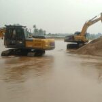
Over the past decade, farms, schools, health facilities, hotels and roads around Kenya’s Rift Valley lakes have disappeared under water. Lakes Baringo, Bogoria, Nakuru, Elmenteita, Solai, Naivasha and Turkana have all risen to levels not seen in decades. Public debate often reduces the story to “heavy rain”, but the rift setting makes the picture more complicated. This article explains the geological controls behind the flooding, what is well established, and what is still debated.
The Rift Valley: A Landscape Built for Lakes
The Kenya Rift is part of the East African Rift System, a zone where the continental crust is slowly being pulled apart. Stretching of the crust creates faults, and blocks of land drop between them to form a down-faulted valley, called a graben. Rainwater and rivers drain into the lowest parts of this valley.
Many rift lakes sit in closed or nearly closed basins. Water arrives from rivers and rain, and leaves mainly through evaporation and underground seepage. Because there is no big river carrying water away, a small change in the water balance can change the lake level noticeably over a few seasons.
Rift lakes have also come and gone through time. Terraces above Lakes Nakuru, Naivasha and Elmenteita record the shorelines of a much larger ancient lake, often called the Gamblian lake, which existed in the early Holocene, roughly 12,000 to 7,000 years ago. Today’s flooding is a reminder that these basins are natural reservoirs, and that people have built in places the water has occupied before.
Why Small Level Changes Cause Large Floods
The shape of the lake floor matters. Many rift lakes are shallow, with gently sloping margins. On a gentle slope, a rise of a metre can push the shoreline hundreds of metres inland. Reported expansions illustrate this: Lake Baringo grew from roughly 217 km² in 2014 to about 264 km² in later assessments, and Lake Naivasha grew from about 113 km² in 2010 to around 173 km². A government task force linked the rise of Lake Baringo to the loss of well over a hundred square kilometres of riparian land and thousands of homes.
This is why lake flooding is a land-use problem as much as a hydrology problem. Settlements, lodges and farms were established on the exposed shoreline during drier decades.
Cause 1: More Water Coming In
The first and most widely supported driver is a wetter water balance. Climate scientists link the lake rise to higher rainfall over the region, and the rise has coincided with some of the warmest years on record. Wet seasons in the late 2010s, including the strong positive Indian Ocean Dipole phase of 2019, delivered unusually large inflows to catchments feeding the lakes.
Geology then shapes how that rainfall becomes lake water. Steep volcanic escarpments, thin soils and cleared slopes produce fast runoff. Where vegetation has been removed, more water reaches the lake as surface flow and less soaks into the ground.
Cause 2: Sediment Loading and Catchment Erosion
Rivers entering the lakes carry soil. Deforestation, overgrazing and poor farming practice upstream increase erosion, and the sediment settles on the lake floor. Over years this raises the bed and reduces the lake’s storage volume, so the same amount of water occupies a larger surface area.
A national task force report highlighted soil erosion and disruption of the hydrological cycle as important contributors. Sediment loading is a slow process, but it compounds the effect of wet years. It is also one of the few causes that land managers can influence, through terracing, riparian buffers and reforestation.
Cause 3: Changes in Underground Outflow
Several rift lakes have no surface outlet, yet some of them, including Naivasha, Baringo and Bogoria, remain relatively fresh despite very high evaporation. That freshness points to water leaving through the ground. Rift rocks are broken by faults and fractures, and volcanic layers can be highly permeable, so lakes can drain through underground pathways.
History supports this. In 1921 Lake Naivasha is reported to have shrunk to a very small body of water, which scientists often link to underground leakage during a dry period. If fractures or pore spaces in the lake bed become clogged by fine sediment, underground discharge may fall, and lake levels would rise even without extra rain. Conversely, new openings could make a lake fall.
This mechanism is plausible and consistent with how closed rift basins behave, but it is difficult to prove, because underground flow paths are hidden. It needs direct measurement through geophysics, tracer tests and monitoring boreholes.
Cause 4: Tectonics, a Contested Explanation
Some Kenyan geologists have proposed that ongoing movement along rift faults has altered basin geometry or underground drainage. The argument is that compressional and tensional stress patterns in the crust may tilt or deform basin floors, or open and close fracture networks.
Other specialists are sceptical. They point out that the rise occurred in many lakes at once, across different geological settings, which fits a regional climate signal better than a set of separate fault movements. They also note that tectonic strain accumulates slowly, whereas the rise of these lakes was fast.
The honest scientific position is that tectonics cannot be ruled out as a local influence, but it has not been shown to be the main driver. The Geologists Registration Board has carried out assessments across Baringo, Bogoria, Solai, Nakuru, Elmenteita and Naivasha to test these questions, and findings from such studies should be treated as the best available evidence as they are published.
Cause 5: Human Pressure on Catchments and Basins
People change the water balance in several ways. Urban growth adds hard surfaces and drainage that deliver more runoff and, in the case of Nakuru, waste and solids to the lake. Wetlands that once absorbed floodwater have been drained or built on. Abstraction for irrigation can lower lakes, but it cannot offset multi-year wet spells.
Not Every Lake Is Rising: Magadi and the Value of Context
Lake Magadi in the south has been reported as drying, while Turkana has overflowed in places. These contrasts remind us that each basin has its own geology, climate and hydrology. A single explanation will not fit every lake, so site-specific studies are necessary.
What Geologists Can Do for Communities and Planners
A credible response combines several lines of work:
- Hazard mapping: using LiDAR or drone elevation data and satellite imagery to map the zone likely to flood under different lake levels.
- Basin and fracture studies: electrical resistivity, gravity and seismic surveys to locate buried faults and possible leakage zones.
- Water balance modelling: measuring inflows, evaporation and underground exchange with gauges, isotopes and monitoring wells.
- Sediment budgets: estimating how much material rivers deliver and where it settles.
- Planning input: setting buffer zones and relocation criteria using historical shorelines, not just recent ones.
Building codes and county planning should treat the old Holocene shorelines and recent high-water marks as signs of where lakes can return.
Key Takeaways
Rising Rift Valley lakes are best understood as a convergence of causes: a wetter climate, eroded catchments, shallow basins, and uncertain changes in underground outflow, with tectonic influence still debated. For residents and investors, the practical lesson is to plan for lake levels higher than today’s, and for decision-makers, to fund monitoring that can separate climate effects from geological ones.
If you are assessing land, infrastructure or a development near a rift lake, a registered geologist can review the geological setting, historical shorelines and flood exposure before you commit.
Sources and Further Reading
- Why lakes in the Rift Valley are rising at an alarming rate, Nation
- Experts: Why the water levels of Rift Valley lakes are rising, Nation
- The culprits behind rising water levels in Rift lakes, Nation
- Why Rift Valley, Nyanza lakes are overflowing, People Daily
- Geologists probe Rift Valley lakes’ rising waters, The Standard