Skip to content

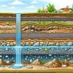
An aquifer is a body of rock or sediment that can store and transmit useful quantities of groundwater. Not every rock that contains water is an aquifer. Clay, for example, can hold a lot of water but releases it so slowly that it is not a practical source. An aquitard (or aquiclude) is a layer that restricts groundwater flow.
Two properties define how a rock behaves as an aquifer:
- Porosity: the proportion of the rock that is void space. It determines how much water can be stored.
- Permeability (hydraulic conductivity): how easily water flows through the rock. It determines how much water can be delivered to a borehole.
In unconsolidated sands and gravels, water moves between grains (primary porosity). In hard rocks, water moves mainly through fractures, joints and weathered zones (secondary porosity). Kenya has a remarkable diversity of geology, from active volcanoes to ancient crystalline rocks, so it contains many aquifer types. For practical purposes, three broad groups are useful: volcanic, sedimentary and basement aquifers.
Confined, Unconfined and Semi-Confined Aquifers
Regardless of rock type, aquifers are also classified by their hydraulic setting:
- Unconfined (water-table) aquifer: the top of the saturated zone is the water table, open to the atmosphere through the unsaturated zone above. Water levels respond quickly to rainfall and pumping.
- Confined aquifer: bounded above and below by low-permeability layers. Water is under pressure, so the water level in a borehole can rise above the top of the aquifer, and occasionally to the surface (artesian conditions).
- Semi-confined (leaky) aquifer: overlain by a layer that is partly permeable, allowing some exchange of water.
In layered volcanic sequences, you can have several aquifers separated by clay-rich horizons, with different water levels and qualities.
1. Volcanic Aquifers
Where they occur. Volcanic rocks cover a large share of central and western Kenya and the Rift Valley, including the slopes of Mount Kenya, the Aberdares, Mount Elgon, the Kenya Rift floor and flanks, the Nairobi area and large areas of the south-western highlands.
Geology. These aquifers form in lavas (basalt, trachyte, phonolite), pyroclastic deposits (ash, tuff, agglomerate) and interbedded sediments and buried soils. Kenya’s volcanic history spans many millions of years, producing complex stacks of layers.
How they hold and transmit water.
- Fractured lavas. Cooling and tectonic stress create joints. Vesicular and rubbly flow tops and bottoms can be highly permeable. Massive flow interiors are tight.
- Tuffs and pyroclastics. Some are porous and permeable, others are compacted or altered to clay and act as barriers.
- Weathered contacts and paleosols. Buried soils between flows can be clay-rich aquitards or permeable weathered zones.
- Faults and fracture zones. In the Rift Valley, faults and fissures can channel water and provide high-yield targets.
Typical borehole performance. Yields range widely, from low to very high. Many productive boreholes in volcanic terrain deliver several cubic metres per hour, and exceptional boreholes much more, while others in tight rock yield little. Depths are often substantial (commonly 100 to 300 metres in places such as Nairobi and Nakuru), because productive horizons may lie beneath thick, low-permeability layers.
Water quality. Volcanic groundwater can be excellent in highland recharge areas. In the rift floor and drier zones, long residence time, high temperatures and evaporation produce water high in sodium, bicarbonate and fluoride. Studies in Nakuru County have recorded fluoride up to 72 mg/L in places, far above the WHO guideline of 1.5 mg/L, with the highest values on the rift floor and lower values near escarpment recharge zones. Dissolution of fluoride-bearing volcanic minerals and glass, together with evaporative concentration, is considered a main driver.
Siting challenges. Layering, lateral variability and structural control mean that siting needs good geological and geophysical information. Calibrating geophysics with local borehole logs is especially important.
2. Sedimentary Aquifers
Where they occur. The coastal belt (Mombasa, Kilifi, Kwale, Lamu), the north-eastern and northern basins (Garissa, Wajir, Mandera, Turkana and others), and river and lake plains such as the Tana River floodplain and the Lake Victoria basin margins.
Geology. These include sandstones, limestones, coral limestones, alluvial sands and gravels, and lake deposits. Some formations are very old (Mesozoic and older sedimentary sequences in the north-east and coast), while others are recent alluvium.
How they hold and transmit water.
- Granular (intergranular) flow. In sands and gravels, water moves between grains. Porosity is high and flow is relatively uniform, making yields more predictable than in fractured rocks.
- Karst and fracture flow in limestones. In coral and other limestones, dissolution creates cavities and conduits that can be extremely productive but also vulnerable to contamination.
- Layered systems. Alternating sands and clays create confined and semi-confined aquifers.
Typical borehole performance. Yields can be good to high in clean sands, gravels and fractured or karstic limestones. Depth varies from shallow (tens of metres in alluvial plains) to several hundred metres in deep basin settings.
Water quality. Quality varies sharply. Along the coast, shallow aquifers are vulnerable to saline intrusion, in which seawater moves inland when freshwater is over-pumped. In the arid north, many sedimentary aquifers contain brackish or saline water from low flushing and long residence time, though some contain fresh water that is a lifeline for communities. Shallow alluvial aquifers can be contaminated by surface activities.
Siting challenges. Mapping the thickness and continuity of sand layers, avoiding clay-rich or saline zones and managing coastal abstraction are the main issues.
3. Basement Aquifers
Where they occur. Large parts of eastern and south-eastern Kenya (Machakos, Kitui, Makueni, Taita-Taveta), western Kenya, parts of the coast hinterland and areas around Lake Victoria.
Geology. The basement complex consists of ancient crystalline rocks such as gneiss, schist, migmatite, quartzite and granite, formed and deformed over hundreds of millions to billions of years. In their fresh state, these rocks have almost no primary porosity or permeability.
How they hold and transmit water.
- Weathered zone (regolith). Long exposure to tropical weathering produces a layer of decomposed rock above fresh bedrock, which can store water and feed underlying fractures. Its thickness varies from a few metres to several tens of metres.
- Fractured zone. Fractures in the upper part of the fresh rock, particularly faults, shear zones and joints, provide pathways for water. They often connect with the overlying weathered zone.
- Structural control. Because water occurs in discrete fractures, borehole success is highly sensitive to location. A borehole drilled on a fracture zone can be productive, while one drilled a short distance away in solid rock may be dry.
Typical borehole performance. Yields are typically low to moderate, often below a few cubic metres per hour, with some higher-yield exceptions at major fracture zones. Boreholes are often shallower than in volcanic terrain, commonly tens to over a hundred metres, with the main water strike in the weathered-fractured interface.
Water quality. Often fresh in higher rainfall areas. In drier areas, water can be brackish due to evaporation and limited flushing. Some basement waters contain elevated fluoride, iron or manganese depending on local mineralogy.
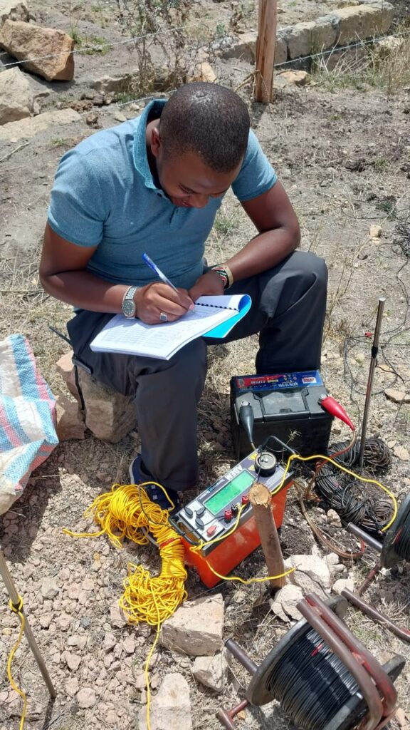
Siting challenges. Structural geology is crucial. Lineament analysis from satellite imagery, geological mapping of faults and fractures and electrical resistivity profiling to locate low-resistivity fracture zones are standard tools. Sand dams and subsurface dams are widely used to supplement groundwater supply in the drier basement areas of eastern Kenya.
Comparing the Three Aquifer Types
| Feature | Volcanic | Sedimentary | Basement |
|---|---|---|---|
| Main storage/flow | Fractures, vesicular zones, porous pyroclastics | Pores between grains; karst in limestone | Weathered zone and fractures |
| Predictability | Moderate to low (layered, variable) | Moderate to high in uniform sands | Low (fracture-controlled) |
| Typical yields | Low to very high | Moderate to high | Low to moderate |
| Typical depth | Often 100 to 300 m | Tens to hundreds of m | Tens to over 100 m |
| Water quality concerns | Fluoride, sodium, salinity on rift floor | Salinity, saline intrusion, contamination | Brackish in dry areas, iron, fluoride locally |
| Key siting tool | Geophysics plus borehole log calibration | Stratigraphy, salinity mapping | Lineaments, structure, resistivity profiling |
Mixed and Transitional Settings
Real geology rarely fits neat categories. For example, volcanic rocks often overlie basement, and the contact between them can be a productive zone. Rift basins contain sediments interbedded with volcanics. Alluvial deposits fill valleys cut into basement. A borehole may penetrate several aquifer units, and a hydrogeologist must decide which to screen and which to seal off, especially if one has poor quality water.
Recharge and Sustainability by Aquifer Type
Volcanic aquifers near mountains typically receive substantial recharge from highland rainfall, but deep rift-floor aquifers may be poorly recharged and rely on lateral flow from the highlands.
Sedimentary aquifers in arid regions may contain “fossil” groundwater recharged in wetter climatic periods, so abstraction can be unsustainable if recharge is low. Careful monitoring is vital.
Basement aquifers have limited storage, so they respond quickly to rainfall variation and drought. Over-pumping can quickly deplete the stored water in the weathered zone.
Understanding recharge helps determine sustainable yield and informs the abstraction permit process.
Why Aquifer Type Matters to You
Knowing which aquifer you are dealing with helps you:
- Set realistic expectations for depth, yield and cost.
- Choose appropriate methods for siting and drilling.
- Anticipate water quality issues and test accordingly.
- Design the borehole properly, including screen type and gravel pack.
- Manage the aquifer sustainably and plan for droughts.
- Communicate effectively with regulators and contractors.
For example, in unconsolidated coastal sands, you may need fine screens and gravel packs to control sand and an abstraction limit to avoid saline intrusion. In basement rock, you may focus on locating fractures and may accept lower yields with storage. In volcanic terrain, you might screen specific productive horizons and avoid clay layers.
Frequently Asked Questions
Which aquifer type is best? None is universally best. Sedimentary aquifers offer predictability, volcanic aquifers can offer high yields, and basement aquifers offer modest but widely available supplies. Quality, depth and sustainability matter as much as yield.
Can one borehole intersect multiple aquifers? Yes. A design may screen several zones or only the best. Mixing waters of different quality is a risk.
How can I find out which aquifer lies beneath my plot? Review geological maps and nearby borehole logs, then commission a hydrogeological survey.
Do artesian boreholes exist in Kenya? Confined aquifers can produce flowing or near-flowing boreholes in some settings. Their occurrence depends on local geology and pressure conditions.
Are aquifers connected across county boundaries? Often, yes. Aquifers follow geology, not administrative boundaries, which is why regional management through WRA and catchment bodies is important.
Conclusion
Kenya’s aquifers are as diverse as its landscapes. Volcanic aquifers offer high potential but complex layering and water-quality risks, sedimentary aquifers range from excellent to saline, and basement aquifers depend on weathering and fractures. Recognising these differences is the first step toward drilling productive, safe and sustainable boreholes.
For hydrogeological assessments that account for your local aquifer setting, contact Reg. Geol. Mbugua Githae (MGSK) at consult.innercoregeoconsultants.co.ke.