Skip to content

The Great Rift Valley is Kenya’s most recognisable landscape, with its steep escarpments, deep lakes and volcanic peaks. It is also a place where the Earth’s crust is slowly tearing apart. This process creates fertile soils, geothermal energy, lakes and tourism, but it also generates earthquakes, volcanic activity and ground cracking. Millions of Kenyans live, farm and work along the Rift, so understanding these hazards is a practical necessity, not an academic exercise.
How the Rift Forms
The East African Rift System is a continental rift where the African plate is splitting into two smaller plates, the Nubian and Somali plates. The Eastern Branch, which crosses Kenya from Lake Turkana in the north to Lake Magadi and northern Tanzania in the south, is pulling apart at a few millimetres per year. That sounds slow, but over millions of years it produces:
- Normal faults that drop blocks of crust to form valley floors (grabens) and lift flanking escarpments.
- Volcanism, as thinned crust allows magma to rise.
- Hot springs and geothermal systems, where groundwater is heated at depth.
- Closed lake basins that fill with water and sediment.
Seismic and volcanic hazards come from the same tectonic engine.
Volcanic Hazards
Kenya has dozens of Quaternary volcanoes, many in the central and northern Rift. Prominent examples include Longonot, Suswa, Menengai, Eburru, Olkaria, Paka, Silali, Emuruangogolak, Barrier and Teleki. Several have young deposits and active geothermal systems, which are signs that heat remains below.
Eruptions in Kenya are infrequent and have been small in recorded history, but several volcanoes are considered potentially active. Longonot is reported to have erupted in the 19th century, and others have recent lava flows or ash deposits. The hazards depend on the volcano type and eruption style.
- Lava flows: mostly slow, destroying whatever they cover. Basaltic flows at fissure systems can travel several kilometres.
- Ash and tephra fall: ash can collapse roofs, damage crops, contaminate water, disrupt aviation and harm health.
- Pyroclastic flows and surges: fast, hot clouds of gas and ash, particularly from trachytic volcanoes with explosive potential.
- Volcanic gases: carbon dioxide can accumulate in low spots, such as pits, caves and cellars, and displace oxygen. Hydrogen sulphide and sulphur dioxide cause irritation and poisoning.
- Lahars (volcanic mudflows): heavy rain on loose ash can create destructive flows.
- Caldera collapse and ground deformation: sudden or gradual shifting of the ground.
Monitoring volcanoes in Kenya is limited compared with well-known volcanic countries. Geothermal developers such as KenGen and GDC operate seismic networks and gather data on ground deformation and gases, which helps scientists detect unrest. Researchers also use satellite radar (InSAR) to watch for uplift and subsidence at Rift volcanoes, and some have shown signs of ground movement without erupting.
Seismic Hazards
Earthquakes in the Rift occur mainly on normal faults and around volcanic centres. Most are small and cause no damage, but larger ones occur.
- The 1928 Subukia earthquake is among Kenya’s strongest recorded earthquakes, reaching magnitude 6.9 in some catalogues. It produced surface ruptures and shook the area north of Nakuru.
- Other significant events have occurred around Lake Turkana, the Lamu region, Lake Victoria and northern Tanzania, and tremors are felt in Nairobi, Nakuru and Naivasha every year.
- Swarm earthquakes accompany magma movement and fluid flow in volcanic areas.
Hazards from earthquakes include:
- Ground shaking: the main cause of damage. Soft sediments and volcanic ash amplify shaking compared with solid rock.
- Surface faulting: buildings on or across an active fault can be torn apart.
- Liquefaction: water-saturated sand loses strength and flows, common near lakes and rivers.
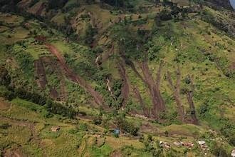
- Landslides and rock falls: shaking triggers slope failure on escarpments.
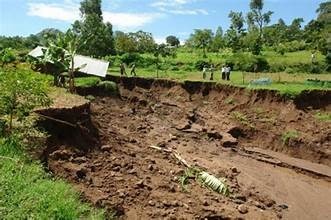
- Ground fissures and subsidence: cracks may open or widen. In March 2018 a large fissure opened near Mai Mahiu after heavy rains, drawing wide attention, and similar cracks occur elsewhere in the Rift as water erodes weak volcanic material along faults.
- Seiches and lake effects: shaking can cause waves in lakes.
Seismic hazard is not evenly spread. Zones close to active faults, thick soft soils and unconsolidated lake sediments deserve the closest attention.
Induced Seismicity and Geothermal Activity
Geothermal energy development in the Rift involves drilling, fluid extraction and reinjection. These activities can cause small earthquakes. Microseismic monitoring at fields such as Olkaria shows that most events are minor, but operators must track them carefully to manage pressure, avoid damaging infrastructure and maintain public trust.
Who Is at Risk?
Major towns and infrastructure sit within or near the Rift: Nakuru, Naivasha, Gilgil, Narok, Eldoret’s escarpment, Kericho and Nairobi’s edge. Critical assets include:
- Geothermal power plants and transmission lines.
- The Standard Gauge Railway and highways crossing the Rift.
- Dams, pipelines and water supplies.
- Informal settlements on unstable or low-lying ground.
- Tourist lodges and flower farms around the lakes.
Vulnerability depends not only on hazard but also on building quality, awareness and emergency planning. Poorly built masonry houses with heavy roofs are especially at risk in strong shaking.
How Geologists Assess These Hazards
Hazard assessment is built from several data sources.
- Geological and fault mapping: identifying active faults, young volcanic deposits and eruption history through field mapping, trenching and dating methods.
- Seismic monitoring: local and regional seismometer networks provide earthquake catalogues, which feed probabilistic hazard models.
- Geodesy: GPS and InSAR measure the slow stretching of the crust and any deformation near volcanoes.
- Geophysical surveys: gravity, magnetic and resistivity data help map faults, magma chambers and sediment thickness.
- Geochemical monitoring: soil gas, fumarole and spring chemistry can reveal changes in volcanic activity.
- Site response studies: measuring how soils amplify shaking, using shear-wave velocity profiles and microtremor surveys.
- Hazard modelling: probabilistic seismic hazard analysis estimates the chance of different levels of shaking within a time period, and volcanic hazard maps outline areas threatened by lava, ash and flows.
Reducing Risk
Planning and construction decisions have the greatest impact on safety.
- Avoid active fault traces. Keep buildings back from mapped fault lines and fissures by distances recommended by a geologist.
- Use seismic-resistant design. Reinforced frames, good detailing, lighter roofs and quality materials greatly reduce collapse risk.
- Investigate the ground. Geotechnical surveys detect soft soils, liquefaction-prone layers and cracks before foundations are built.
- Manage water. Drain surface runoff away from fissures and weak volcanic soils to prevent erosion and collapse.
- Respect volcanic gas risks. Do not enter pits, caves or depressions near active vents without gas detectors, and avoid camping in hollows.
- Prepare. Households, schools and businesses should agree on evacuation routes, assembly points and emergency kits.
- Support monitoring. Seismic stations, GPS and public information campaigns are vital and cost little relative to disaster losses.
Kenya’s building code requires structures to consider seismic loads, and Environmental Impact Assessments for major projects should include geohazard analysis. Always check the current code and engage qualified professionals.
Living with the Rift
The same processes that create hazards also create benefits: geothermal electricity, rich volcanic soils, mineral-rich lakes such as Magadi and Bogoria, and some of the world’s most remarkable landscapes. The aim is not to avoid the Rift but to understand and respect it. A site that appears quiet can still lie on a fault, and a fertile slope can be a landslide zone. Good science, sound planning and awareness help communities enjoy the Rift’s advantages while limiting its dangers.
Key Takeaways
- The Rift is tectonically active, with volcanic centres and normal faults that produce earthquakes, fissures and potential eruptions.
- Hazards include ground shaking, surface faulting, liquefaction, ash fall, volcanic gas and landslides.
- Hazard assessment combines mapping, monitoring, geophysics, geochemistry and modelling.
- Safe site selection, good construction and preparedness reduce risk significantly.
References and Further Reading
- Ebinger, C.J. et al. Studies of rift tectonics and magmatism in the East African Rift, Nature Geoscience and Geophysical Journal International.
- Biggs, J. et al. (2009, 2016). InSAR studies of volcanic deformation in the East African Rift.
- Smith, M., Mosley, P. (1993). Crustal heterogeneity and basin development in the Kenya Rift Valley. Tectonics.
- Ambraseys, N.N. (1991). The Subukia earthquake of 1928 and related seismicity, Kenya.
- Kenya Electricity Generating Company (KenGen) and GDC microseismic monitoring reports.