Skip to content

Call/WhatsApp +254 (0) 722 672 309 / 0202672309 / 0720675811.

Structural and Exploration Geologist

Geol Mbugua Githae
  • Home
  • About
    • Geologist
  • Services
    • IoT
      • IoT Equipments
      • Softwares.
  • Data Centre
  • C & S
  • GeoAI
    • Geo Tools
    • GeoAI
      • GeoGPT
    • Research
    • Remote Sensing
  • Articles
    • Renewable Energy
      • Geothermal
      • Solar
    • Geotechnical
    • Remote sensing
    • Mining
      • Mineral Feasibility Studies
      • geological maps
      • Exploration
    • Hydrogeology
    • Carbon Capture
    • Hazards
  • Contact Us
Search
Get a quote
Get a quote
Geol Mbugua Githae
  • Home
  • About
    • Geologist
  • Services
    • IoT
      • IoT Equipments
      • Softwares.
  • Data Centre
  • C & S
  • GeoAI
    • Geo Tools
    • GeoAI
      • GeoGPT
    • Research
    • Remote Sensing
  • Articles
    • Renewable Energy
      • Geothermal
      • Solar
    • Geotechnical
    • Remote sensing
    • Mining
      • Mineral Feasibility Studies
      • geological maps
      • Exploration
    • Hydrogeology
    • Carbon Capture
    • Hazards
  • Contact Us
Exploration at a mining site

A Guide to Structural Geology Mapping for Resource Exploration

Ore doesn’t deposit itself randomly. Faults, fractures, folds, and shear zones create the pathways and traps that control where mineralizing

A Guide to Structural Geology Mapping for Resource Exploration Read More »
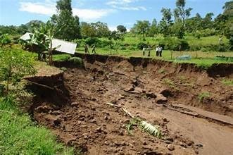
landslide vs mudslide

Understanding Geological Hazard Assessments for Construction Projects

Not every piece of land is equally safe to build on. Landslides, seismic activity, expansive soils, flooding, and subsidence can

Understanding Geological Hazard Assessments for Construction Projects Read More »

geologist doing exploration for groundwater

Exploration Methods for Lithium: How Geoscience Approaches Differ by Deposit Type

Lithium demand has surged alongside the growth of battery manufacturing and electric vehicle adoption, pulling a wave of new exploration

Exploration Methods for Lithium: How Geoscience Approaches Differ by Deposit Type Read More »

gemstone Mineral

satellite Remote Sensing for Mineral Exploration: A 2026 Guide

Mineral exploration has always been a game of narrowing down possibilities. Traditional methods — ground surveys, drilling, and airborne geophysics

satellite Remote Sensing for Mineral Exploration: A 2026 Guide Read More »

Subsidence

InSAR Monitoring for Land Subsidence and Ground Deformation

Ground doesn’t move quickly — until it does. Subsidence and deformation often unfold over months or years, invisible to the

InSAR Monitoring for Land Subsidence and Ground Deformation Read More »

GEOLOGICAL GeoAI

Multispectral vs. Hyperspectral Imaging: Which Is Right for Your Geological Survey?

Choosing the right imaging technology can make or break the value of a remote sensing survey. Multispectral and hyperspectral imaging

Multispectral vs. Hyperspectral Imaging: Which Is Right for Your Geological Survey? Read More »

Geological map

How LiDAR Is Transforming Geological Mapping and Terrain Analysis

Vegetation has always been the enemy of geological mapping. Dense forest canopy can hide fault scarps, landslide scars, and outcrops

How LiDAR Is Transforming Geological Mapping and Terrain Analysis Read More »

Geotechnical

Geotechnical Site Investigation: What to Expect and Why It Matters

Every successful construction project rests, quite literally, on what’s beneath it. A geotechnical site investigation is the process of understanding

Geotechnical Site Investigation: What to Expect and Why It Matters Read More »

Aquifer Mapping and Characterization

Climate Change and Groundwater: What Satellite Data Reveals About Shifting Water Tables

Groundwater is often called the world’s hidden buffer against climate variability — the reservoir that keeps wells flowing during drought

Climate Change and Groundwater: What Satellite Data Reveals About Shifting Water Tables Read More »

Radar

Land Subsidence Monitoring Using Satellite Radar (InSAR): A Guide

Ground doesn’t usually move fast enough for people to notice — a few centimeters a year is invisible to the

Land Subsidence Monitoring Using Satellite Radar (InSAR): A Guide Read More »

Groundwater

Geophysical Survey Methods: Choosing the Right Tool for Mineral and Groundwater Exploration

Remote sensing and satellite data can narrow a search area from thousands of square kilometers down to a shortlist of

Geophysical Survey Methods: Choosing the Right Tool for Mineral and Groundwater Exploration Read More »

Aquifer Mapping and Characterization

Aquifer Mapping with Remote Sensing: Locating Groundwater from Space

Groundwater is, by its nature, invisible from the surface — which has historically made finding it one of hydrogeology’s more

Aquifer Mapping with Remote Sensing: Locating Groundwater from Space Read More »

← Previous 1 … 13 14 15 … 22 Next →

Recent Posts

  • Unlocking Africa’s Geothermal Resource Potential
  • Unveiling Africa’s Geological Resources
  • Incentivizing Geothermal Energy
  • Why Boreholes Dry Up
  • Drone Mapping for Geology and Mining

Recent Comments

  1. Brenda Fassie on The Role of Remote Sensing in Identifying Mineral Deposits
  2. The ground water company on How to Read a Geological Map – Beginner to Pro
  3. The ground water company on How to Read a Geological Map – Beginner to Pro
  4. The ground water company on How to Read a Geological Map – Beginner to Pro

“Science Beneath the Surface. Strategy Above It.”

Geol. Mbugua Githae (MGSK) || Principal Geologist.

Geol Mbugua Githae

Geologist | IGSL | Proweb Tutors | Contact | Green Energy


Mailto: geologist@innercoregeoconsultants.co.ke

About Us

A leading consultant Geologist based in Kenya and operating across Africa. He specializes in structural geology, mineral exploration, geotechnical assessments, hydrogeological surveys, and GIS-based mapping solutions.

“Science Beneath the Surface. Strategy Above It.”

Reach Us

Thika Rd, Spur Mall, Kiambu, Kenya.
P.O. Box 9356 – 00200 KBU.

Tel: 0202672309.
Phone: 0722672309/0720675811.

Mailto: Geologist@innercoregeoconsultants.co.ke

Work With Us

Open Hours

Mon – Fri 0800 – 1800 Hrs
Sat            0800 – 1300 Hrs

Inquire With Us.

Copyright © 2021 | Geol Mbugua Githae, MGSK | IGSL

Structural and Exploration Geologist.

imunify-bot-check
avat

Geol Mbugua Githae

Typically replies within minutes

Any questions related to Geol Mbugua Githae?

WhatsApp Us

🟢 Online | Privacy policy

WhatsApp us